Life cycle management
ArcGIS connects disparate asset systems and connects life cycles around location. Furthermore, it defines network and environmental relationships while embracing real-time inputs.


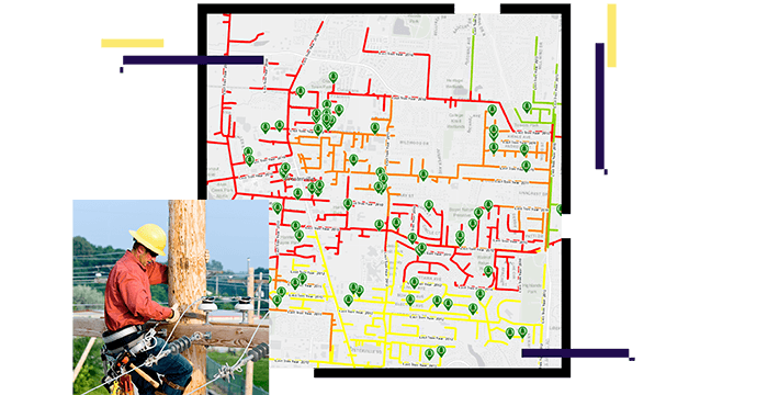
Visualize your assets
Esri helps you get the most value from your assets. ArcGIS uses location to fine-tune asset management. It provides fresh insights into performance, risks, resources, and costs. Using location, utility staff can discover patterns and trends that simple reporting cannot detect—improving asset management results.
Align with industry standards using real-world modeling, analytics, and broad access. Create full operational awareness with ArcGIS.
ArcGIS connects disparate asset systems and connects life cycles around location. Furthermore, it defines network and environmental relationships while embracing real-time inputs.
ArcGIS visualizes vulnerabilities and uncovers financial and operational relationships. It evaluates asset performance and activities while predicting failures with AI/ML.

ArcGIS simplifies data collection while speeding inspection and maintenance tasks. It unifies field and office staff, and bridges workflow steps with location.

TECHNICAL PAPER
ArcGIS uses location to fine-tune asset management.
User Story
UK Power Networks deployed Collector for ArcGIS and saved more than $180,000 by reducing the cost per inspection.
ebook
Explore how ArcGIS uses location to fine-tune asset management.
Poster
Visualize the asset management capabilities in ArcGIS.