Most recent
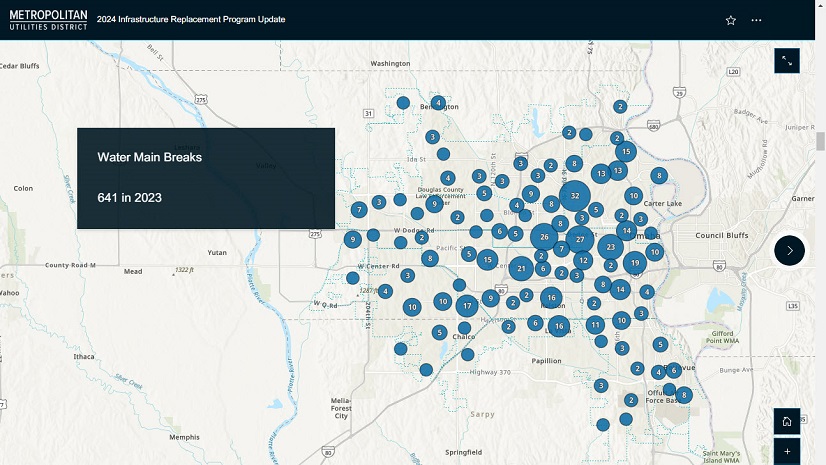
Geospatial Solutions Support Metropolitan Utilities District’s Vision for the Future
M.U.D. implemented ArcGIS Enterprise and Utility Network, resulting in an accurate, real-world data model with full network connectivity.
Most recent
M.U.D. implemented ArcGIS Enterprise and Utility Network, resulting in an accurate, real-world data model with full network connectivity.

Digital Twins for Infrastructure at the 2024 Esri User Conference
GCEC's use of the joint use solution

Discover highlights from Esri's IMGIS Conference! See how GIS shapes tomorrow's infrastructure.

Marc Goldman penned a summary of his recent participation in a webinar and a live panel discussion on digital twins.
This reading list provides a broad overview of the ArcGIS Utility Network and its application for electric utilities.

Digital transformation is exploding—changing work and even the way we order lunch on the go.

Esri's ArcGIS location technology brings IoT data to life in spatial context.

ArcGIS Platform offers location services to elevate utility apps.