The 366th Civil Engineering Squadron at Mountain Home Air Force Base near Boise, Idaho, needed to transform its space management processes.
Challenge
The US Air Force has defined job- and rank-based space entitlement regulations, and Mountain Home Air Force Base required a solution to quickly identify whether a space’s occupants were receiving their entitled space designation. The engineering flight team was tasked with performing a space assessment of the base. This assessment sought to optimize office spaces, understand space utilization, and facilitate better decision-making for personnel allocation. The engineering flight team had previously relied on manual, paper-based methods, but the growing complexity and scale of its operations demanded a more sophisticated and digital approach.
Partner
Matrix Design Group, Inc., is a nationally recognized, award-winning firm that specializes in civil engineering and geospatial and digital solutions. Matrix recognizes the power of geographic information system (GIS) technology in delivering engineering, planning, environmental, design and construction, and government consulting services.
Solution
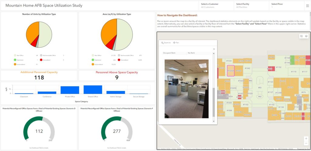
Matrix undertook a two-phase project to efficiently collect, analyze, and visualize data while ensuring compatibility and accuracy within a comprehensive GIS database. Data were reconciled to existing infrastructure since the current building records (maintained as computer-aided design and drafting [CADD] files) were not completely up-to-date. Initially, a survey was conducted on a representative sample of 10 buildings, using ArcGIS Field Maps to collect and verify room-specific data, including dimensions and occupancy details. This laid the foundation for the second phase, which involved incorporating Esri’s ArcGIS Indoors. This phase extended the project to assess over 50 buildings and involved leveraging Python scripting and open-source libraries to develop a flexible, data-driven, and future-proof system. The team meticulously converted floor plans, corrected inaccuracies, and utilized the Indoor Space Planner tool to visualize potential space optimization. The team produced color-coded dashboards to indicate space utilization, facilitating prompt and well-informed decision-making.

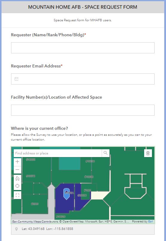
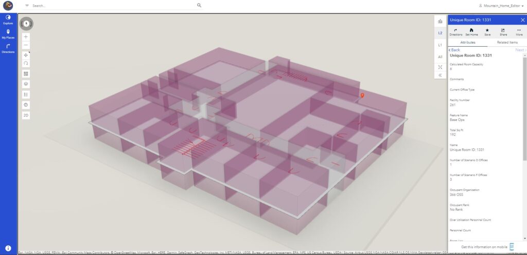
The team also created a client-side data editor and an ArcGIS Indoors data viewer to showcase room attributes, photos, and 2D and 3D building visualizations. ArcGIS Survey123 was integrated with the viewer to create a powerful interface for submitting Space Requests and crowdsourcing maintenance needs through a form-driven process. The solution included interfaces that could perform intricate analysis and automate the entire space-planning workflow, while remaining flexible enough for new users to update the data or change variables via an Excel-based template.

Results
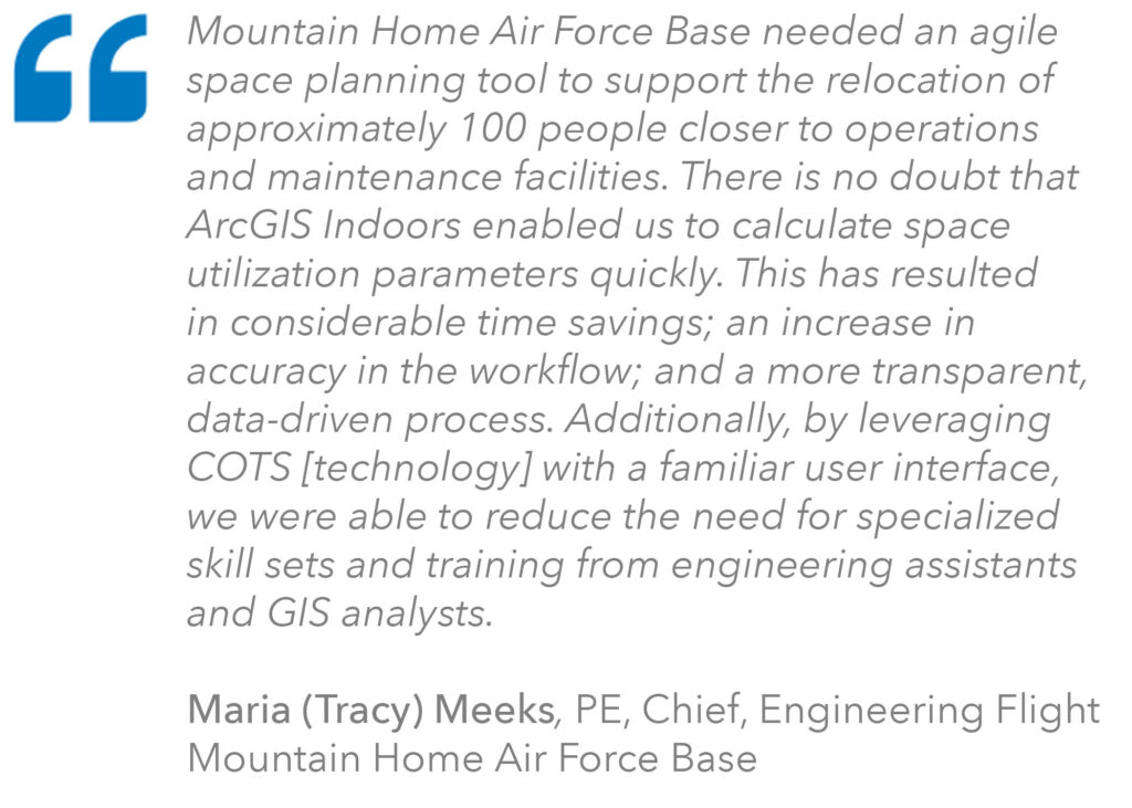
The implemented solution significantly streamlined the space management workflow, providing accurate, field-verified data for quick assessments. This shift to a GIS-based approach not only saved time but also improved accuracy and transparency in the decision-making process. Users can now digitally submit space request forms, navigate the base using 3D visualizations and route planning, and easily model people movement to new work areas. This project now serves as a road map for similar implementations within the Air Force.


Future Considerations
The engineering flight team expressed interest in expanding the system’s capabilities. These considerations included incorporating the Internet of Things (IoT) for emergency equipment tracking, crowdsourcing work orders, navigating within buildings, and aiding in construction planning. The team members envision a comprehensive system that not only optimizes space but also facilitates sustainable practices and aids in emergency response protocols.
The successful implementation of this GIS-based solution has modernized the base’s space management and paves the way for future advancements, demonstrating the potential for innovation and efficiency within Air Force operations.
Learn more about location intelligence for AEC:
GIS for Architecture, Engineering, and Construction
Stay Connected with Esri’s AEC Team:
Subscribe to the AEC industry newsletter “Esri News for AEC”.
Join the Architecture, Engineering and Construction Community

