A perk of my role is that I travel often for work. In each new city I visit, I make a point to log a run. To do this, I find the nearest park or greenway, and because of that, I am more likely to spend my time (and money) at the cafes and shops along their borders. This also means I get to take mental notes and compare these parks city-by-city. To this day, and perhaps I am biased, one of my favorite city greenways continues to be that of Chattanooga’s, where I went to college. From the city’s greenway I could commute from campus, up to the arts district for lunch, and across the river to meet friends for dinner in the evenings, while never having to put myself at risk of cars.
Parks are the workhorses of a healthy community. The healthier the park, the healthier the community. Health, in this instance, is both literal and figurative. Health means well-maintained, lush and green, but it also means safe, well-planned, equitably accessible and connected, and contributing to a community’s economics, sustainability and resilience. Parks play an important role at the intersection of our social, environmental, and economic well-being, and this role has heightened visibility in a post-pandemic world where the threats of climate change can no longer be ignored.
But this is a lot of responsibility for a park, and to play such an important role for our communities requires that we plan and manage parks in a modern way, with modern considerations. This is why geographic information systems, or GIS, is the mission-critical enterprise business system that streamlines the complexity of managing a modern parks system, powered by “where.”
My colleagues and I are kicking off a blog series that explores the role of parks and GIS from multiple perspectives: public works, planning, health, equity, climate and economy.
A City in A Park: Chattanooga, Tennessee
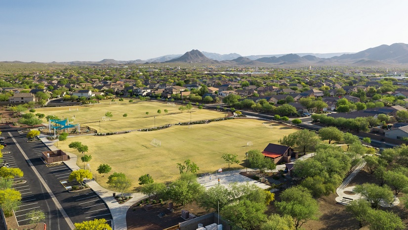
Chattanooga, Tennessee already boasts the moniker “The Scenic City” due to it being nestled in between the Cumberland Plateau that rises beautifully from the West and the foothills of the Blue Ridge Mountains to the East. As citizens descend into the heart of downtown, the grandeur of Lookout Mountain anchors the scenery as the beautiful Tennessee River winds its way through a gorge and spills out into the city’s center.
One of the fastest growing cities in Tennessee, voted numerous times as one of the best places in America to live, the city is attractive due in large part to its wealth of outdoor recreation. But this wasn’t always the case. In the 60’s, the city was famously featured numerous times for its terrible pollution and poor air quality. The New York Times reflected on this in 1972, saying “motel operators here were accustomed to complaints from travelers that “fallout” from the city’s corrosive murk was peeling paint off their cars overnight. Chattanooga was ranked by Federal officials as the nation’s sootiest city.”
In the 50 years since Nixon established the EPA, the City of Chattanooga has completely re-invented their approach to their economy, which has included a keen eye to environmental concerns as they continued to meet or exceed expectations of EPA air quality standards through the years. Recovering from the embarrassment of being the poster child for America’s pollution problem in the 60’s, the city has long understood the relationship between a healthy environment and a healthy economy. So it’s no surprise that Mayor Tim Kelly was able to easily translate these strategies to issues of climate change and community resilience with the passage of Chattanooga’s Climate Action Plan.
Parks Are Chattanooga’s Strength
The goals of the climate action plan are categorized into four main categories: Transportation, Buildings and Waste, Greenspaces and Waterways, and Jobs and Opportunities. One of the strengths of the climate action plan is their park plan, which encompasses every single one of these categories.
The defining vision for Chattanooga Parks is to be “A City in a Park” and become America’s first “National Park City.” Reading their Parks and Outdoors Plan (POP), “The City and planning team asked Chattanoogans to envision what their parks and outdoors could look like in 100 years, and to describe how the current system falls short of meeting the needs of their families and communities.”
The result was a beautifully designed master plan, with a strategy for short-, medium-, and long-term phases that centered on five principles: Access, Equity, Nature, Place and Quality.

GIS Drives Success
But the city has another strength – they understand the power of GIS to reveal and assess relationships to support these kinds of visionary plans. Take, for example, their work on the city’s tree canopy. Supported by the University of Tennessee at Chattanooga Interdisciplinary Geospatial Technology Lab (UTC IGTLab), the city has mapped their urban tree canopy, but also assessed this against demographics to get a better picture of shade equity across the city. The full story map can be explored here.


GIS allows the city to visualize complex relationships, such as shade equity. Armed with this geospatial data-driven knowledge, the city and their partners can easily justify federal grants to implement their multi-faceted parks plan.
In just the past year, the city has been awarded nearly $30 million between an Urban Forestry Grant and more recently with EPA’s Community Change Grant. This later grant, spearheaded by the Trust for Public Land, provides nearly $20 million to “develop a 2.6-mile trail system in south Chattanooga, expand greenspace and tree canopy, and improve stormwater and floodplain management using nature-based solutions. This project, first identified as a community priority in 2002, will help transform and reconnect three disadvantaged communities that have been isolated by railroads, highways, and other barriers. More than 3,800 individuals live within a half mile of the trail.”
In addition to the city’s existing GIS analyses, the Trust for Public Land was able to strengthen their grant proposal with the use of their ParkServe application, which allows users to assess any city’s park system against common questions of equity, health, climatic and environmental considerations.
GIS has helped launch Chattanooga’s incredible momentum for executing their vision. I have no doubt that not long from now, they will absolutely be America’s first National Park City.
Beyond Maps, GIS Supports Holistic Park Operations
Geographic information system (GIS) technology is a mission-critical tool for understanding all park operations across your entire community— equitable distribution of services, planning and design, effective operations, and even strategies to leverage parks for climate adaptation. GIS is the enterprise IT business system that gives your park management staff the geospatial advantage. GIS supports planning and design, smart operations, education and outreach, community health and well-being, equity and climate resilience.
While Chattanooga’s example touches on many of these components, our Parks Perspective series will take a closer look at specific case studies and solutions to help inspire your parks plan.
And if you want to learn more now, you can visit our Planning Parks and Recreation for the Next Generation landing page and explore how Washington state, Montgomery County, the city of Escondido and others are leveraging GIS to achieve their parks and recreation goals.