Since 1960, the American Public Works Association (APWA) annually uses its National Public Works Week (NPWW) to help promote the importance and value of public works agencies, projects, and professionals to the public. Each year APWA selects a theme for NPWW; this year’s theme is Advancing Quality of Life for All. The public works discipline is the foundation of our quality of life. It plans, builds, operates, manages, and maintains the vital assets and infrastructure we often take for granted. Public works agencies and professionals provide critical services that keep our communities thriving.
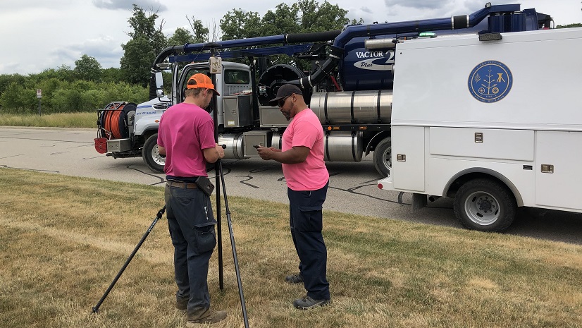
Often, we tend to focus on the part of public works that we see outside when traveling through our communities. When you imagine public works professionals, images of engineers, field workers, drivers of heavy equipment, and other highly visible outdoor workers come to mind. Easily unacknowledged are the public works office staff, including Geographic Information System (GIS) professionals.
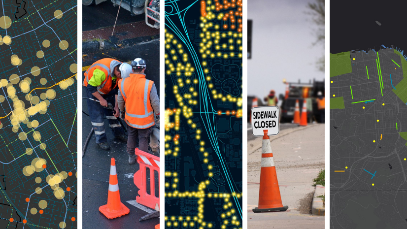
GIS professionals are essential to public works operations. Location is never an afterthought in public works as it is a spatial business; everything public works does has a location. GIS is the mission-critical, enterprise IT system designed to turn spatial data into insight that supports better decision making. GIS supports all facets of public works from operations and maintenance, streets, roads, and bridges, field and fleet management, capital project design and engineering, public grounds and facilities, and emergency response. For decades, thousands of public works agencies have used GIS to incorporate spatial thinking in their daily operations and this is consistently recognized by APWA and its members in its annual Top Tech Trends.
While we use this week to celebrate all public works professionals, I would like to take this opportunity to highlight those behind the scenes providing significant business value to public works agencies, their communities, and the public, including all the GIS professionals. Here are some samples of their impactful work:
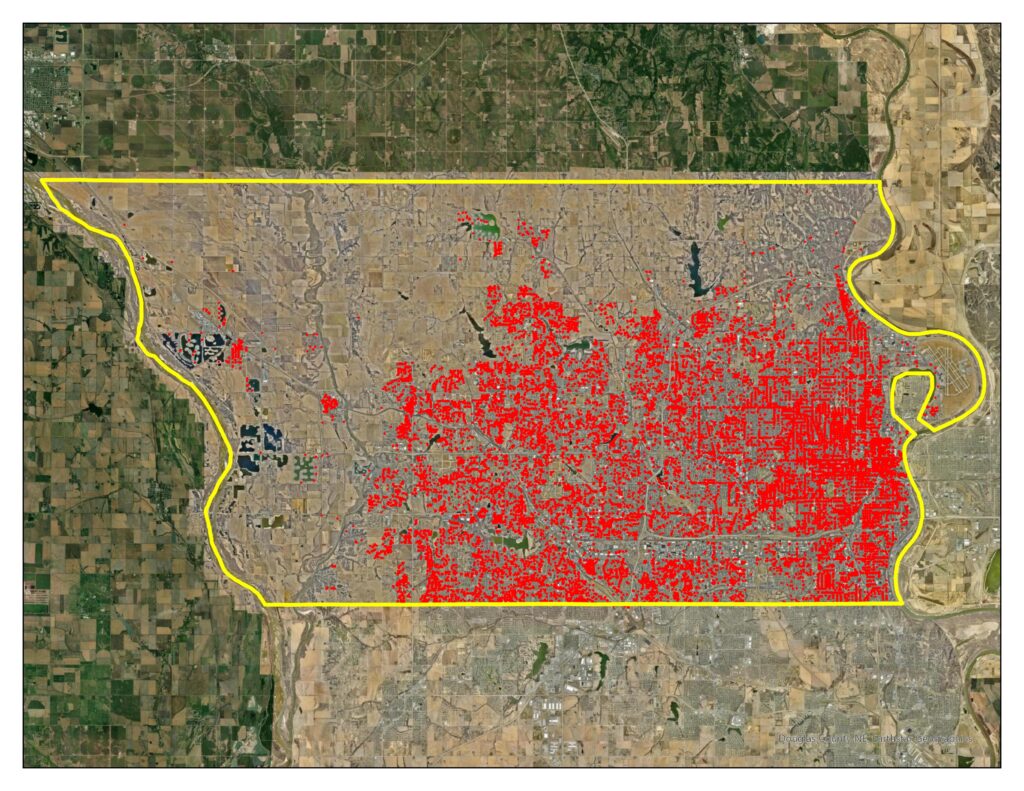
Douglas County, Nebraska, leveraged deep learning models within ArcGIS for extracting features from imagery to identify over 34,000 ADA curb ramps within the county. This model saved a considerable amount of time and money and allowed the county to shift human labor to other prioritized capital improvement projects that needed more assistance. Being able to efficiently capture and inventory all curb ramps within the county aid in the overall plan for improving walkability.
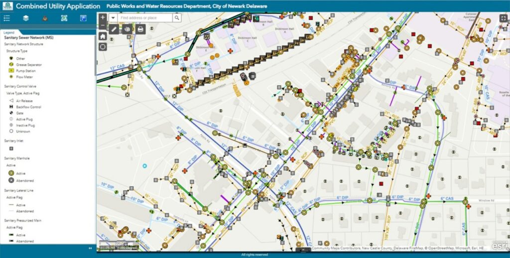
Newark, DE implemented GIS to support digital transformation that allowed the City to modernize their public works and water resources operations. City administrators realized they could increase their level of service and efficiency by applying a geographic approach to city business. Within seven years, the city transitioned to an enterprise GIS, enabling the reimagining, rethinking, and rebuilding of the PWWR (Public Works and Water Resources) department.
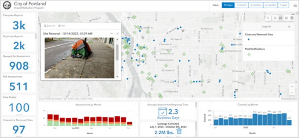
Homelessness is a human crisis that constantly calls for solutions in local communities. The City of Portland, Oregon, was experiencing the need to clean up shelters in its community that pose a risk and do so in a fair and unbiased manner. Since the city implemented GIS, staff can now streamline report intake processes and deploy mobile workers to a campsite quickly. Since campsite reporting is now displayed on a dynamic dashboard, community members can proactively monitor the campsites in the area as well as their requests.
As communities across the globe battle complex challenges like climate change, homelessness, inequity, aging infrastructure, and traffic crashes, the solutions will be driven by GIS and their public works agencies. Let us celebrate the importance of all public works professionals during NPWW, but not forget to recognize the impact that the GIS professionals bring to the operations.
For more information on how the next generation of public works is powered by GIS, please visit this site go.esri.com/gis-top-tech.