Nama Electricity Distribution Company (NEDC), one of Oman’s leading utility providers, is critical in powering the nation by delivering electricity across the Sultanate of Oman, excluding Dhofar. Serving over 1.4 million customers, NEDC maintains an extensive network of over 51,000 transformers and nearly 47,000 km of power lines. As the sole licensed distributor, NEDC’s mission includes powering homes and businesses and safeguarding public and asset security through innovation. Recently, the company adopted Geographic Information System (GIS) technology to transform its asset inspection and security practices, positioning itself as a leader in operational excellence and safety.
CHALLENGE
Safety has always been a priority for NEDC, yet aging infrastructure and rising electricity demand have made it increasingly difficult to manage asset inspections and repairs effectively. When the Authority for Public Services Regulation (APSR) levied record fines due to safety violations, NEDC knew they needed a more robust solution. The traditional inspection processes—time-consuming, manual, and prone to oversight—were no longer viable. With APSR’s audits highlighting critical safety issues like exposed cables, insufficient substation security, and missing padlocks, NEDC recognized the need for a reliable system to proactively identify, track, and resolve asset-related risks in real-time.
“We were facing substantial fines and safety challenges. It was clear we needed a solution that provided visibility across our asset base.” Mazin Al Salmani, General Manager of Operations and Maintenance.

Inspection of Mini Feeder Pillar (MFP) in Progress for Asset Security Campaign.
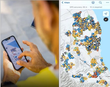
The campaign began with about 100 field engineers conducting systematic inspections. Each engineer was assigned specific substations and was responsible for checking all associated assets, including feeder pillars, transformers, and meter panels. Using GIS-linked maps, engineers updated asset statuses from “In Progress” to “Completed,” ensuring seamless coverage and eliminating redundancy. If an engineer identified a defect, such as an unsecured padlock or an exposed cable, they logged the issue with a photo in ArcGIS Survey123. Real-time updates allow office-based teams to track progress instantly on a dashboard, providing unmatched transparency and operational efficiency.
“GIS is far more than a tool for data storage; it’s a solution that empowers us to monitor and maintain our assets in ways previously unimaginable.” Majid Saleem Al Abrawi, Acting Head of GIS Development.

.Mobile Workers Utilizing GIS to Identify and Address Unresolved Defects.

Asset Security Dashboard: Real-Time Statistics and Issue Tracking
RESULT
The GIS-enabled Asset Security Campaign has significantly enhanced asset safety and regulatory compliance. With over 15,000 substations inspected across Muscat and South Al Batinah, NEDC swiftly addressed immediate hazards while developing a strategic approach for long-term maintenance. By standardizing asset management processes, NEDC reduced APSR-imposed fines and bolstered its public safety record and organizational reputation.

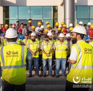
NEDC Inspection Collection Team Briefing for Asset Security Campaign
BENEFIT
The campaign demonstrated that GIS technology is more than an asset register; it’s a proactive management tool. Field and office staff leveraged mobile applications to track and resolve issues, resulting in a coordinated, transparent inspection process. ArcGIS Dashboards provide real-time visualizations of repair statuses, allowing teams to prioritize critical issues efficiently. This initiative set a new operational standard for NEDC, optimizing field resources and promptly addressing all safety issues.

Enhancing Transparency: Mobile Application Use by Field and Office Workers.
NEXT STEPS
Having successfully implemented the campaign in Muscat and South Al Batinah, NEDC plans to extend the GIS-enabled process to other regions in Oman. The company aims to standardize GIS-based inspections for future asset management endeavors, setting a sustainable, long-term course for public and operational safety.
“GIS provided NEDC with a sustainable, efficient means of executing our Asset Security Campaign and transformed our asset management approach.” Saif Mohammed Al Rawahi, GIS Manager.

