ArcGIS Living Atlas of the World is a collection of authoritative geographic information from around the world, curated by Esri and its partners. These layers provide valuable data on various geographic phenomena such as land cover, vegetation, hydrology, soil types, and more. You can use this data to enhance your Architecture, Engineering, Construction (AEC) and Environmental consulting project workflows and empower your users, both GIS and CAD, with direct access to the data and tools they need to draw insights that create actionable opportunities for your organization. AEC and Environmental consulting firms are busy and always on the go, so it can be hard to find the time to explore the vastness of the Living Atlas and identify what content really lends itself to providing value to the work you’re doing. In this blog, we’ll highlight resources we see as being valuable to AEC and Environmental consulting firms and the specific workflows they perform.
If you’re new to ArcGIS Living Atlas, visit this blog for more details on how to get the most out of Living Atlas:
Ten ways to get the most out of ArcGIS Living Atlas
For AEC and Environmental consulting professionals, the Living Atlas can be used to analyze and understand the geographic context of a project site. For example, the National Land Cover Database (NCLD) layer can provide insights into the existing vegetation and land use patterns, allowing architects and engineers to design structures that are in harmony with the surrounding environment. The National Hydrography Dataset layer delineates the rivers and waterbodies for an area which becomes a richer story when shown with the NLCD impervious surfaces and flood-prone areas from the FEMA USA Flood Hazard layer. These layers together can support the design and construction of resilient and sustainable drainage systems for infrastructure projects.
At a proposal stage or pre-planning desktop analysis, Environmental consulting firms can leverage the Living Atlas data to layer information for a rich and insightful understanding of a project site before field crews are deployed to conduct environmental assessments and impact studies. These layers provide up-to-date and accurate information on various environmental parameters, allowing consultants to analyze the potential impacts of a project on the surrounding ecosystem. This can include assessing the impact on wildlife habitats, wetland environments, water resources, and sensitive ecological areas. By incorporating this data into their analysis, AECs and Environmental consultants can provide more informed recommendations and mitigate potential environmental risks which are carried throughout the design, construction, and OM&M phases of a project.
Overall, Esri’s Living Atlas layers offer a wealth of authoritative geospatial data that can enhance decision-making processes throughout the lifecycle of their projects and make more sustainable and environmentally conscious choices in the AEC and Environmental consulting industries.
Key benefits of ArcGIS Living Atlas
- Save time – Explore curated maps, apps, and data layers from Esri and thousands of other organizations, all in one place!
- Data confidence – Esri partners with top agencies like NOAA, USGS, FEMA, USFW , USDA, and many others to bring you up-to-date, authoritative data that you can trust.
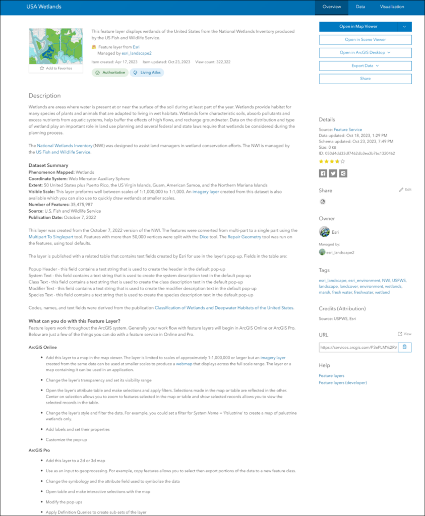
- Versatile project use, whether it’s for Architecture, Engineering, Construction, or Environmental consulting
- Living Atlas maps, apps, and data layers provide geographic context for many project scenarios. From prebuilt apps that let you explore imagery for an area over time, to authoritative data layers that can contribute to wetland delineations, the Living Atlas has resources to help support your project needs
- Save time in preliminary stages of the project, whether that’s ground truthing, site selection, desktop planning, or customizing multi-discipline project team sites in planning and permitting phases of project work
- Create sustainable, repeatable, and adaptable workflows over and over by using these Esri maintained layers, apps, and deep learning packages on the many different projects that an AEC will encounter.
- Use on public or internal Hub sites – Share the love of data! Living Atlas content is publicly available and a great resource for enhancing your already amazing Hub sites, whether you are collaborating internally or participating in public stakeholder engagement.
- Enhance your CAD designs – The ArcGIS for AutoCAD plugin, provides seamless integration between GIS and CAD workflows allowing for smoother collaboration and data exchange. Whether it is accessing detailed terrain information, environmental data, or infrastructure networks, leveraging Living Atlas within ArcGIS for AutoCAD empowers AEC firms to streamline processes and deliver more robust and successful projects.
- AI Jumpstart – ArcGIS pretrained deep learning models eliminate the need for huge volumes of training data, massive computing resources, and extensive artificial intelligence (AI) knowledge. They save you time from building a custom model from scratch and allow you to focus on extracting or identifying features from your project site to start designing sooner!
Ways AECs and Environmental Consultants can Leverage Living Atlas Content
Enhance Workflows with Authoritative Layers
From initial planning and design to site characterization and downstream operational awareness, the authoritative data sets available through Living Atlas offer invaluable insights and context. Here are some examples of how they can be applied to your project and support your needs and day-to-day operations.
Identify and Support Risk Mitigation
Project risk mitigation is important, and whether your project is small or large, Living Atlas is a scalable source of information to evaluate and mitigate risk with confidence. The Environmental Impact Assessment (EIA) stage of a project helps to identify potential risk to the environment and surrounding community in the short and long term.
Based on these EIA findings, a plan of action is put in place for the project to mitigate the risk with an aim to minimize impact to the project site and surrounding areas as much as possible. Living Atlas can support these initial environmental assessments through layering information, such as USA Forest Type, Critical Habitat for Threatened and Endangered Species, Intact Habitat Cores (2023), and USA Federal Lands.
Another common AEC workflow is to assess risk to infrastructure and assets. Through a suitability analysis exercise, using information such as geology, slope, earthquakes, and flood risk zones, Living Atlas layers can help to delineate potential areas of risk. This enables AECs to provide suggestions for enhanced support or alternate routing with the aim to reduce financial impact in the future.
CAD and GIS Interoperability
AEC projects use various sources of data, whether that’s design drawings from architects, existing site conditions from a surveyor, field collected data, or construction design drawings, there’s a need for interoperability. The ArcGIS for AutoCAD plugin, provides a rich integration between GIS and CAD for more effective collaboration.
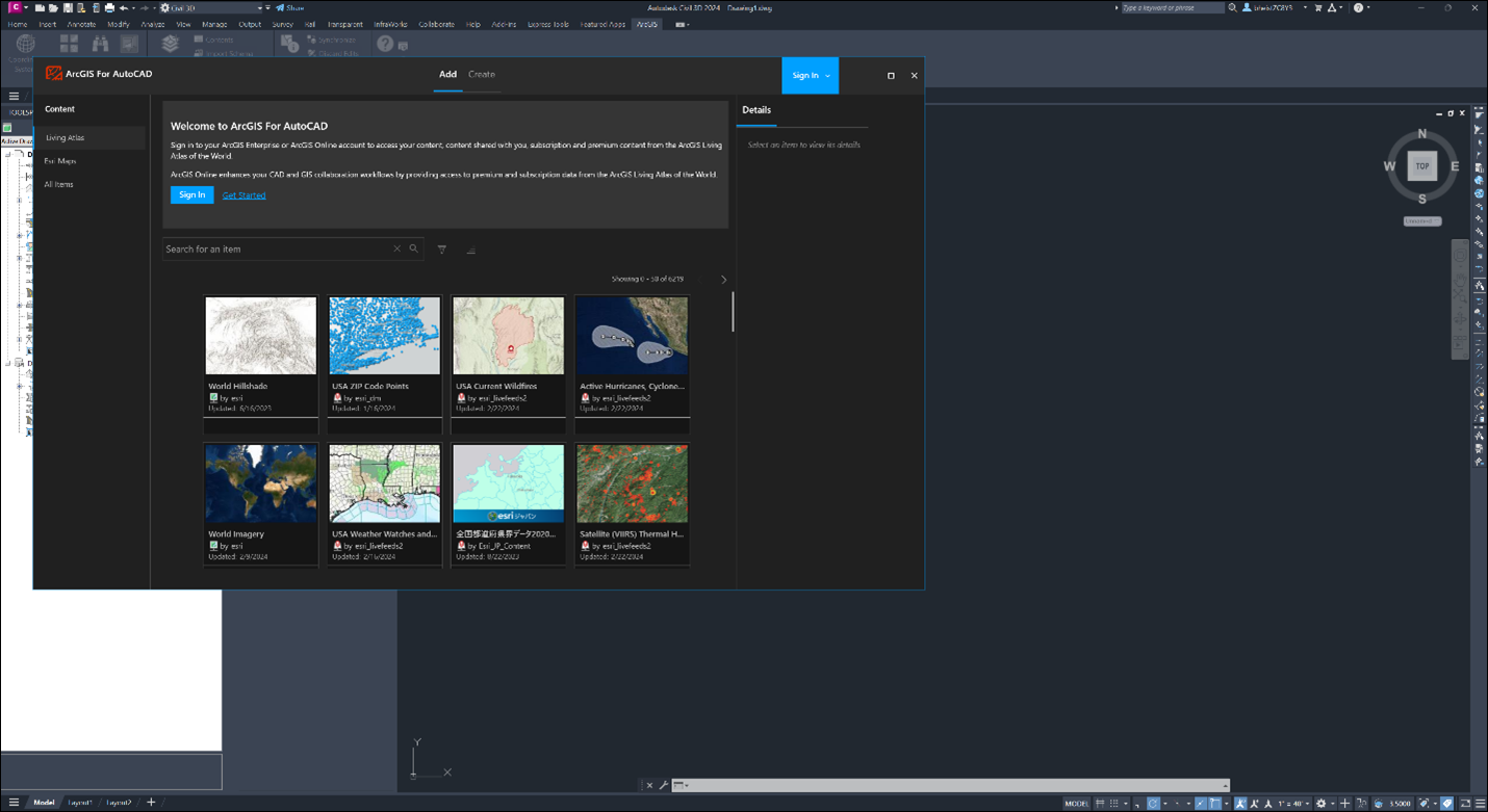
Whether it’s accessing detailed terrain information, environmental data, or infrastructure networks, leveraging Living Atlas within ArcGIS for AutoCAD empowers AEC firms to connect to GIS project content within the CAD environment to foster collaboration, use location to geoenable teams, and ultimately deliver more robust and successful projects.
Access live feeds
Live feeds are geospatial data sets that are captured in real-time (weather, streaming). ArcGIS Living Atlas includes authoritative live feeds that help you monitor and learn more about current and predicted conditions. These cover a broad range of topics such as traffic, wildfires, weather, alternative fuel stations, stream gauges, and more.
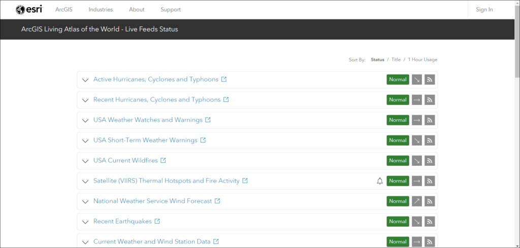
When managing field efforts, Project Managers can evaluate potential hazards with Living Atlas live feeds to keep field teams safe and help mitigate unexpected project delays.
Pre-Trained Deep Learning Models
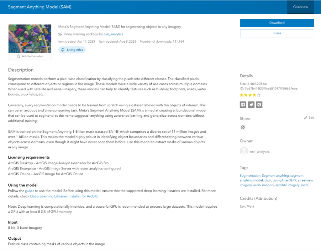
ArcGIS pretrained deep learning models eliminate the need for huge volumes of training data, massive computing resources, and extensive Artificial Intelligence (AI) knowledge. Accelerate your geospatial workflows with built-in expertise and resources designed specifically for image feature extraction, land-cover classification, image redaction, and detecting objects. Automate the way you extract meaningful insights from imagery, point clouds, and video.
Pretrained deep learning models can instantly recognize complex shapes, patterns, and textures at various scales within images, point clouds, or video. This means that you can off-load tedious tasks of digitizing and extracting geographical features, such as roads, solar panels, and building footprints, with ease. Find all the current packages available here: Pre-trained Deep Learning Packages
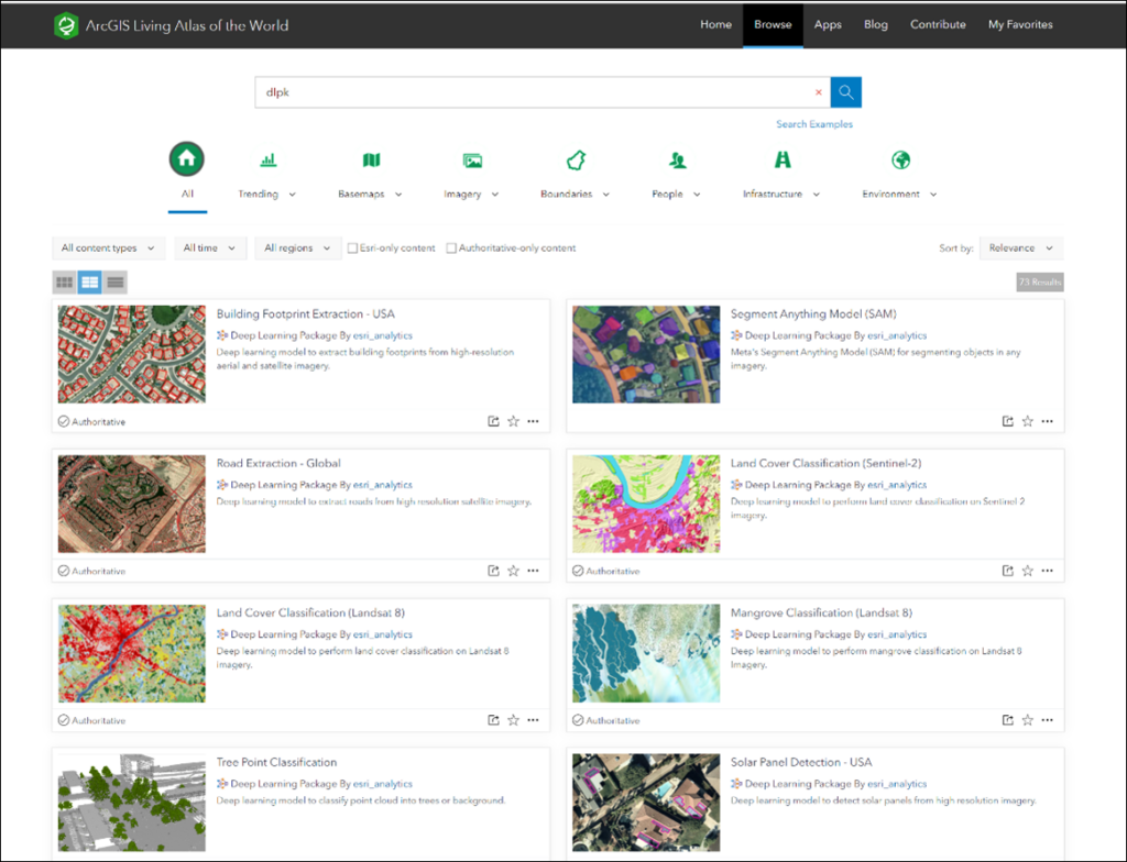
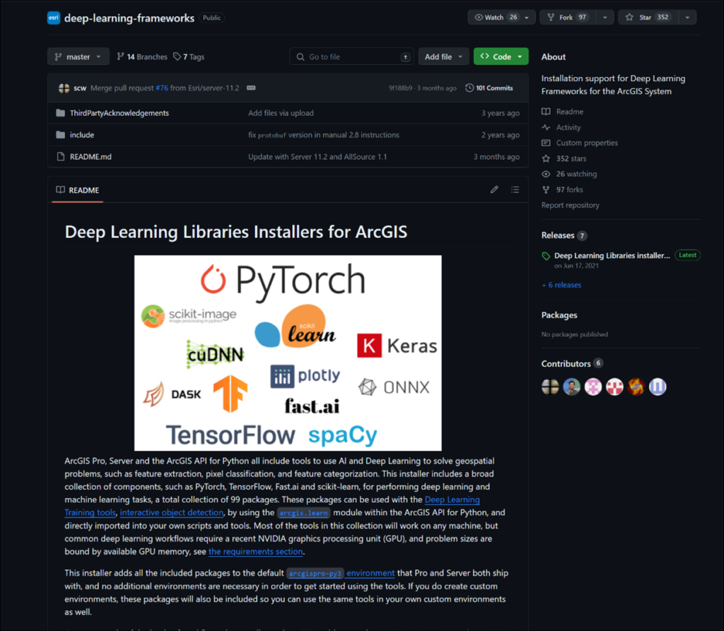
Deep learning capabilities are available in ArcGIS Pro, for use with imagery and point clouds, through several tools and capabilities. But before we are able to leverage any of these capabilities, we’ll first need to prepare our Pro environment. Visit the Install Deep Learning frameworks GitHub page for more information.
Do you have ArcGIS Enterprise and want to leverage deep learning? Learn how to configure ArcGIS Imager Server for deep learning raster analytics on your Enterprise environment.
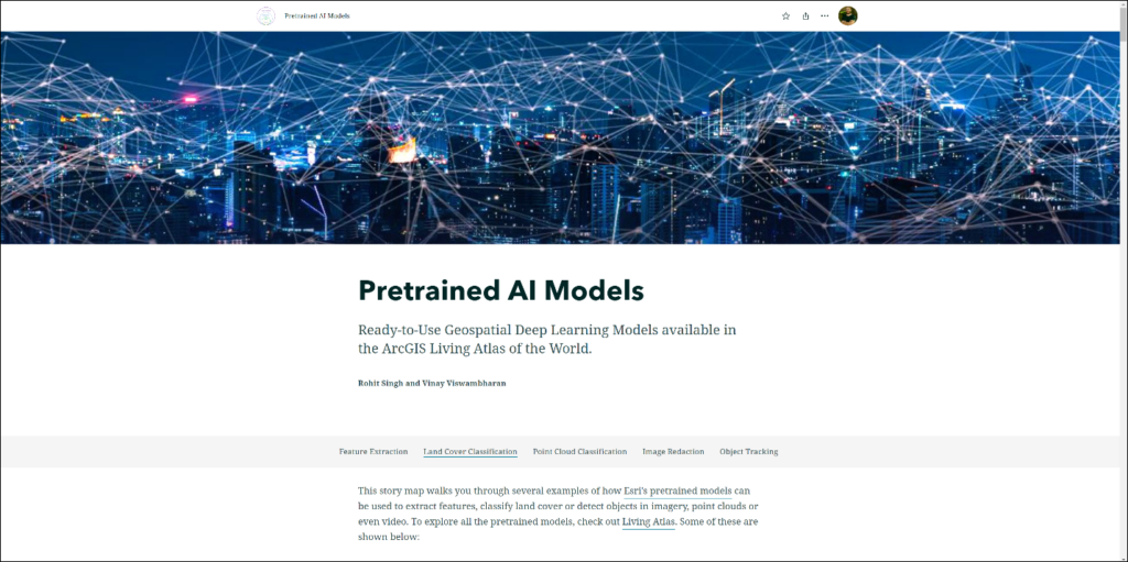
Interested in a sneak peek? Take a look at these Deep Learning packages in action with the Pretrained AI Models StoryMap.
There are also ways to refine these pre-trained models to work with features common to your geography. See the following articles for other ways to work with these models.
- Train Deep Learning Model
- Repurposing Deep Learning Models using Transfer Learning in ArcGIS
- Fine-Tune a Pretrained Deep Learning Model
- Learn Module form the Python API
Apps
Content from ArcGIS Living Atlas of the World is used to make stunning, valuable apps for visualization and analysis. These are a great way to explore different datasets, download data or extract layers for other workflows and to get inspired by what can be created with the many layers contained within the Living Atlas. Some of these apps may become your go-to for certain project needs.
- World Imagery Wayback – This app offers a dynamic Wayback browsing and discovery experience where previous versions of the World Imagery basemap are presented within the map, along a timeline, and as a list.
- ArcGIS Vector Tile Style Editor – ArcGIS Vector Tile Style Editor is a tool to give you a fast and easy way to create a custom vector basemap style that matches your brand and the type of app that you are building.
- Sentinel-2 Land Cover Explorer – Annual 10-meter global land use/land cover maps presented in a ready to use web application for dynamic visual and statistical change analysis.
- EcoExplorer – Explore the terrestrial ecosystem through the World Ecophysiography Map.
- Air Quality Aware – The Air Quality Aware app is intended to provide information about the current conditions of air quality in the United States, along with the potential human health impacts.
- Landsat Explorer – A custom web application for visualizing and analyzing Landsat imagery.
- SSURGO Downloader – This application provides quick access to ready-to-use project packages filled with useful soil data derived from the SSURGO dataset.
Living Atlas gives you that advantage for all your AEC project workflows, by saving you time searching for project data, jumpstarting your data analysis through deep learning packages, and helps interpret complex information through apps by providing a common visual language. Living Atlas can be adapted towards the wide spectrum of AEC projects you’ll encounter, allowing you to focus on the things that matter most to deliver your projects successfully.
List of AEC Curated Content – Living Atlas layers to explore!
We have launched a Living Atlas for AEC and Environmental Consulting StoryMap that includes a list of AEC curated Living Atlas layers, apps, and deep learning packages to support your workflows. This is a living StoryMap and these are a small subset of Living Atlas layers that can support your environmental planning, design approach, construction management, and ongoing operations on AEC and Environmental consulting projects. We will be updating this list from time to time to include new and relevant layers. If you have any additional layers that the AEC community could benefit from knowing about, comment on our AEC Living Atlas Community post and we’ll add it to our living curated StoryMap list!

