If you weren’t among the 4,100+ professionals who attended GEOINT 2024, you truly missed an outstanding event. Themed “GEOINT: Essential in All Dimensions and Domains,” this year’s conference brought together experts and enthusiasts from across the GEOINT community. It offered an unparalleled opportunity to explore how GEOINT is in every facet of our lives, connecting, learning, and innovating together. Join us as we delve into the highlights from GEOINT 2024.
GEOINT Foreword—May 5
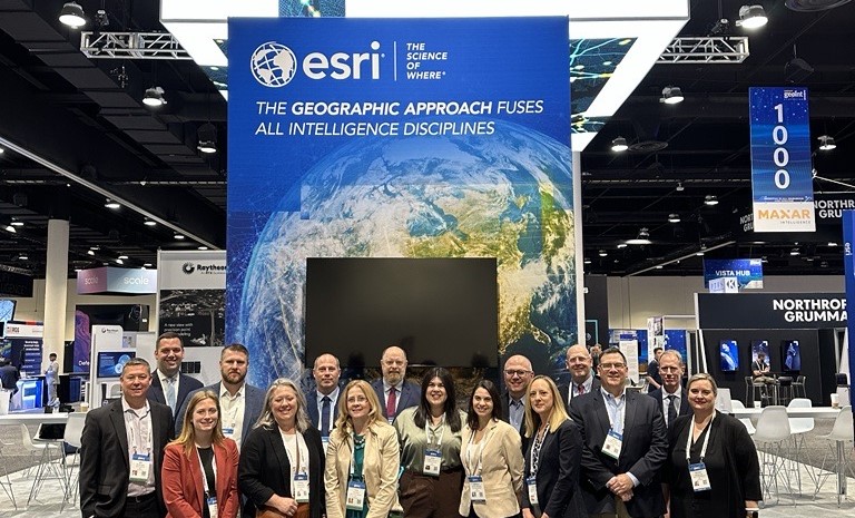
On Sunday, over 600 attendees participated in GEOINT Foreword sponsored by Esri. The focus was on exploring the potential of cutting-edge technology relevant to the GEOINT community. Christy Monaco, USGIF VP of Programs, emphasized the importance of understanding disruptive technology and how we must take responsibility for how it is used. Dr. Tara Mott, NGA Account Manager at Esri, and Jeffrey Dawley, Director of Intelligence at Esri, served as emcees for the foreword.
The “PNT Beyond GPS” panel emphasized the importance of quantum sensing for enhancing US GPS capabilities. The panelists discussed the necessity for standardization and the potential use of Earth’s magnetic anomalies for positioning, navigation, and timing.
On another panel, panelists discussed integrating AI models to enhance geospatial conversational AI experiences, aiding GEOINT planning and response missions using “Geo-GPT” capabilities.
Dare King, COO of the CIA’s Center for Cyber Intelligence, concluded the event by highlighting the role of GEOINT in cyber threat mitigation. She emphasized the need for collaboration with the private sector to keep pace with adversaries that target data for counterintelligence and influence operations.
GEOINT Day 1—May 6
On Monday, speakers highlighted the critical importance of space security, the rapid advancement of technologies, the integration of AI, and the necessity for industry collaboration to ensure global stability and effective decision-making.
Dr. Stacey Dixon emphasized the dual nature of increased access to space, which brings benefits and risks, particularly from satellite collisions and space debris. She highlighted the need for industry collaboration to mitigate these risks and maintain space security. Finally, she urged the audience to collaborate to avoid conflict and reduce risks in space.
Lt. Gen. David Miller, US Space Force, provided a historical perspective on military space operations and emphasized the growing need for the Space Force and a robust industrial base. He stressed the importance of rapid, high-quality analysis for decision-makers.
Vice Admiral Frank Whitworth, Director of the National Geospatial-Intelligence Agency, discussed the agency’s adaptation to meet the needs of modern conflicts, emphasizing the importance of providing actionable understanding and context.
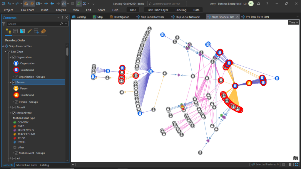
Tim Murphy, Director of Contextual Intelligence at Esri and Jeff Jonas, CEO, Founder, and Chief Scientist at Senzing presented on illicit activity detection with multi-int data fusion.
Shortly afterward, Amy Clarke, Senior Solution Engineer at Esri, and Tim Murphy, Director of Contextual Intelligence at Esri, hosted a training session using GIS and graph analytics to determine how Kevin Bacon is connected to Carmen Sandiego.
GEOINT Day 2—May 7
On Tuesday, discussions underscored the importance of collaboration, the evolving nature of technological challenges, and the critical role of GEOINT in national and international security. Integrating AI and commercial strategies and fostering international partnerships emerged as key strategies for advancing GEOINT capabilities.
La’Naia Jones, CIA Chief Information Officer, kicked off the morning by emphasizing the essential role of GEOINT in defense and intelligence and the necessity of treating intelligence as a collaborative effort. She highlighted the complex nature of modern conflicts and the CIA’s role in facilitating smoother sharing across networks through the Intelligence Community’s Cloud Computing Enterprise (C2E) program. She concluded by expressing confidence in the agency’s capabilities to adapt to future challenges.
A panel discussed how space conflicts could impact ground, sea, and air operations and the role of GEOINT in tracking threats. The panel emphasized the importance of intelligence from space data in modern conflicts and the influence of GeoAI and the NATO 2030 agenda.
Next, on a panel for democratizing GEOINT tradecraft, Robert Cardillo, USGIF Board Chair and panel moderator, emphasized the industry’s focus on collaboration rather than competition. The panel recognized the role of automation but emphasized that human-driven analytics remain crucial. They also highlighted the need to motivate and challenge data-literate personnel and the democratization of GEOINT capabilities across various sectors.
Earlier that morning, Esri and the USGIF hosted a breakfast for Minority Serving Institutions. The event aimed to unite students, faculty, senior leaders, and industry professionals to foster connections and collaboration. This was the second event in the series, following the inaugural gathering in February in Washington, DC, during Esri’s Federal GIS Conference (FedGIS). NGA deputy director Tonya Wilkerson, former DIA chief of staff Johnny Sawyer, and Dr. Tara Mott from Esri engaged with the students, discussing their career progressions, opportunities in the GEOINT community, networking, internships, and collaborating on curriculum and resources. Over 35 students and faculty from Bethune-Cookman University, Harris-Stowe State University, Fayetteville State University, North Carolina Central University, and Florida A&M University attended the event.
Later in the day, Gaby Gutierrez, a solution engineer at Esri, hosted a training session on enabling operations with the power of AI and open-source data.
Day 3—May 8
On Wednesday, discussions emphasized the critical role of modernization, collaboration, and the integration of new technologies in maintaining national security and strategic superiority. Key areas of focus included cloud computing, software modernization, 5G, and the importance of ethical AI development. Day 3 also highlighted the necessity of international and public-private partnerships in advancing GEOINT capabilities.
John Sherman, Department of Defense (DoD) CIO, discussed the evolving security environment, especially emphasizing the DoD’s continuous adaptation to emerging challenges and new technologies. He highlighted the impact of commercial imagery and the shift towards zero trust architecture for security, as well as three key areas of evolution: migration to cloud computing through the Joint Warfighting Cloud Capability (JWCC) initiative, 5G technology, and software modernization. He said, “We’ve got to be able to share data at the speed of mission,” and collaborate with interagency and international partners.
Chirag Parikh from the National Space Council highlighted GEOINT’s crucial role in national security, civil sector, and economic vitality. The evolving regulatory environment encourages government-private sector collaboration in cloud computing and AI. Challenges facing the community include integrating Space Force initiatives and threats from remote sensing satellites.
We look forward to seeing everyone at GEOINT 2025, which will be held May 18–21 at the America’s Center Convention Complex in Saint Louis, Missouri.
Learn more about applying GIS in defense and intelligence