A Customer Spotlight
Challenge
Guadalupe Valley Electric Cooperative (GVEC) is a major utility provider in south-central Texas, serving over 110,000 customers across a vast area. One of the challenges GVEC faced was managing the joint use of its utility poles. Driven by broadband initiatives, the volume of attachment requests more than doubled in a few years. The process involved communications companies sending their requests and documentation via email, which were then reviewed and responded to by GVEC’s joint use coordinators. This method, while functional, was not without its inefficiencies.
Tracking permit status via email was inefficient, often leading to multiple rounds of back-and-forth between coordinators as they tried to sort out the details. Questions like “Which permits are open?” and “Are we missing any information?” were common, as was the struggle to locate the right email with the attached form.
Spreadsheets and manual forms are slow and prone to error, making it difficult to communicate the details between parties and ensure accurate billing. The staff could not visualize or analyze where the activity was taking place. Furthermore, safety issues may result from poor communication, inaccurate records, and violations.
Solution
GVEC found an answer to these challenges. They used the downloadable no-cost Electric Joint Use solution to configure ArcGIS for this purpose. This solution helps manage the approval process, securely communicates with attaching agencies, supports field verifications with mobile apps, and creates an authoritative joint use inventory. The best part? It can be deployed in minutes, promising a swift and efficient transformation. Henrietta Krellenstein, GIS analyst at GVEC, commented, “The Electric Joint Use solution was easy to set up and customize to fit our needs.”

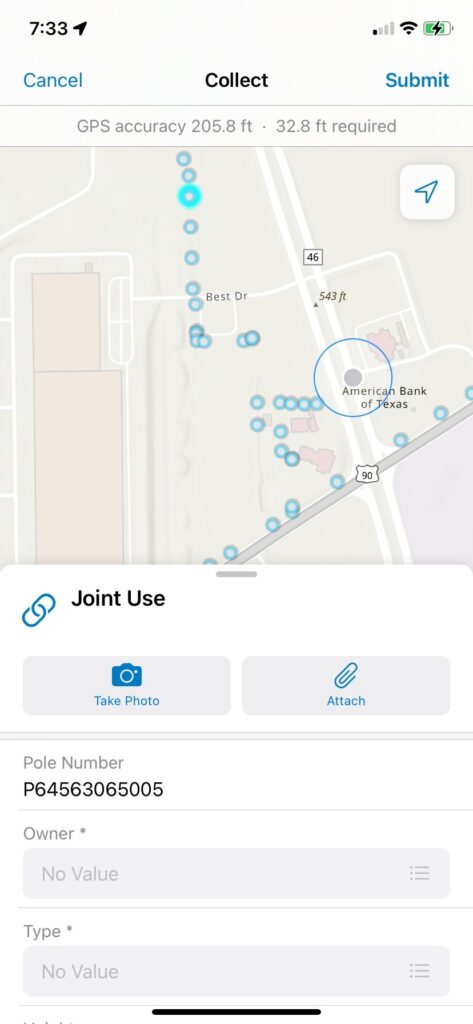
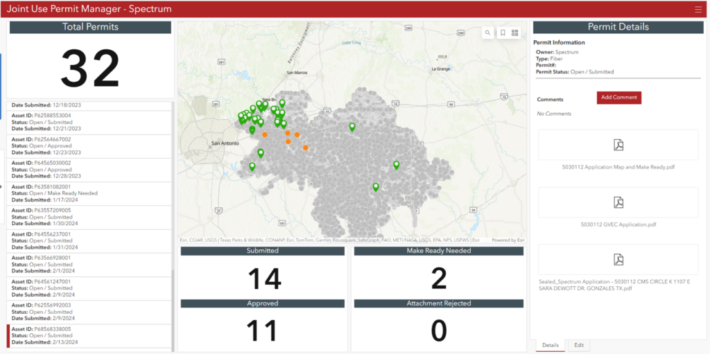
The collection of focused maps and apps work together as a comprehensive system from permit submission through field verification. The solution builds upon GVEC’s ArcGIS Enterprise system of record and ArcGIS Online. ArcGIS Survey123 forms collect data, while ArcGIS Field Maps provide maps in the field. Staff, communications companies, and contract inspectors use the system securely in their respective parts of the workflow. Communication companies utilize an ArcGIS Hub website to access their respective dashboards for permit activity and to resolve issues.
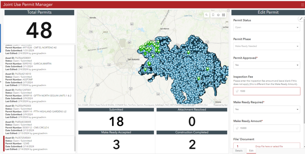
The utility’s joint use coordinators verify the documentation is complete and then determine any needed make-ready work and cost. GVEC configured email notifications so prospective attachers are immediately notified when a make-ready cost is added. When the attacher approves the cost, GVEC proceeds with the work. Any notes and data, including photographs supporting the work, are easily captured.
Results
GVEC’s permitting process is much simpler and faster now. Attachers submit their specific requests in a structured, self-documenting manner. Straightforward reporting is a natural byproduct of the accurate activity record.
GVEC is leveraging its investment in ArcGIS and location-based data. The Electric Joint Use solution streamlines the process of approving joint use requests, saving time and cost and improving service. All parties benefit from improved, predictable communication and documentation. Furthermore, this approach provides a data-driven basis for accurate billing, reducing issues and disputes.
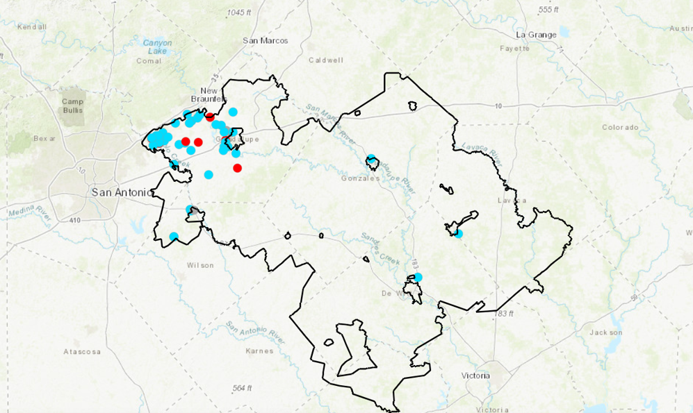
Utility staff also appreciate visualizing attachment locations, which aids planning and resource allocation. Reducing potential safety hazards from violations supports GVEC’s commitment to employee and public safety. The GVEC team is looking to other workflows for a similar approach to efficiency, effectiveness, and customer satisfaction.
“It has been powerful to see where the majority of our attachments are located and what patterns have emerged.” —Henrietta Krellenstein, GIS Analyst, Guadalupe Valley Electric Cooperative