Introduction and Background
Environmental science and engineering is a multidisciplinary field that integrates the biological, social, and physical sciences to solve the environmental problems we face every day. Environmental consulting firms, such as Tetra Tech, ERM, Arcadis, Golder, and GHD, examine the interaction between humans and their built natural surroundings to characterize and analyze complex problems. Every environmental driver—from compliance to pollution to habitat to biodiversity—has a geographic component.
AEC Sector and the Environmental Consulting Industry
AEC stands for architecture, engineering, and construction. A big part of the AEC sector includes the environmental consulting or management business. Much like the AEC sector itself, the environmental business casts a wide net of practices that are among the top industry focus areas at Esri. The renewed focus will help our team better understand and support the important environmental project work that industry consultants do.
Problem: Environmental Consultants Today Are Not Leveraging Modern GIS Technology to Its Full Potential
The benefits of GIS technology are constrained only by its users’ capability to understand, innovate, and apply its patterns. Limited use of GIS in environmental consulting typically manifests as the following:
- GIS regarded as only a simple mapmaking tool
- Outdated technology, deployments, and workflows
- Lower return on investment (ROI)
- Data silos and duplication
- Missed opportunities for growth and efficiency gains
- Failure to enable digital transformation
- Isolation from the data science community
- Lack of integration with solution development
Modern GIS Platform
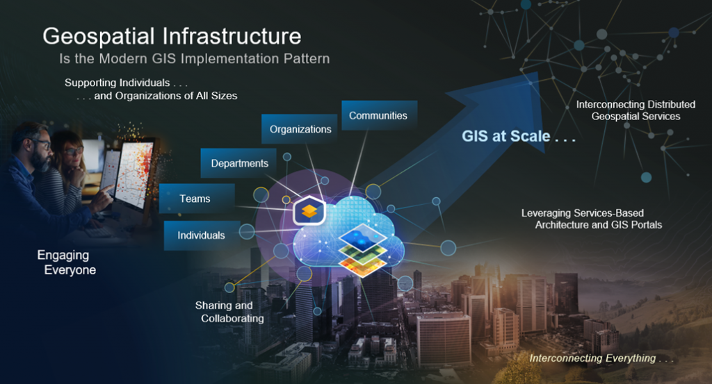
Modern GIS enables participation, sharing, and collaboration. The Esri ArcGIS ecosystem provides the visualization, collaboration, and analytical capabilities for organizations to empower employees and external stakeholders to make, use, share, and discover maps and web-based applications. ArcGIS can visualize and analyze information from other enterprise systems as well as external data sources such as imagery, remote sensing, and CAD/building information modeling (BIM).
How GIS Can Help in Environmental Consulting Practices
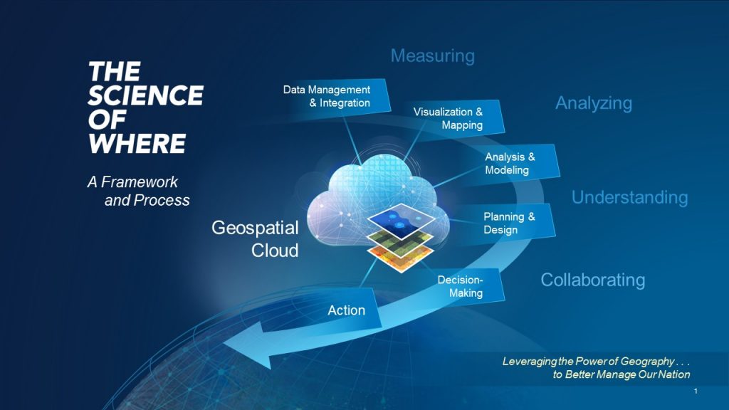
GIS has a long history of supporting environmental consultants to organize, analyze, manage, visualize, and make sense of our complicated world. As technology evolves, increasingly powerful GIS tools are becoming more accessible and, in a way, even more critical. GIS has become a game changer in the environmental consulting industry in areas such as the following:
- Modernizing and supporting electronic data collection in the field
- Understanding complex situations, making predictions, and offering tangible solutions
- Streamlining the regulatory environmental review process and reporting
- Facilitating collaboration and information sharing between many different stakeholders
It is hard to imagine modern-day environmental consulting without GIS technology.
Planning and Assessments
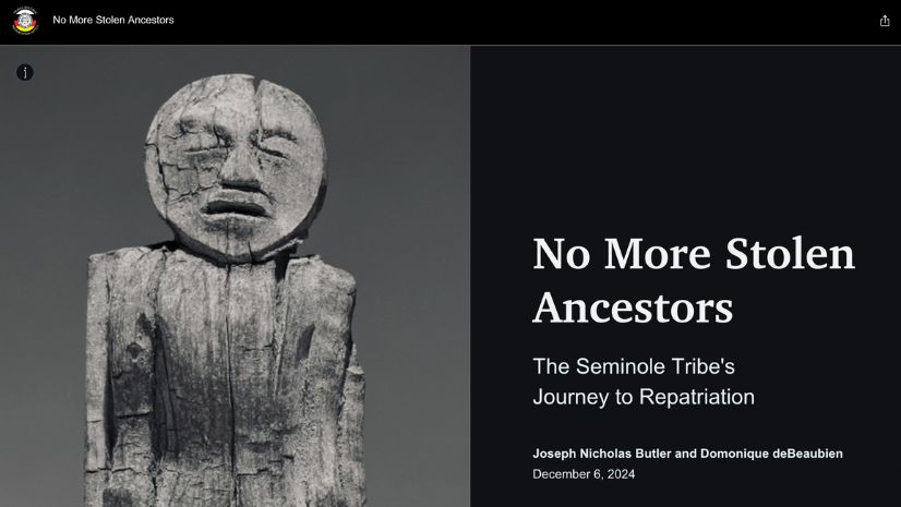
Environmental Impact Statements (EIS) require immense amounts of diverse data to be collected, analyzed, and documented. Many environmental consulting firms are adopting GIS technologies to perform complex resource analysis, distribute data to stakeholders, and produce numerous graphics and illustrations to communicate the findings. This, in turn, streamlines the environmental review process required by the National Environmental Policy Act (NEPA) and other environmental laws and regulations. Digital EIS reports created using ArcGIS StoryMaps are becoming popular deliverables.
Climate change and biodiversity loss have become top threats facing our planet. Many communities are developing climate change adaptation and resiliency strategies with the help of engineering and environmental consulting firms. Scientists, policy makers, developers, engineers, and many others have used GIS technology to better understand a complex situation and offer some tangible solutions to build more resilient communities. In the United States and in 60 countries around the world, 30×30 initiatives to conserve at least 30 percent of the land and ocean by 2030 are now in place to help confront the threats of climate change and biodiversity loss. The global commitment to dramatically cut back on carbon emissions will require new approaches and a much more efficient use of water, food, energy, shelter, and transportation. Esri’s GIS tools play a role in contributing toward these solutions.
Green infrastructure is a strategically planned and managed network of open space, watersheds, wildlife habitats, parks, and other natural and seminatural areas that enrich and sustain communities. As the world changes, connected landscapes are more likely to survive than isolated environments. Green infrastructure planning addresses what is fundamentally a spatial problem. Data about the natural world and built environment—from many sources, in a variety of formats, and at a range of scales—can be combined and modeled to uncover patterns and visualize relationships. GIS technology supports integrated strategic territorial planning, applying systems thinking to factor in relationships and outcomes when creating comprehensive plans. Communities are using GIS in tandem with other technologies to identify valuable local landscapes, prioritize which ones to protect, and plan connections within and beyond their boundaries.
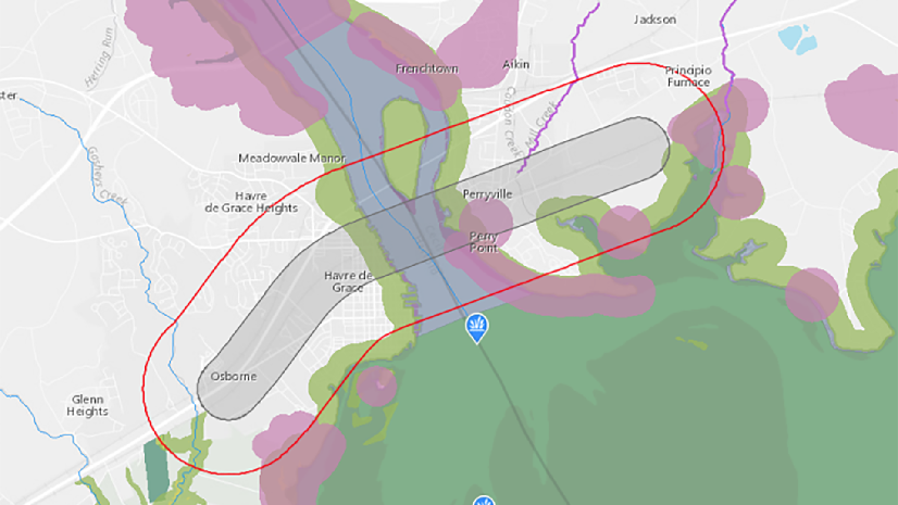
GIS technology allows environmental consultants to gain an improved understanding of contaminated sites. By gathering and analyzing remarkable volumes of environmental data, GIS enables users to observe, measure, and monitor restoration sites with incredible detail and precision. The data can be visualized on maps and dashboards that facilitate collaboration among all project stakeholders to respond quickly to areas in need of remediation. Users are empowered to craft innovative solutions that consider the entire restoration site, as well as nearby urban areas, businesses, and residents, with strategies that match the specifics of each place.
Environmental Measurement
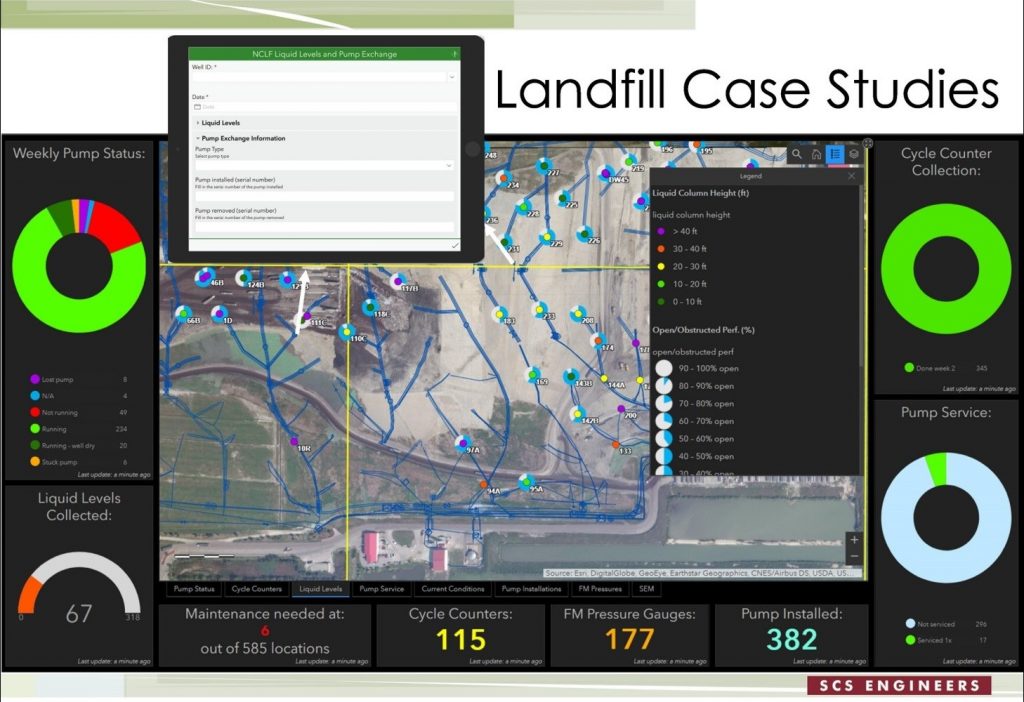
Maps have always been the way we understand the broader context of a plan, a place, or a situation. Today, entirely new kinds of maps and data visualizations are possible given the integration of sensors and the data we all generate with our devices. Around the world, organizations are applying field apps, drones, artificial intelligence (AI), machine learning (ML), and the Internet of Things (IoT) to populate a real-time view of assets and people on a shared map. Massive amounts of field data collection via digital forms and drones have been transformative for the environmental projects. The ability to consistently discover, access, and share historical measurements greatly empowers consultants to identify trends and predict outcomes.
Analytics and Prediction
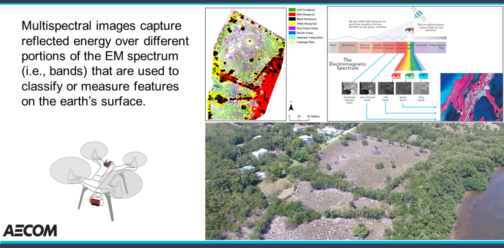
Modern GIS software brings clarity to complex challenges, such as climate change and biodiversity loss, by helping to make sense of the massive volume and variety of data. Datasets can be enriched, analyzed, and overlaid, revealing patterns and relationships that would otherwise remain hidden. GIS shows us an accurate picture of current conditions and allows us to model and simulate intervention strategies. GIS technology provides evidence-based information about places and proposed projects that can help address uncertainties and alleviate concerns. Data, reporting, and visualization integrations between GIS, CAD, environmental data management systems (EDMS), and laboratory data provide invaluable information about site conditions that can ultimately help with understanding the patterns and predictions.
Environmental Reporting and Management
A GIS-based decision support system can facilitate collaboration between many different stakeholders including government departments, community representatives, investors, and infrastructure owners and operators. Satisfying the demand for sharing large volumes of field information both internally and with clients in near real time is very important for the environmental consulting industry. Many environmental projects are in remote areas, necessitating the ability to access and collect enterprise information despite low or no internet connectivity. ArcGIS supports disconnected workflows, allowing information collected in the field to be synced to enterprise systems once connectivity is resumed. Digital project dashboards and interactive maps for real-time field information sharing and decision-making have proved to be very useful. The power of the web is transforming how environmental consultants deliver their services. The ability to put the operational field data in the hands of decision-makers is changing the game for them. Environmental consultants have been creating dynamic deliverable spaces (web maps and dashboards) for their clients, enabling them to own their data and maps and to scale the tools as the project requires.
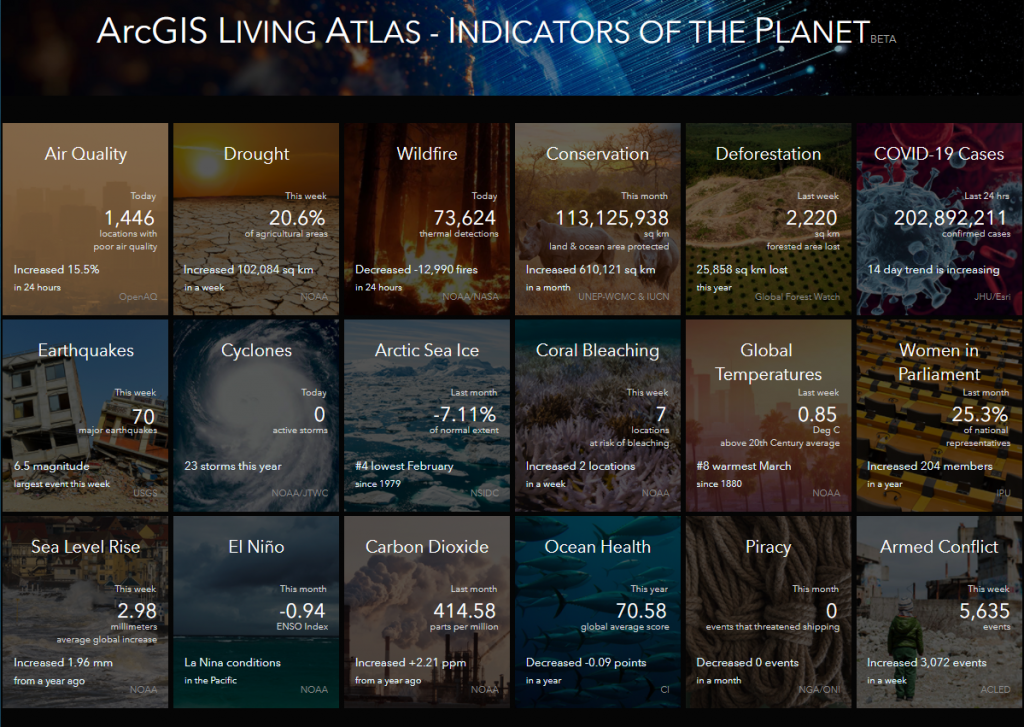
ArcGIS Living Atlas of the World is the foremost collection of geographic information from around the globe. It includes imagery, basemaps, demographics and lifestyle data, landscapes, boundaries and places, transportation, earth observations, urban systems, oceans, and historical maps. ArcGIS Living Atlas Indicators of the Planet is a place where policy makers, science communities, and the public can come to explore topics and better understand the nature of change on the planet.
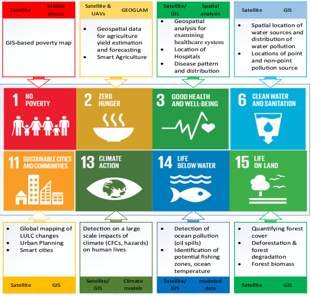
Recognizing the value of GIS at a global scale, the United Nations has organized the Sustainable Development Goals (SDGs) with GIS as a foundation. Each participating country is collecting relevant data dealing with society, the environment, and the economy to tackle SDGs related to such challenges as poor water quality, forest loss, and lack of affordable clean energy. Considering the wide range of targets of the SDGs, geospatial technology is essential to monitoring and evaluating their progress and accomplishment, which will ultimately lead to achieving the goals. ArcGIS plays a fundamental role in creating and sharing SDGs data and informing policy formulation and decision-making around sustainable development programs and investments. Esri’s collaboration capabilities—including StoryMaps allow SDGs stakeholders, such as local, national, and global policy makers, to freely share information.
Many environmental consulting firms have reactive emergency response projects tackling such disasters as disease outbreaks, hurricanes, earthquakes, tornadoes, oil spills, and fires. Real-time dashboards are a vital tool for responders, enabling proactive mitigation of climate change impacts. Addressing the energy crisis with renewable energy, green infrastructure, and sustainable development will be a continued focus for the environmental consulting industry.
Business Innovation and Digital Transformation
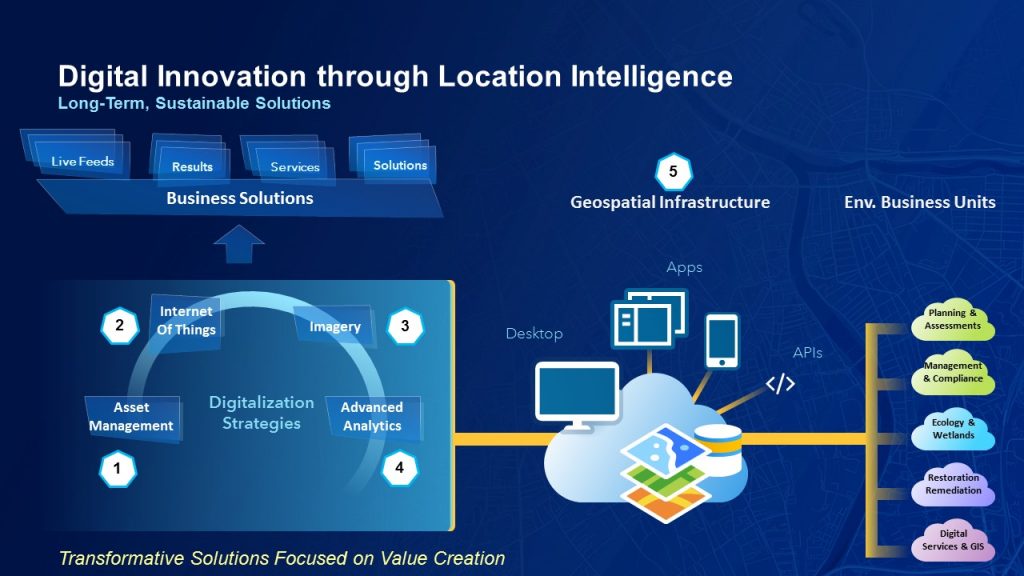
Most digitally savvy executives use data-driven insights to propel decision-making. The most competitive organizations and industries are transforming core business practices by tapping into a critical dimension of data—location. Location data—the where factor—is especially valuable for businesses and organizations today. In an era where we are connecting billions of data-producing products, assets, buildings, and devices to the Internet, each with a unique location, the need to use location intelligence technology to discover the hidden value in data will only grow. Fed by spatial analytics and real-time data, location intelligence technology has broad applications.
GIS is transforming engineering and environmental firms through improved workflows, better collaboration, and strategic partnerships to build smart communities and assets for the future, driving the digital transformation. Many consulting firms have created digital service lines to facilitate this transformation for their clients, empowered with location intelligence and Esri’s innovative GIS tools.
Enhancing the digital and business transformation of the environmental consulting industry can be achieved through the following:
- Extending location to improve the productivity of project teams
- Realizing new industry solutions
- Supporting the creation of new revenue streams
Conclusion
Modern GIS takes advantage of advanced technologies like artificial intelligence, spatial analysis, remote sensing, cloud computing, reality capture with drones and sensors, robust field data collection, and real-time and 3D visualization to ensure that development projects are environmentally sustainable. GIS is a powerful technology that enables the environmental consulting industry to perform better and protect the environment we live in.
With modern GIS technology deployment, environmental consulting firms will be able to
- Get the most value from their technology investment.
- Have connected, efficient workflows.
- Provide better service to clients.
- Deliver work digitally.
- Drive business transformation.
- Open new business opportunities.

