For several decades, the world of Architecture and Urban Design has been influenced by a range of technologies. From CAD and its ability to digitize the drawing process, enabling professionals to create detailed and intricate drawings and plans with unparalleled accuracy and speed. Or 3D modeling on the PC which has delivered lifelike renderings allowing designers to visualize concepts with unprecedented realism and accuracy. Or, photo-editing tools, improving visual communication and presentation with powerful capabilities, allows architects, designers, and urban planners to manipulate, combine and refine images, renderings, and photographs with precision and creativity.
However, among the wide range of tools and platforms available for many years, Esri’s suite of Geographic Information Systems (GIS) solutions stands out as a unique offering enabling data-driven insights combined with compelling visualization and unparalleled communication capabilities. With a comprehensive collection of desktop, online, and mobile application that includes ArcGIS Pro, ArcGIS CityEngine, ArcGIS StoryMaps, and the Living Atlas of the World, Esri has revolutionized the practice of urban planning and architectural design. These GIS tools serve as catalysts for change, empowering professionals to navigate the complex interplay of spatial data, community dynamics, and environmental factors with unequaled precision and insight.
Through the advent of GIS tools and the growing use of these solutions, Esri is ushering in new ways of creativity and efficiency in the field of Architecture and Urban Design. Gone are the days of relying solely on manual processes and intuition; today, architects, urban planners, and designers leverage the power of GIS to inform every stage of the design process. From site selection and analysis to conceptualization, visualization, and stakeholder engagement, Esri’s tools provide a robust framework that streamlines workflows, enhances decision-making, and ultimately leads to more sustainable and inclusive urban environments.

Clay Starr, Esri’s Senior Account Manager and lead of the Architecture, Urban Design & Planning team, emphasizes the significance of GIS in this context, stating, “Esri’s GIS solutions offer unmatched capabilities and low barrier to entry for architects and urban planners, enabling them to integrate authoritative, contextual data seamlessly into their projects to make informed decisions.” Starr points to a recent project of one of his customers, where ArcGIS Pro was instrumental in analyzing environmental factors and regulatory frameworks for a mixed-use development in a rapidly growing urban area. “ArcGIS Pro uniquely allowed the design team to assess the site’s suitability for development while ensuring compliance with local zoning regulations and environmental restrictions,” he adds.
Understanding Geographic Dynamics with ArcGIS Pro: Environmental, Topographical, and Infrastructural Considerations
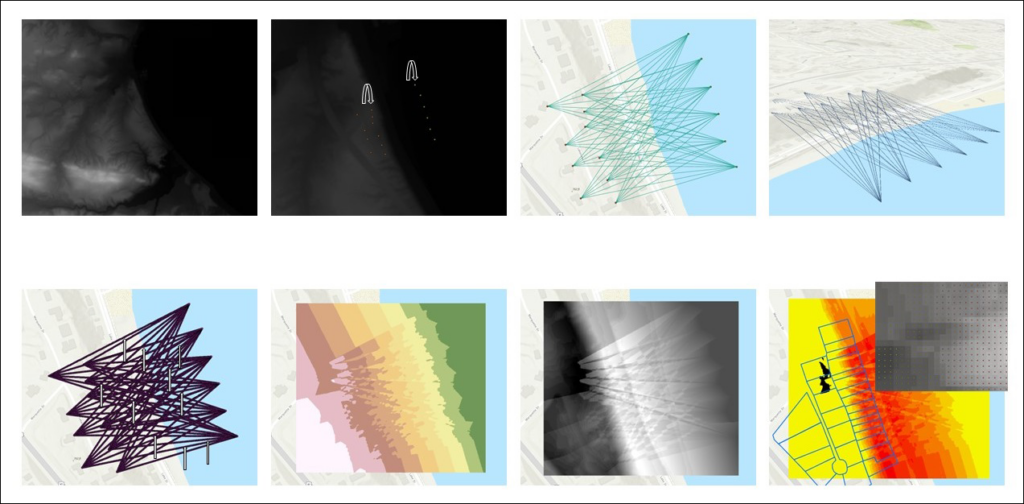
ArcGIS Pro plays a pivotal role in enabling architects and planners to comprehend the intricacies of geography by addressing various environmental factors, topographical features, terrain nuances, and existing infrastructure layouts. Renia Kagkou, Senior Solution Engineer specializing in Architecture, Urban Design, and Planning at Esri, underscores the importance of ArcGIS Pro, noting, “With ArcGIS Pro, designers can conduct sophisticated spatial analyses for site selection, unpacking existing socio-environmental conditions, and defining program distribution.” Kagkou references a project she collaborated on where ArcGIS Pro was used to conduct a detailed line of sight analysis to support height limitation policies, that will maintain uninterrupted views of Lake Michigan for a proposed residential community. Renia describes how a non-profit community development organization in Delaware gained insights, “By using ArcGIS Pro, the organization and the designers they collaborate with, were able to analyze a wide range of geographic data, including demographics, land use, transportation networks, and access to resources. By overlaying and analyzing this information, they gained valuable insights into the complexities of the neighborhoods they were working in, identifying areas of opportunity and potential challenges.”

Navigating Ecological, Socioeconomic, and Governance Considerations with ArcGIS CityEngine
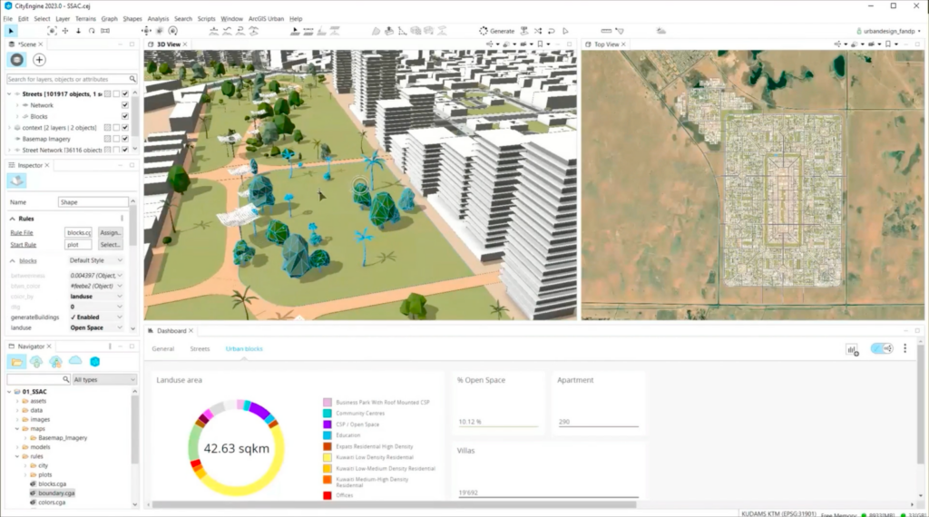
Esri’s ArcGIS CityEngine facilitates the integration of spatial data to provide insights into the potential ecological, socioeconomic, and governance (ESG) impacts of proposed initiatives. Shiori Sasaki, AIA, Senior Consultant at Esri Professional Services, Built Environment – AEC Practice, highlights the capabilities of Esri’s parametric solution, stating, “By leveraging tools like CityEngine and ArcGIS Urban, architects and planners can rapidly generate 3D models of urban environments that are connected to underlying, contextual data, enabling project team members and clients to visualize and assess the implications of design decisions or proposed policies.” Sasaki cites a recent project by architecture firm Foster + Partners who used ArcGIS CityEngine to create an optimized city layout based on criteria like access to parks and essential services. The rich 3D model was then published to a Web Scene and passed into Epic Games’ Unreal Engine to create an immersive 3D visualization of the proposed city, allowing stakeholders to explore different design scenarios and understand their impacts on the surrounding environment and community, both spatially and through dashboard KPIs.

Fostering Community and Stakeholder Engagement with ArcGIS StoryMaps
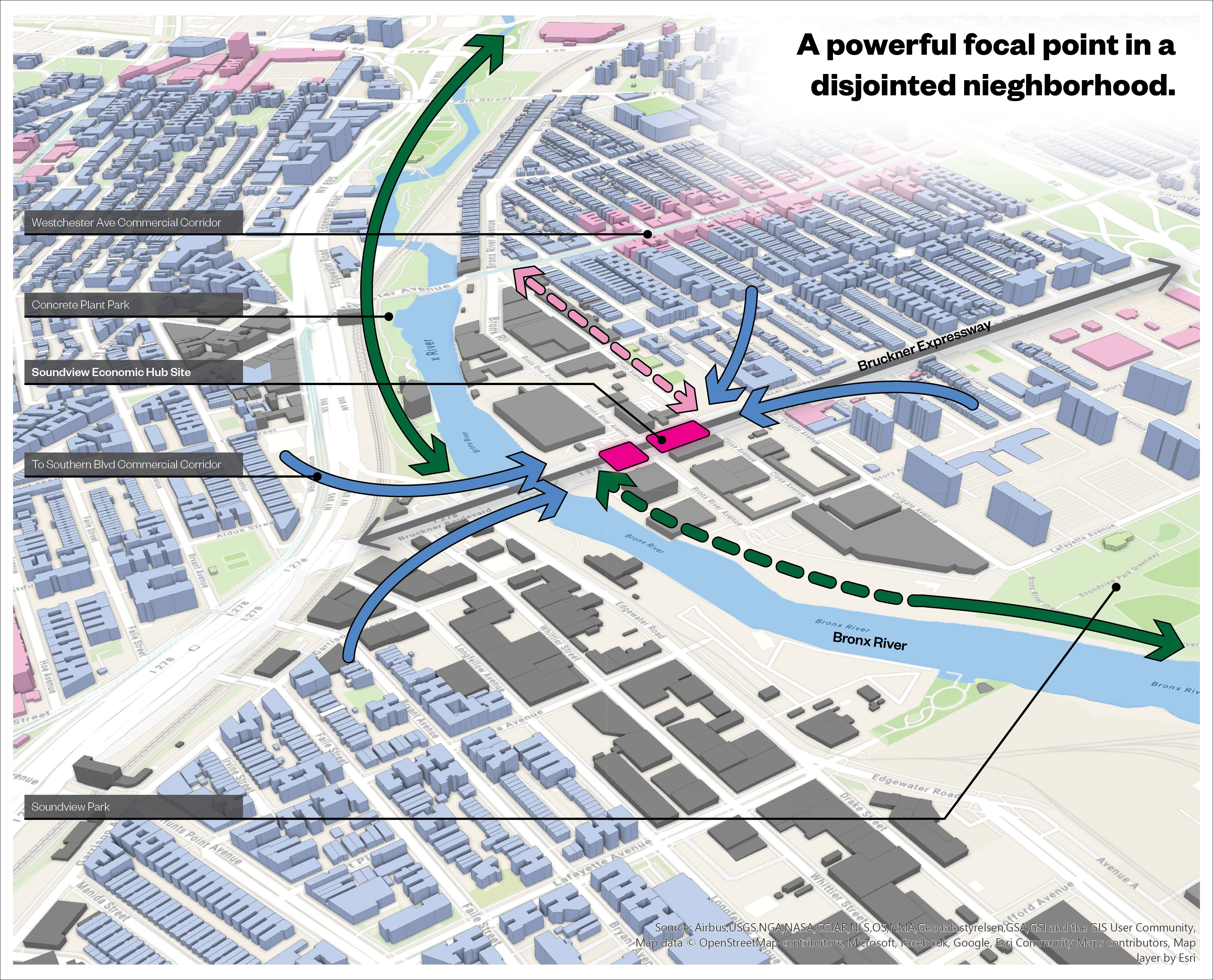
ArcGIS StoryMaps emerges as a powerful tool for fostering meaningful engagement between urban planners, developers, and community stakeholders through interactive maps and visual data representations. Patrick Wallis, Esri Built Environment Lab Director, emphasizes the importance of community engagement facilitated by ArcGIS StoryMaps, stating, “ArcGIS StoryMaps enables stakeholders to communicate their visions effectively, fostering collaboration and ensuring that urban development projects are responsive to community needs.” Wallis recalls a project where ArcGIS StoryMaps was used to create an interactive narrative showcasing the historical significance and future plans for a revitalization project in an urban neighborhood, sparking community dialogue and garnering support for the initiative.
Analyzing Scenarios, Evaluating Options, and Enhancing Decision-Making Metrics with Living Atlas of the World
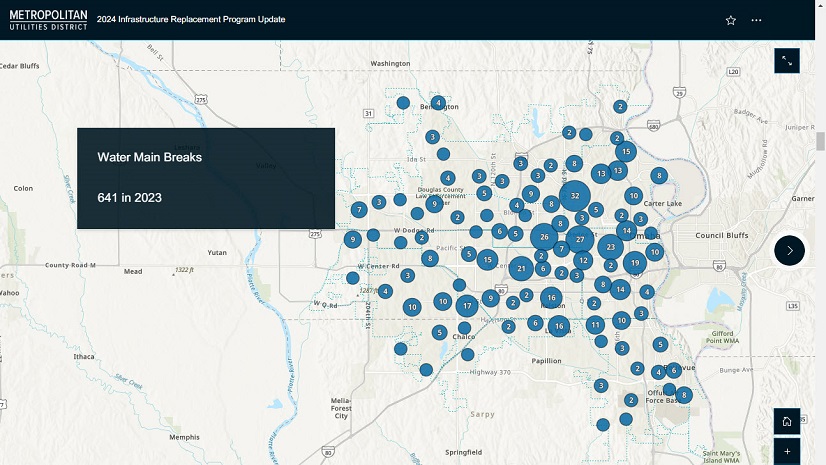
Esri’s Living Atlas of the World enriches the decision-making process by providing access to a wealth of authoritative spatial data. Clay Starr underscores the significance of the Living Atlas of the World, stating, “By leveraging the comprehensive datasets and large learning models available in the Living Atlas of the World, architects and planners have access to vast amounts of data allowing them to analyze scenarios, evaluate options, and automate tasks helping them make informed decisions that prioritize sustainability and community well-being.” Starr references a recent project where the Living Atlas of the World was utilized to assess the impact of sea-level rise on coastal communities, informing the design of resilient infrastructure and land-use policies to mitigate future risks.
Esri’s GIS solutions, including (but certainly not limited to) ArcGIS Pro, ArcGIS CityEngine, ArcGIS StoryMaps, and the Living Atlas of the World, empower architects and urban planners to design vibrant, sustainable, and inclusive urban environments. Through the insights provided by these tools and the successful projects they have contributed to, professionals can navigate complex geographic dynamics, engage stakeholders effectively, and make informed decisions that shape the future of our cities.
To learn more about leveraging Geographic Information System (GIS) data and the geographic approach for more informed planning and design visit this StoryMap.

