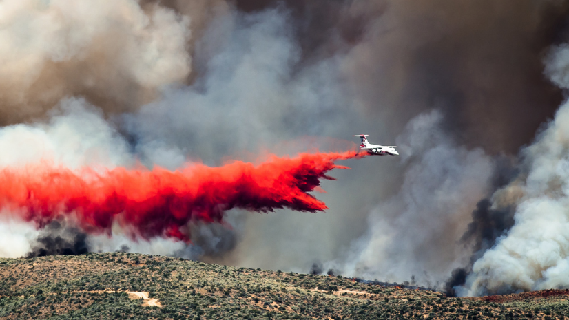
Esri public safety personnel were pleased to support the Eastern Mediterranean Wildland Urban Interface (WUI) Symposium held in Athens, Greece, in March 2024. The event served as a pivotal gathering for experts, practitioners, and policymakers from both the United States and Europe. As urban conflagrations continue to escalate globally, the interface between wildlands and the built environment becomes increasingly significant. In this briefing document, we’ll explore key topics discussed during the symposium, shedding light on the challenges faced by fire agencies on both continents.
Defining Wildland Fire vs. Urban Conflagrations Driven by Wildfires
Wildland fire refers to fires within natural landscapes such as forests, grasslands, and other undeveloped areas. These regions play a crucial role in ecosystem health, biodiversity, and carbon sequestration. However, when fires ignite within these wildland areas, they pose significant threats to nearby communities, infrastructure, and lives. The distinction between wildland fire and urban conflagration lies in their context: wildland represents the untouched natural environment, while urban conflagration signifies an uncontrolled fire that spreads rapidly through communities. A recent article available on USDA’s website, “WUI Is Not a Wildland Problem,” emphasizes that these urban conflagrations present unique challenges requiring tailored solutions beyond traditional risk reduction, mitigation, and firefighting approaches.
What Challenges Do We Face?
1. Mitigation
Mitigating fire risk in the WUI involves collaborative efforts among fire agencies, local governments, and communities. Strategies include fuel reduction through controlled burns, defensible space around structures, and community education. Effective mitigation reduces the likelihood of ignition and limits fire spread in residential areas.
2. Code Development and Enforcement
Building codes and land-use regulations play a critical role in enhancing wildfire resilience. Fire-resistant construction materials, setback requirements, and landscaping guidelines are essential components. Consistent enforcement across jurisdictions is vital for safeguarding communities.
3. Evacuation and Notification
Timely evacuation during emergencies saves lives. Early warning systems, well-defined evacuation routes, and community drills are essential. Coordinating with emergency services and educating residents on evacuation procedures are key challenges. FEMA, USFA, and NIST are working diligently on mass communication and evacuation capabilities to support local and state operations in response to these significant events.
4. Data-Informed Community Risk Reduction (CRR)
Leveraging data analytics and geographic information system (GIS) technology, fire agencies can assess risk, prioritize mitigation efforts, and allocate resources effectively. Understanding community vulnerability, identifying high-risk areas, and implementing targeted interventions are crucial.
5. US National Collaboration on Evacuation and Refuge Areas (TFRA)
Coordinating evacuation efforts across agencies and jurisdictions is complex. The Temporary Fire Refuge Area (TFRA) program aims to standardize protocols, establish communication channels, and designate safe refuge areas during evacuations. Collaboration ensures efficient response times and minimizes chaos. NIST experts are working on developing standards for this capability.
6. Mutual Aid (EU Model)
The European Union’s European Civil Protection and Humanitarian Aid Operations established the Emergency Response Coordination Centre to manage mutual aid operations and serve as a model for cross-border cooperation during significant incidents. Sharing resources, personnel, and expertise across countries enhances response capabilities. Learning from the EU’s practices can strengthen international collaboration.
7. Dealing with Recovery Issues
After urban conflagrations, communities face recovery challenges. Infrastructure repair, mental health support, and ecosystem restoration are critical. Agencies must address long-term impacts, including repopulation, assistance funding, long-term sheltering, soil erosion, water quality, and habitat recovery.
8. Wildfire Response and Training for Structural Firefighters
In the United States, a large percentage of wildfires and WUI incidents are first addressed by local and state fire resources. Structural firefighters often lack specialized training for wildland firefighting. Incorporating wildfire-specific modules into their training ensures effective response. Joint exercises and knowledge exchange bridge the gap between structural and wildland firefighting. The USFA is identifying the appropriate funding and training development for municipal fire service agencies in their response to these incidents.
Please reach out to Esri if you need any assistance with wildland urban interface issues, risk reduction, mitigation, risk assessment, operations, and recovery issues.


