Introduction
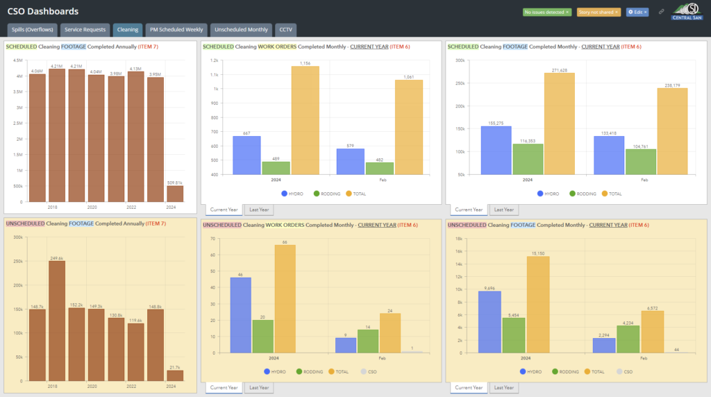
Central Contra Costa Sanitary District (Central San) is a special district in California, serving nearly half a million residents and more than 15,000 businesses on over 3,000 parcels within a 146-square-mile service area. Established in 1946, Central San provides vital wastewater collection and treatment services to a diverse range of communities via 1,500 miles of sanitary sewer piping, playing a crucial role in public health and environmental protection. Central San has dedicated itself to maintaining this crucial infrastructure through rigorous inspection and maintenance protocols and detailed geospatial management using ArcGIS Enterprise.
The Challenge
Central San is very proactive in constant inspection and maintenance on their sanitary sewer system. However, Central San found themselves inundated with data from daily pipe inspections conducted by both their internal crews and external contractors. Their crews annually inspect up to 50,000 feet of sewer lines, with external contractors covering up to 100,000 feet. Further complicating the issue, contractor data and internal crew data were stored and delivered via separate methods, making consolidation into the Esri GIS a painful process. The existing pipe inspection software, reliant on Access databases, was fraught with issues, particularly when receiving and integrating data from contractors. Additionally, the previous internal crew pipe inspection software was tied to specific hardware, often causing a break in the link and limiting access since the software did not have a web version for staff use. This resulted in staff having to download data to local computers, restricting access, and creating bottlenecks in the workflow as they tried to bring their closed-circuit television (CCTV) inspections to their robust Esri ArcGIS.
The Solution
In 2017, Central San’s Collection System Operations Division made a pivotal decision to switch to ITpipes, drawn by its web interface and the seamless partnership and integration with Cityworks and Esri Feature services. In 2020, Central San required the contractors to switch to ITpipes which facilitated a streamlined workflow where the external contractor’s hosted ITpipes cloud syncs data to Central San’s cloud and then to their on-premises service. The process for issuing pipe inspection work became more efficient, with work orders created in ITpipes and synced out to trucks. Following inspection and QA/QC processes by the contractor and Central San, the inspection video and observations automatically become readily available to all staff via a link in their Esri GIS, enhancing asset management and maintenance planning.
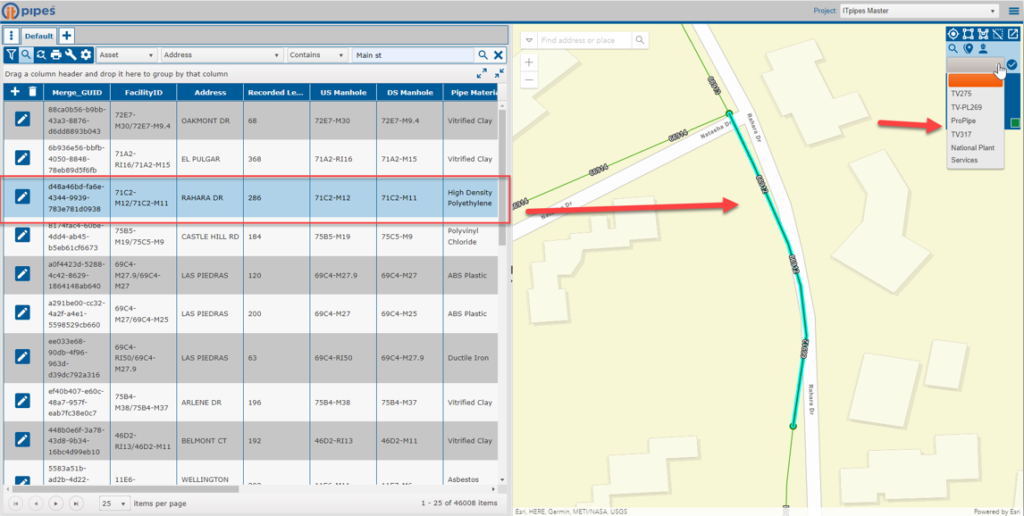
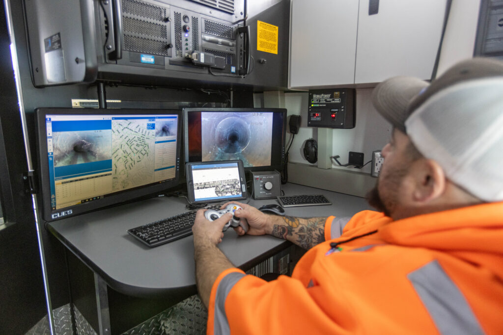
For internal field crews, the robust integration with Cityworks empowers Central San’s Collection System Operations. Work orders issued through Cityworks are automatically downloaded by ITpipes and assigned to the appropriate truck. This integration simplifies the inspection process, reduces data entry errors, and enables Central San to track costs for staff and equipment effectively. Additionally, ITpipes Mobile integrates Esri basemaps to ensure up-to-date geographical information is available to field inspectors, enhancing the accuracy and efficiency of inspections.
“ITpipes has greatly reduced staff time required to manage our CCTV contract by allowing us to use a graphical interface to easily see what pipes are due for inspection and assigning the work to the Contractor with a few clicks. The web interface has reduced the time needed to process and review the videos from a few months to a week.”— Jason DeGroot, Senior Engineer
The Result
The adoption of ITpipes and its integration with Cityworks and Esri has significantly improved Central San’s operational efficiency, allowing for better management and assignment of work. This system overhaul has ensured that the entire sewer network is inspected every ten years, with automated processes and detailed geospatial visualization, reducing the risk of missed inspections. As a result, sewer spills (also known as overflows) have dramatically declined. Central San’s capital improvement program has seen tangible benefits from these efforts, replacing and repairing infrastructure based on actionable insights from the inspection data.
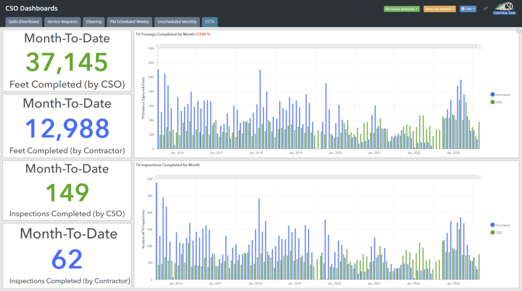
For Senior Engineer Jason Degroot and his team, the new system has alleviated the cumbersome methods previously used to determine maintenance needs. Errors have been reduced thanks to pre-populated fields in ITpipes, automatically pulling the asset ID from Esri GIS, thereby streamlining the process from inspection to data analysis and reporting. This efficiency has freed up significant time for staff like GIS Analyst Carl Von Stetten, who previously spent significant time each month reconciling CCTV inspection data with GIS, a task now rendered obsolete by the seamless data sync capabilities of ITpipes.
“The integration of ITpipes with ArcGIS and Cityworks enabled us to turn our infrastructure inspection data into accessible and actionable intelligence, simplifying workflows across our organization.” — Carl Von Stetten, GIS Analyst
Conclusion
Central San’s transition to ITpipes, in collaboration with Cityworks and Esri, exemplifies the power of integrated technology solutions in managing and maintaining critical infrastructure. The result is a more efficient, accurate, and accessible system that not only saves time and resources but also significantly improves the reliability and safety of the community’s sanitary sewer system.
Stay Connected with Esri’s Water Team
ArcGIS is an extensive information system that enables modernization of workflows with easy-to-use applications for the field and office. Strengthen your organization with smart water solutions that will increase efficiency and provide insight for decision-makers. Visit the Esri Water Utilities web site for more information.
Join the Water Utilities Community
Follow #EsriWater on social media: X | LinkedIn
Subscribe to the Water Industry newsletter “Esri News for Water Utilities and Water Resources“

