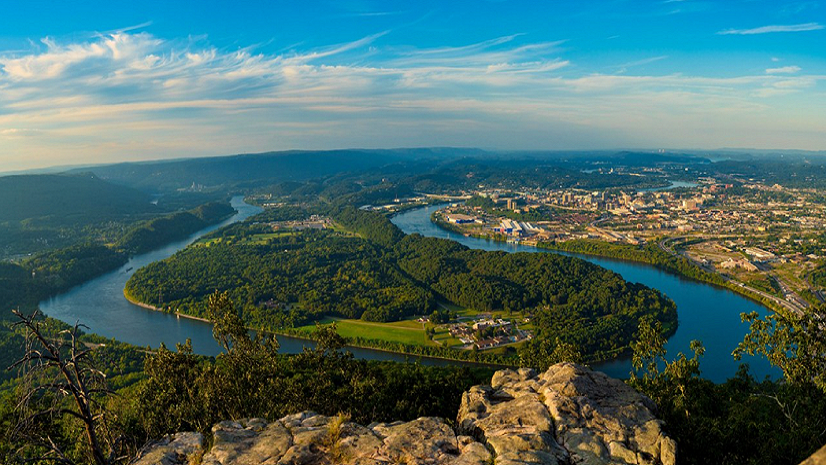
America’s population migration, particularly over the last 5 years, has been anything but stagnant. When the counter-urbanization trend began in 2019, nearly 2 million residents left urban areas for suburban and rural settings. That trend was exacerbated by the pandemic. Residents saw fewer requirements and benefits of living in denser settings and moved to areas they found more desirable. This led to many suburban and rural areas being overwhelmed by new housing demands that they had previously anticipated would slow, since more people were moving into urban areas in the early and mid-2010s.
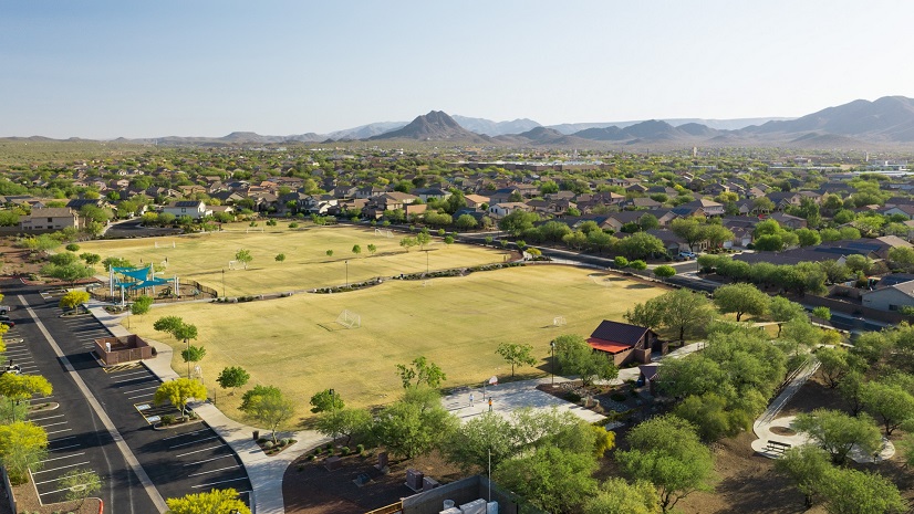
Housing development does not exist in a vacuum. It requires infrastructure, including roads, utilities access, and proximity to jobs, services, education, healthcare, and parks and recreation. At the municipal level, multiple departments must review, analyze, and sign off on developments, but its planners that drive the narrative when it comes to ensuring developments meet the needs of residents.
A key part of that process is creating and preserving parks and green spaces. Most municipalities have requirements for this based on the size of the development and/or the number of new residents that will be added. Developers, who are also aware of these requirements, will include this in their plans, but it is up to planners to analyze whether what is provided meets the actual needs of residents (as opposed to checking a box on the review sheet).
Using a Geographic Approach to Parks and Green Spaces in Current Planning
ArcGIS provides the tools that planners need to design and analyze parks and green spaces at small and large scales. Planners can use ArcGIS Urban to create and apply space use types to parcels to represent ground space use. They can also add elevation layers directly to individual development scenarios to see how different surfaces might interact with the terrain. In essence, this is geodesign at work.
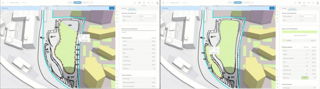
For instance, in the above example, a planner could be looking at a drainage basin within a proposed development that the developer wants to set aside for an open space or park. The surface editing tools in ArcGIS Urban would empower the planner to quickly trace an outline of the proposed park based on the elevation layer. Now, the planner can use a more precise tracing, which enables them to accurately calculate the area coverage of the proposed park. This elevation layer provides the detail and context needed to design ideal spaces and surfaces.
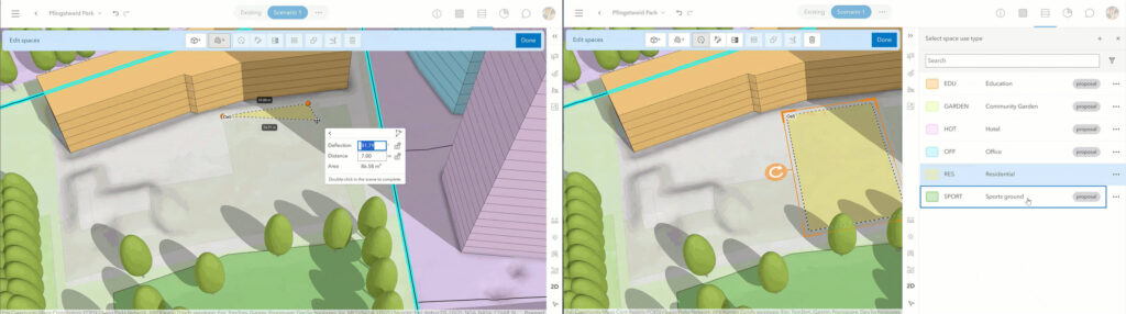
Any planner knows that proposed developments are very detail-oriented and the developer submitting the proposal wants to take maximum advantage of the property. With that in mind, planners can also sketch with exact measurements. In the example below, we can see precise distances and measurements being added to meet the requirements for a soccer field.
The bigger picture is that ArcGIS provides a platform for planners and developers to collaborate more closely, faster, and with greater accuracy. This reduces the development review time and helps push through qualified developments in a timelier manner.
Parks and Green Space in Long-Range Planning
Planning departments are also responsible for maintaining the comprehensive (or long-range) plan for their community. The most challenging aspect of this is accounting for future growth. Where will the greatest demand be? What about the greatest need? When it comes to meeting the needs of residents in 5-10 years, will there be enough affordable housing, commercial space…or parks?
Again, ArcGIS empowers planners with land use planning tools in ArcGIS Urban. At its core, this enables planners to leverage a data-driven (and geographic) approach to allocation of space for parks and green spaces in future land use.
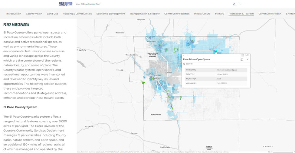
One of the key advantages of long-range planning, as opposed to current planning, is the timeframe with which to work. Long-range plans are updated over a course of months (if not years) and provide a greater opportunity for public engagement. In El Paso County, Colorado, county planners and leaders used surveys, questionnaires, and interactive maps housed in an ArcGIS Hub site to effectively engage as much of the public as possible. This concept of civic inclusion helps to better establish buy-in from the public.

Parks and recreation were a key part of the county’s master plan, as evidenced in their published StoryMap. The master plan focuses on maintaining the 8,000+ acres of parkland, 19 park facilities, and 130 miles of regional trails. More equitable access to these facilities has been prioritized too, as over 60% of the residents in this enormous county are less than a 15-minute drive to a County parks facility (most of the remaining percentage is within the municipal boundaries of Colorado Springs).
Parks Revolve Around Planning
The involvement of the planning department in parks has existed for decades. It’s not new. But with the use of GIS and a geographic approach, planners have never had an easier way to be more directly involved in the process from green spaces location to park design. Equally as important, they have a more collaborative approach than ever, ensuring that all stakeholders have a voice and that residents’ needs are met today and down the road.
Learn more about planning parks and recreation for the next generation using GIS.