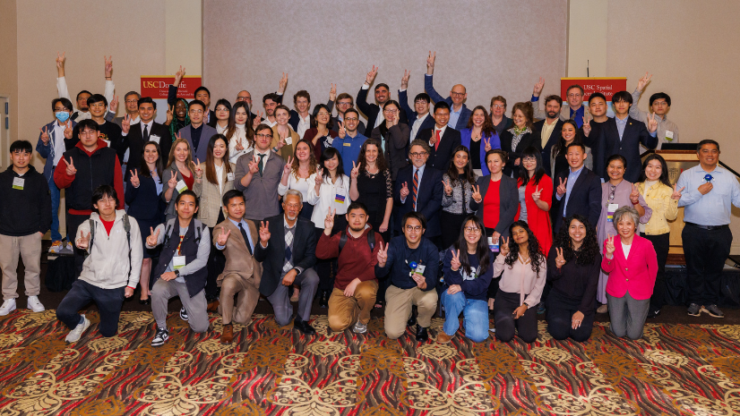
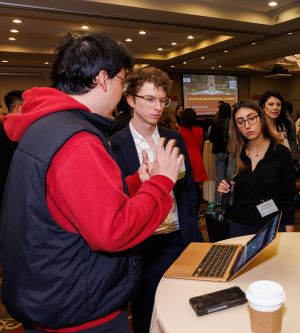
The annual Los Angeles Geospatial Summit, hosted by the Spatial Sciences Institute at the University of Southern California (USC), occurs for a single day at the USC Hotel. This year’s event was held on February 23, 2024, and offered students the chance to showcase their projects to peers, USC faculty, and other attendees from the LA geospatial technology community. The summit attracts university students from across Southern California, providing them with opportunities to network, attend presentations by industry leaders, and gain insights into the future of geographic information system (GIS) technology.
“Every year, students tell us that presenting their ArcGIS StoryMaps and interacting with geospatial [tech industry] leaders about their research in the LA Geospatial [Summit] ArcGIS StoryMaps Competition is an invaluable opportunity and a professional game changer.”—Susan Kamei, Managing Director, Spatial Sciences Institute, University of Southern California
For three consecutive years, Esri has hosted the LA Geospatial Summit ArcGIS StoryMaps competition. In it, students apply geospatial technology by researching a topic, conducting analysis, and summarizing their results using ArcGIS StoryMaps. The competition recognizes winners in three categories:
- Most Innovative Use of Technology
- Most Compelling Communication Using Maps
- Most Suitably Applied Methodology or Analysis
“The LA Geospatial Summit ArcGIS StoryMaps stories continue, year after year, to impress the Esri judges and staff with their depth of analysis, elegant design, and innovative use of our tools,” said Esri account manager Andrew Haglund, one of the competition’s judges.
This year, a panel of judges for the competition awarded one group of students for each category. Below are summaries of the projects in each category.
Most Innovative Use of Technology
In this category, project entries must reflect innovative use of GIS or a complementary technology, provide a clear explanation of how the technology was applied, and evaluate the use of technology or analysis.
The winning project was Geographic Access to Health by Andrew Kampfschulte and Jonathan M. Tan, both students at USC.
“This team made masterful use of ArcGIS StoryMaps story blocks to manage flow and contextualize the problem of focus. Their effective use of maps throughout the story supported the narrative and guided the reader,” said Haglund.
In this project, granular patient data was used to understand transportation barriers and explore the role that transportation plays in accessing affordable pediatric health care, and demonstrated the utility of patient geocoding to better contextualize the environment that patients reside in.
Through geocoding patient addresses, analyzing patient population characteristics, and observing the distances to care and the differences in commute times, Kampfschulte and Tan gained a deeper understanding of the challenges faced by patients. This study aims to demonstrate the advantages of using a spatial approach to understand care access and to explore the impact of distance on health-care delivery.
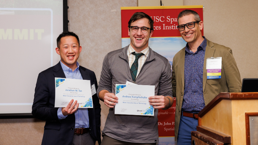
“LA Geospatial [Summit] was a great experience to network with other students, faculty, and employers and take in the breadth of geospatial work being done in the LA area. The ArcGIS StoryMaps competition was such a unique way to synthesize and present the work I had been doing, and it really helped frame my research for a broader audience.”—Andrew Kampfschulte, USC (pictured above with Jonathan M. Tan and Andrew Haglund)
Most Compelling Communication Using Maps
In this category, project entries must reflect a clear statement of the problem or issue; adhere to cartographic principles; have a clear narrative; and effectively use communication media, design, and layout.
The winning project was Endangered Species in California by USC students Shaokun Lyu, Peter Lin, and Shuo Yan.
This project offers a captivating exploration of the California condor, the salt-marsh harvest mouse, and the arroyo toad, highlighting their endangered status. Through detailed maps, the project showcases the species’ habitat distribution and population status, shedding light on the causes of their endangerment and proposing actionable solutions. This interactive tool serves as an educational resource, aiming to inspire conservation efforts and raise awareness among residents and policymakers alike.
The project’s conclusion is a call to action and serves as a beacon of hope for the California condor, the salt-marsh harvest mouse, and the arroyo toad, emphasizing the urgent need for establishing protected areas to preserve their habitats. By sharing their stories, the project aims to deepen the public’s understanding and appreciation for these endangered species, advocating for informed awareness and collective conservation efforts. Lyu, Lin, and Yan believe that through these actions, significant progress can be made in safeguarding these creatures and California’s natural beauty.
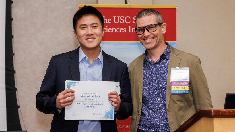
“LA Geospatial Summit provided our team a professional platform to show our work to the experts in the geospatial field. It was a thrilling and impressive adventure for all of us.”—Shaokun Lyu, USC Student (pictured above with Haglund)
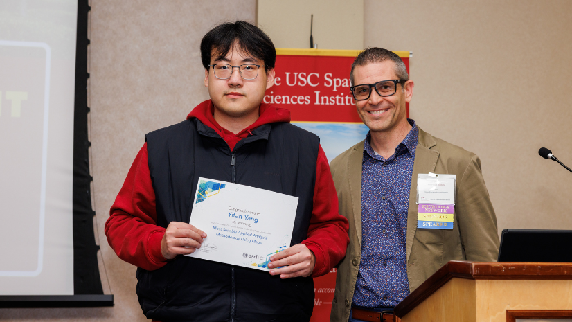
Most Suitably Applied Methodology or Analysis
In this category, project entries must use appropriate analysis tools and have a clear explanation, justification, and analysis of the methodology.
The winning project was Urban Tree Shade Model by Yifan Yang, a student at USC.
“This summit has been immensely valuable as it provided me—a student with an interdisciplinary background—the opportunity to highlight my diverse skills and identify areas for improvement in my projects. Engaging with other attendees was essential to break free from my own limited perspectives,” said Yang.
This project aims to use advanced 3D modeling to analyze shade coverage from trees in Boyle Heights, California. The project used lidar data to create detailed models of terrain and surface features. By analyzing shadows cast by urban elements, particularly shadows cast by trees, the research for this project will inform urban planning and thus optimize tree planting and improve environmental and social outcomes. Through urban greening, the project aims to mitigate heat and enhance livability, contributing to sustainable development in Boyle Heights.
Resources for Students and Emerging GIS Professionals
Esri offers a multitude of resources for students and emerging professionals to help them thrive in a GIS career or get connected with GIS communities and networks:
- Join Esri Young Professionals Network (YPN).
- Access free online training through Esri Academy.
- Attend in-person events by joining a YPN chapter near you.
- Subscribe to the YPN Blog.
Learn about the 2023 LA Geospatial Summit ArcGIS StoryMaps Competition winners.