Geographic Information Systems (GIS) can play a crucial role in land management solutions by providing tools and technologies that help in the collection, analysis, and visualization of spatial data. An industry leader in natural gas distribution, Southern Company Gas (SCG) applies GIS to optimize workflows for fixed assets such as pipelines—representing vital infrastructure for the US energy industry. The SCG land management team required an optimal solution to improve 100-mile-long Illinois pipeline project efficiencies, management, and workflow.
Challenge
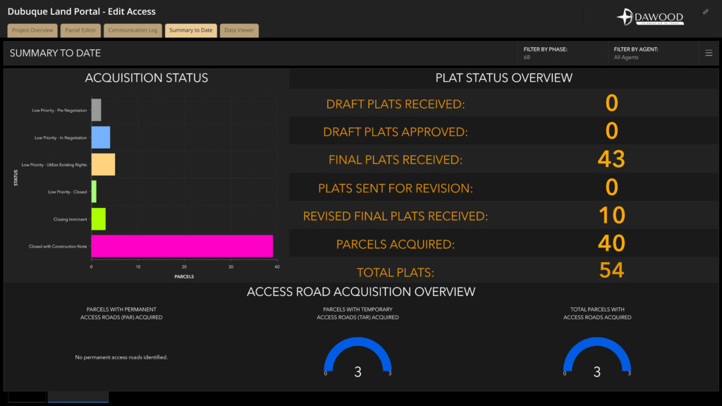
Historically, SCG’s field inspection workflow relied on paper documentation to manage and track new and existing gas pipeline easement acquisitions, including all activities preceding (and required for) acquisition. Working in a flat-file spreadsheet meant that only one person at a time could make spreadsheet changes, making it difficult for the pipeline construction project team to stay current with each parcel status. Inspectors used PDF forms without real-time data access, relying on project manager emails for instructions. The team’s challenges also included effectively providing SCG management with a snapshot view of acquisition metrics and demonstrating progress during meetings. Beyond inefficient use of time, this cumbersome workflow did not illustrate big-picture business value.
Partner
Dawood Engineering, the sole SCG project consultant, is an Esri Silver Partner that provides ArcGIS Online, support and ArcGIS Marketplace offerings. An engineering, technology, and finance solutions firm, Dawood’s portfolio includes custom GIS, asset management, mobile Lidar, and 3D scanning and building information modeling (BIM) solutions for utility, energy, transportation, municipal, and land development clients. Also, Dawood’s wholly owned digital transformation company, ArchiTube, is an Esri Partner Network affiliate and extends ArcGIS applications in the global market and BIM solutions to North American utility clients.
Solution
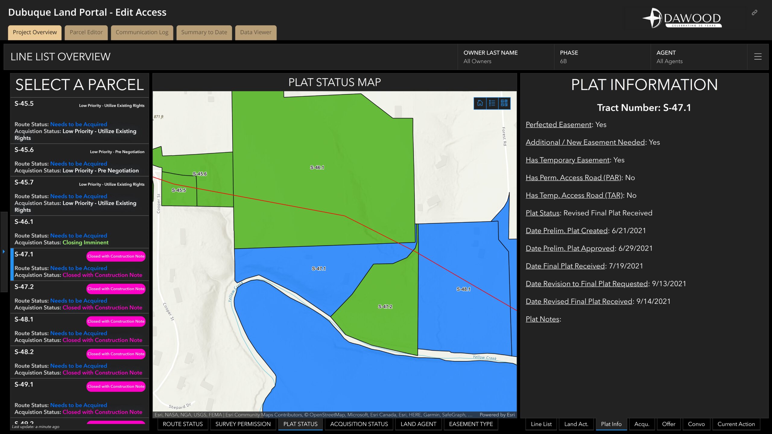
Dawood realized that an automated field inspection process would improve internal inefficiencies and ultimately save SCG time and money while demonstrating the power and value of geospatial technologies. Dawood implemented a land management GIS portal hosted via the Esri AEC Project Delivery subscription service to geoenable the SCG workflow. Dawood developed the portal through several phases to ensure that data schemes, design functions, and reporting aligned with project requirements. The portal uses Esri products such as ArcGIS Dashboards, Project Delivery Subscription, ArcGIS Survey123, ArcGIS Web AppBuilder, and ArcGIS StoryMaps—empowering users to quickly access pertinent information via a web-based repository complete with inputs and updates.

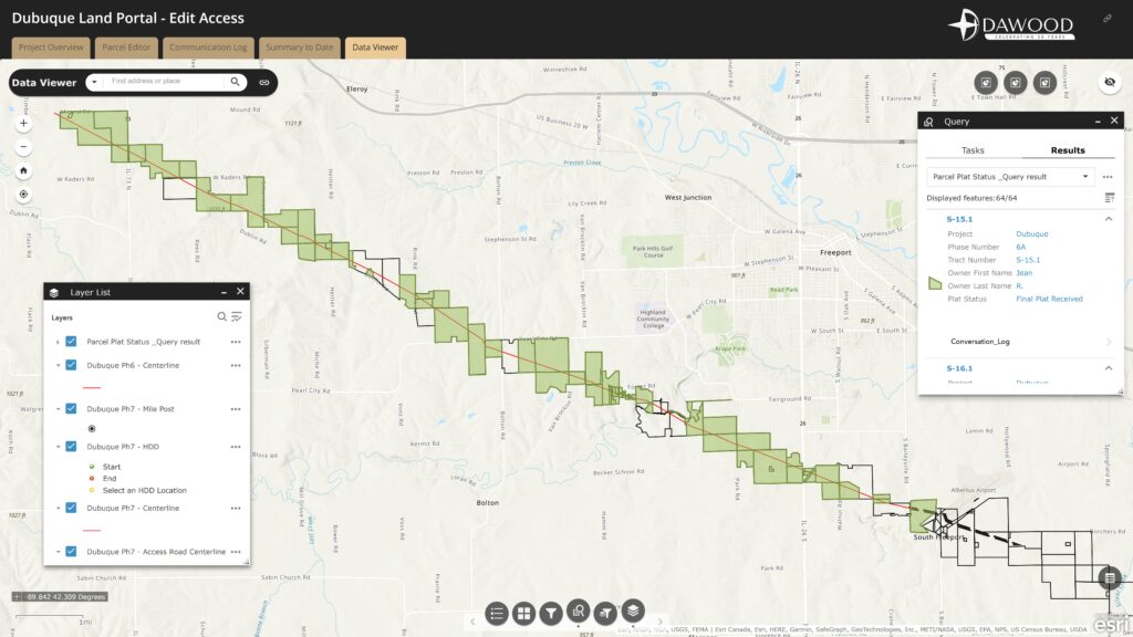
Dawood designed the data schema with map interfaces and filtering widgets to deliver a real-time visualization of each parcel status or the entire pipeline route. The portal also features assigned view-only and editing user administrative privileges to provide appropriate visibility and maintain data integrity.
Results
The geoenabled inspection solution eliminates office time for field inspectors. Real-time data collection, including photo attachments added the field, streamlines file management. The new workflow uses a single device (iPad), which integrates all inspection tasks for a paperless approach. Client data is submitted digitally via ArcGIS Survey123, adhering to standardized naming conventions. Automation and checks ensure consistency, and end-user reports are easily searchable. Web-enabled dashboards provide instant access to results, and a PDF is triggered via webhook for team distribution, promoting the paperless workflow.

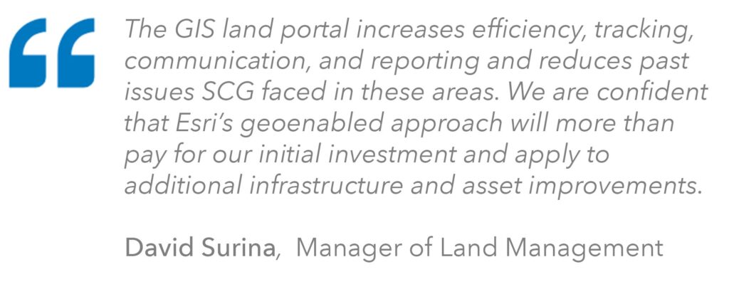
The SCG pipeline team—project managers, land agents, subcontractors, and executives—now is empowered to access, integrate, analyze, and visualize acquisition information quickly and affordably to make the best business decisions. The SCG Land Management GIS Portal is a transparent central repository and project information data hub that significantly improves team efficiency, communication, and collaboration. The web-based solution further enhances the team’s ability to make seamless field or office updates and show property owners the latest design information relative to their property extents—a feature not possible with the previous flat spreadsheet-based workflow.

This digital transformation has increased efficiency and eliminated field office time. It offers peace of mind to clients about proper facility installations and record availability for issue resolution.
The Dawood and SCG relationship shows how technology solution providers help utility customers leverage ArcGIS technology to achieve next-level functionality and maximize their GIS investment.
SCG has contracted Dawood to develop a second-tier to the portal and Dawood is currently expanding the solution.

In 2022, Dawood received Esri’s Web GIS Transformation Award in recognition of the company’s innovative work leveraging ArcGIS software.
Learn more about location intelligence for AEC:
GIS for Architecture, Engineering, and Construction
Stay Connected with Esri’s AEC Team:
Join the Architecture, Engineering and Construction Community.
Subscribe to the AEC industry newsletter “Esri News for AEC”.

