End-to-End 3D Drone Mapping Software

End-to-End 3D Drone Mapping Software

Streamline your workflow from planning to analysis with Site Scan for ArcGIS

Contact sales
Laptop computer analyzing drone imagery of a castle and an iPad showing the flight pattern of a drone around a castle

Site Scan for ArcGIS is the end-to-end, cloud-based drone mapping software designed to revolutionize imagery data collection, processing, and analysis. Maintain your drone flight history while capturing up-to-date imagery when needed. Securely process imagery in a scalable cloud environment and quickly share high-quality 2D and 3D imagery products throughout your organization. Directly publish your drone data to your ArcGIS organization to perform advanced drone analytics such as object detection and deep learning workflows.

Reality Capture with ArcGIS

Man standing at a large round table in front of a large computer monitor with 2 large TV monitors showing a digital 3D image

Complete drone mapping software in the cloud

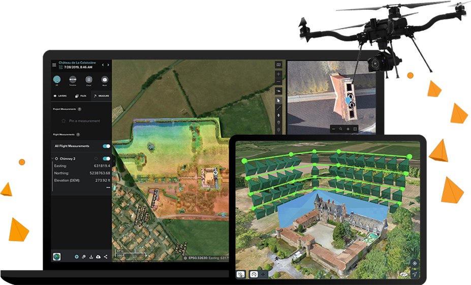
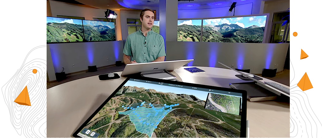
Plan autonomous drone flights in 3D

Increase efficiency by creating and sharing advanced 3D flight plans with your pilots. Overlay 2D and 3D data from ArcGIS Online and ArcGIS Enterprise for enhanced flight safety and data quality. Manage your data in the field and upload it to the cloud.

Download ArcGIS Flight
Ipad screen of a flight plan with terrain follow feature enabled showing the profile view of the flight

Recommended drones

Site Scan for ArcGIS supports the processing of virtually any georeferenced image captured by a drone, whether you use ArcGIS Flight or a different flight planning app. Learn more about which drones work with ArcGIS Flight for flight planning and drone data capture.

Previous
Next
Explore supported drones

Customer spotlight

Improving urban planning and public involvement in Salt Lake County

The Greater Salt Lake Municipal Services District is speeding up land surveying and creating interactive 3D models for proposed developments using advanced GIS mapping and analysis.

Residents can also utilize the county’s drone services for property inspections and evaluations that otherwise would be cost prohibitive to many.

Aerial image of a spacious hilltop lodge surrounded by towering trees

Contact sales

Talk to us to get started with Site Scan for ArcGIS.