Understand and mitigate risk
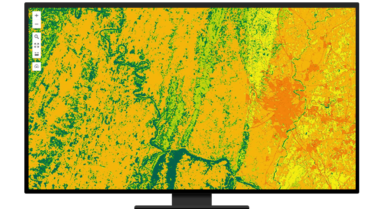
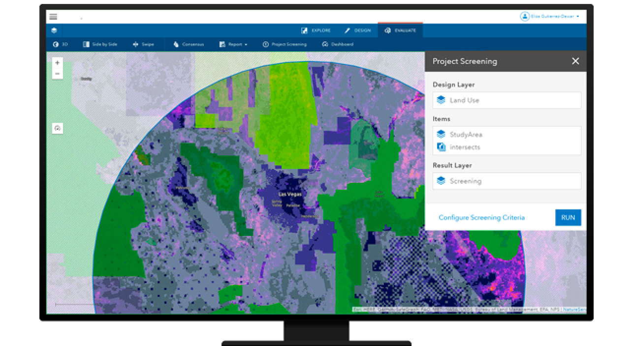
Identify and locate hazards and analyze their proximity to vulnerable communities to identify risk mitigation measures before disaster hits.
A discounted program with software, training, and content for disaster management agencies

Disaster risk management is a geographic problem. To understand and address risk, we must know where hazards are located in relation to vulnerable communities and infrastructure. Designing effective disaster risk management policies therefore requires comprehensive and up-to-date geographic insight.
ArcGIS is a secure and scalable platform that supports all phases of disaster risk management, from understanding risk and identifying mitigation and preparedness strategies to responding to and recovering from disasters.
Access an overview of how Esri solutions can support your disaster risk management work.

Identify and locate hazards and analyze their proximity to vulnerable communities to identify risk mitigation measures before disaster hits.
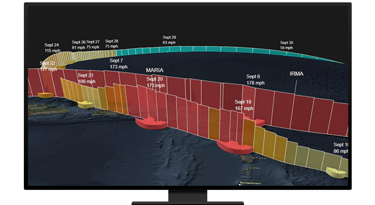
Monitor hazards in real time, provide early alerts of incoming danger, and prepare emergency supplies, evacuation routes, and emergency shelters.
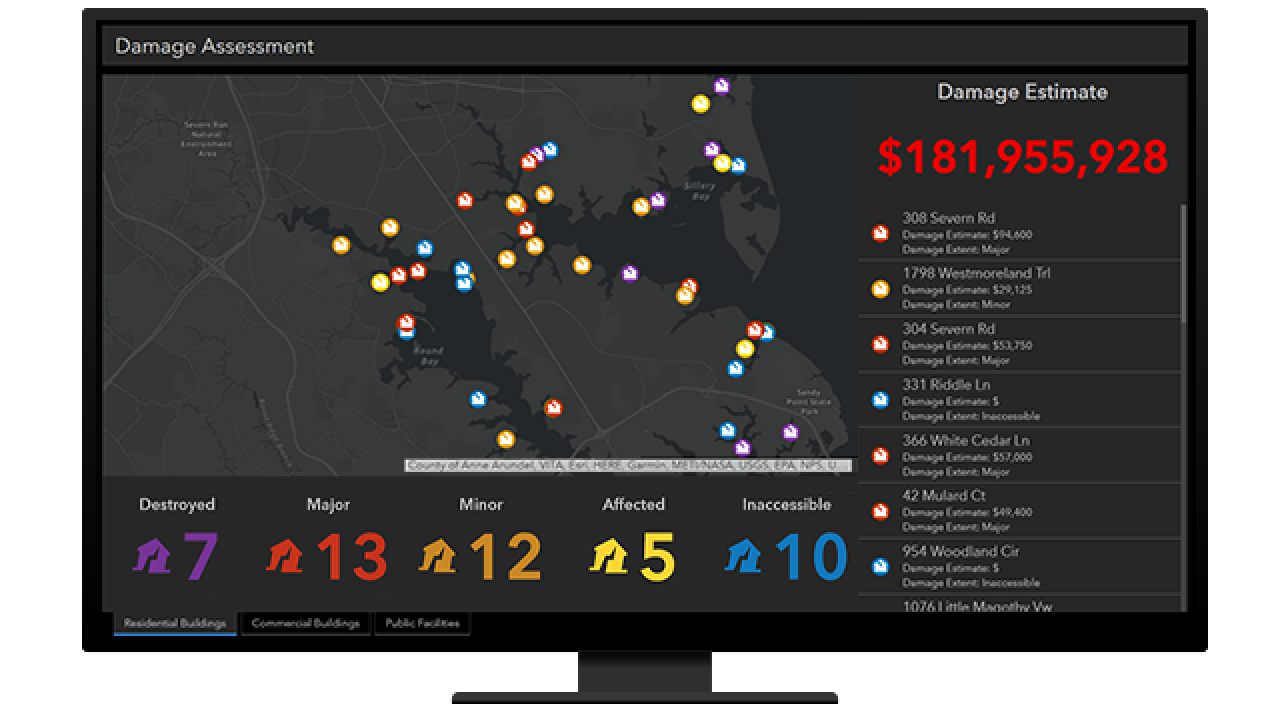
Quickly identify the impact of hazardous events, including who needs assistance, where they are, the extent of the damage, and more.
Identify priorities, plan reconstruction, provide a transparent account of recovery progress, and build resilience for the future.
With the program, agencies are provided access to tools, apps, and services to help them further implement a location-based strategy within their community.

Esri software supports data visualization, advanced analysis, data maintenance, and sharing the results within an organization and with the public.

Esri provides authoritative and ready-to-use content, including datasets, basemaps, and apps that supplement existing geospatial data.

ArcGIS Solutions is a collection of industry-specific ArcGIS configurations to help you leverage your authoritative data and improve operations.

Esri offers many online and in-person resources, such as passes to the Esri User Conference, discounted training courses, and seminars.
Find out more about related programs and resources at Esri that can support your work.
If you are interested in finding out if you and your organization qualify, fill out the form to reach one of Esri’s sales representatives for more information.