Shorten time to delivery
Automated and efficient workflows reduce the time it takes to process aerial imagery to create 3D outputs.
Part of the ArcGIS Reality suite of products
Aerial reality mapping at scale
Load and manage data from multiple flights and multicamera systems. Use control points and reuse existing measurements. Import polygons to constrain surfaces or to set a region of interest.

Optimize the relative and absolute orientation of imagery from multiple flights. Measure control points to correctly georeference your results. Reestimate camera parameters if necessary.

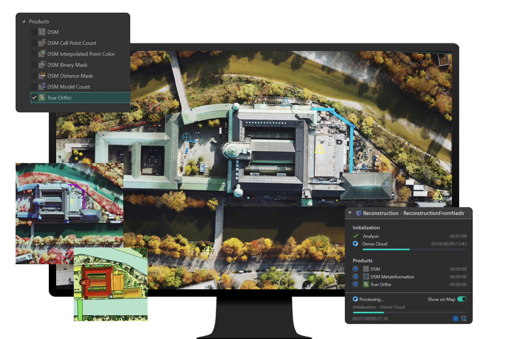
Turn large collections of aligned images into high-quality 3D meshes, point clouds, digital surface models, and true orthos. Control the resolution of the output rasters and meshes. Track progress on the map.
Imagery dataset provided by ©Bluesky Ltd.

Iterate on the alignment and reconstruction to deal with problematic datasets. Use statistical insights to fine-tune out-of-the-box results and manage challenging data.

Use the web to efficiently share available results with your organization and clients. Results are provided in open standard formats and are ready for web streaming.

Explore the software applications that are a part of ArcGIS Reality. Find the reality mapping software that fits the size of your projects and the sensors you work with.
Use this extension to generate large-scale true DSMs, true orthos, DSM meshes, point clouds, and 3D meshes from satellite, aerial, and drone imagery.
Process large volumes of drone imagery faster with cloud-based data processing and create 2D and 3D maps and models that you can quickly share across your organization.
Process drone imagery while offline or in the field. Turn recently collected drone images into 2D and 3D models, even without an internet connection.
Digital twins are representations of real-world objects and their processes and relationships. With ArcGIS Reality, users create highly accurate 3D meshes, true orthos, and point clouds to use as an important piece when developing 3D digital twins of social, natural, and built environments. Learn more about Esri’s 3D capabilities and how they relate to a comprehensive digital twin.

7:00 a.m.–5:00 p.m., Monday through Friday (PT)