Drone Mapping

End-to-end drone mapping software integrated with GIS

Contact sales

An evolving technology landscape

Drones put the power of data collection in your hands

Drone technology is proliferating, making high-resolution, cost-effective, and on-demand image capture an accessible option for more organizations. Location technology forms the foundation for drone mapping software that turns growing imagery collections into valuable business intelligence.

End-to-end drone solutions

Esri software covers every workflow: fleet management, flight planning, 2D and 3D mapping, analysis, and scalable content management and sharing.

Use location to tie all your data together

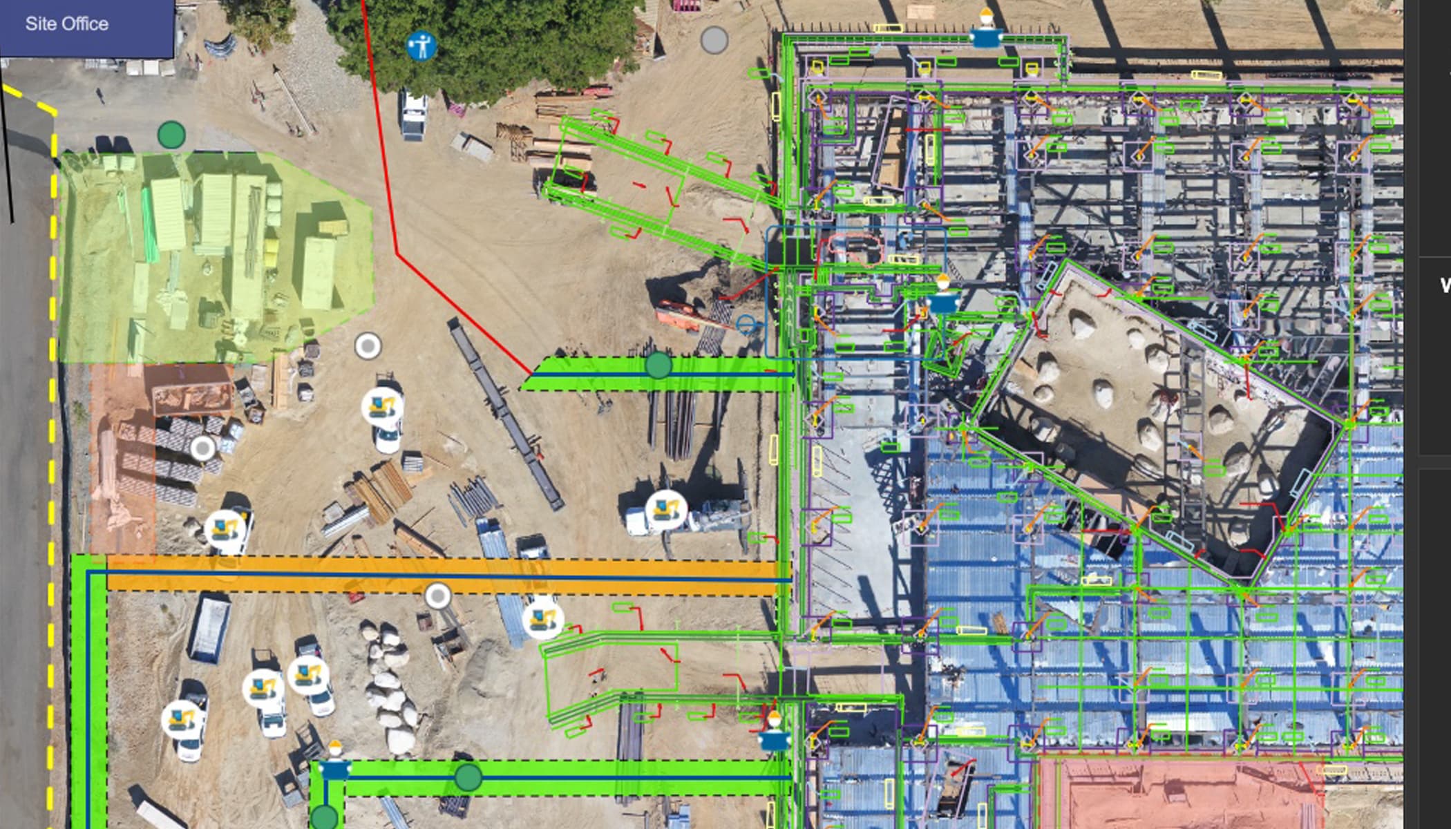
Combine data to create a digital twin. Integrate drone content with building information modeling (BIM), data layers, and real-time feeds.

Part of a comprehensive imagery system

Esri drone solutions are integrated with ArcGIS. Easily extend your work with more imagery types, collaboration options, and advanced analytics.

An off-nadir image of the Hoover Dam and the Mike O’Callaghan-Pat Tillman Memorial Bridge spanning the Colorado River

Drones power on-demand data collection

Industries like construction, natural resources, and more can use drones to capture aerial data and imagery at higher visual and temporal resolution.

What are your priorities?


Esri offers several drone mapping and photogrammetry software solutions for creating or elevating your drone program. Explore key capabilities and get in touch to learn more about the options that suit your needs.

PRIORITY

Map and model complex sites

Capture complex sites using specialized flight planning tools. Maintain a consistent altitude over uneven terrain, for example, or capture imagery around vertical structures to create detailed 3D maps. 

A nadir image of a multi-unit building with a swimming pool

PRIORITY

Standardize drone data capture

Execute repeatable, autonomous drone flights. Choose from flight modes tailored to your specific site, obtain airspace authorizations, and customize checklists to ensure that drone pilots are following procedures.

A map of a mining site shows a 3D drone flight path that captures images from different elevations

PRIORITY

Process offline or on-site

Esri offers a desktop deployment for drone mapping software, so you can turn drone images into 2D and 3D models while in an offline environment. Quick processing enables the creation of georeferenced maps while in the field.

An on-site worker in a yellow safety vest connects a drone to a laptop

PRIORITY

Manage growing data collections

Choose Esri's cloud-based drone software deployment for scalable data processing. Quickly visualize and share your drone reality-capture data within your organization. This option also makes it easy to collaborate on projects and manage your data.

Three panels show drone images of waterfront landscapes, each with a different coloring style and data layers

PRIORITY

Visualize and analyze data

Essential analysis tools for drone imagery are included in all Esri drone solutions. You can measure objects, perform volumetric and temporal analyses, and generate cut/fill maps directly in your drone software interface. And with ArcGIS integration, you can easily bring your drone data into broader mapping and spatial analytics tools.

A digital 3D model of a mining site next to the same model overlaid with high-resolution drone imagery

PRIORITY

Manage your drone fleet

Manage virtually every aspect of your drone program within one software experience. Keep track of every flight, every drone, pilot certifications, and flight history through dashboards and maps.

Three dashboards show information about a drone fleet including recent flight activity, flight locations, and hardware types

How it works

Esri drone software supports all your drone workflows right from the start—no additional point solutions needed.

Mapping the world you work in

ArcGIS is used by thousands of organizations across sectors and industries for drone mapping and more. No matter your business objective, a geospatial system for imagery can support your work.

Previous
Next
An aerial view of the Golden Gate Bridge in San Francisco, California

Flexible deployments


Use ArcGIS drone mapping software locally or in the cloud, based on your work environment and scalability needs.

Compare drone mapping options
Previous
Next

Contact sales

Connecting You with Sales Experts

Talk to someone on our sales team

1-800-447-9778

7:00 a.m.–5:00 p.m., Monday through Friday (PT)

Chat online

Start a chat

Contact the sales team

Fill out the contact form