Coordinate workflows
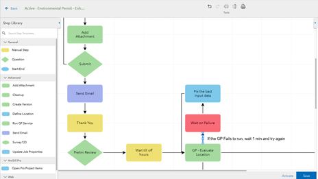
Coordinate complex workflows involving your linear referenced data by using ArcGIS Workflow Manager. Streamline every step of repeatable processes such as route and event editing, data loading, analysis, and quality control.
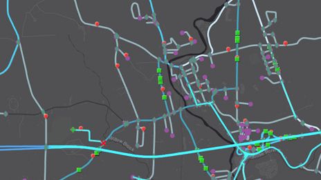
Measure-based location for the transportation industry
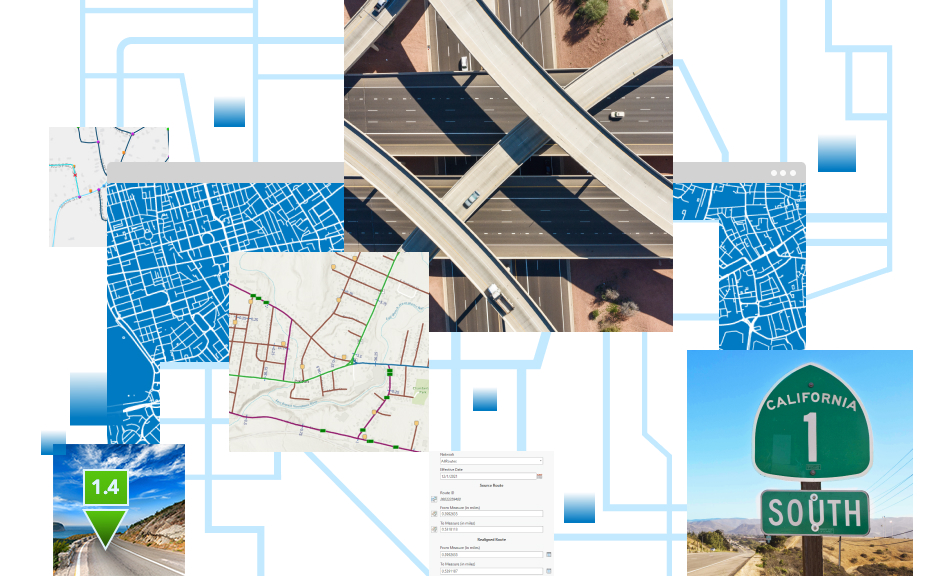
ArcGIS Roads and Highways is a road network management system that lets you efficiently manage route and event data from multiple linear referencing systems (LRS) on a common geographic basis. Easily locate assets and characteristics on or around your road network and expand collaboration by sharing this data across your organization using a measure-based location method.
ArcGIS Roads and Highways is a linear referencing system solution providing industry-specific functionality to manage and locate roadway data. It allows you to integrate data from multiple linear referencing system networks to get a comprehensive view of your road network and perform dynamic segmentation and other analyses.


Maintain linear referenced data from across your enterprise in a single linear referencing system (LRS). ArcGIS Roads and Highways communicates updates to the LRS so you can continue working without waiting for the geographic information system (GIS) to clear its edit queue. Connect GIS data with disparate systems for unified highway data maintenance workflows.

Manage multiple linear referencing methods (LRM) within a single linear referencing system, reducing data redundancy while supporting various measurement and location methods. ArcGIS Roads and Highways allows you to easily translate measures from different LRMs for use in analysis and reporting.

Event behaviors are user-configured rules that manage how events should be updated when the route they're linear referenced against changes in location or measure. These rules are automatically applied, reducing the need to manually update your events when the route changes.

ArcGIS Roads and Highways is a 3D application, allowing the visualization and editing of linear referenced data in both 2D and 3D. You can also choose to apply the measures to your linear referencing system in either 2D or 3D depending on how the data is modeled within your organization.

Linear referenced data that is maintained using ArcGIS Roads and Highways is time aware. This provides you with representations of your data before and after any editing occurs, allowing for time-based analysis of linear referenced data.

With ArcGIS Roads and Highways, the measurements associated with data in external systems can be kept current and synchronized with the edits made to the linear referencing system. This enables data interoperability and sharing across all business units.

Easily visualize and maintain your roadway networks and associated data with built-in route and event editing tools.
Expand the reach of your road networks by sharing linear referenced data using ArcGIS Enterprise and ArcGIS Online.
Utilize your linear referenced data to support annual reporting, such as HPMS, as well as ad hoc requests such as mileage and roadway segment reports.
Coordinate complex workflows involving your linear referenced data by using ArcGIS Workflow Manager. Streamline every step of repeatable processes such as route and event editing, data loading, analysis, and quality control.
Benefit from a complete data validation system for your linear referenced data with tools for automated and visual review processes using ArcGIS Data Reviewer. Utilize Data Reviewer tools to assess, document, correct, and verify the overall quality of your spatial data.
Extend the reach of Roads and Highways by leveraging REST services to build applications to edit and analyze your linear referenced data. Take advantage of Esri partner solutions built on top of ArcGIS Roads and Highways for additional tools and capabilities.

ArcGIS streamlines Massachusetts road improvements

GIS for Transportation (GIS-T) Symposium

Infrastructure Investment and Jobs Act
Extend linear referencing throughout your organization by maintaining and sharing your road network using the ArcGIS system. Perform analysis such as dynamic segmentation and utilize linear referenced data for reporting and other decision-making within your organization.
Load and edit your linear referenced data by using ArcGIS Pro to efficiently manage your road network.
Put the editing of linear referenced event data in the hands of those who know it best across your enterprise by using ArcGIS Enterprise and the Event Editor web application.
Share your linear referenced data with your entire organization to support decision-making and analysis.
Collect linear referenced data in the field using ArcGIS Field Maps to be managed by ArcGIS Roads and Highways.
Access documentation, system requirements, and videos with demos to learn more about ArcGIS Roads and Highways.
Please share your information, and our sales team will contact you soon. We look forward to communicating with you.