GIS analysts
Leverage the power of the entire ArcGIS system.
Unleash the full potential of ArcGIS Urban with an innovative and connected system of applications

Seamlessly integrate ArcGIS Urban with other Esri products and external platforms to build a comprehensive and synchronized planning system.
Deploy ArcGIS Urban on your own infrastructure with ArcGIS Enterprise to ensure data privacy and compliance. Have full control of a centralized platform for storing and managing your data securely.
With the ArcGIS Urban API, you can get access to the data seamlessly created within ArcGIS Urban. This allows for multiple integration paths and enables custom workflows that enhance your urban planning and design processes.
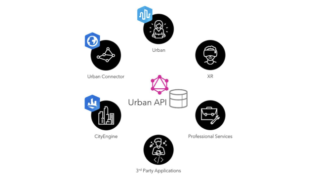
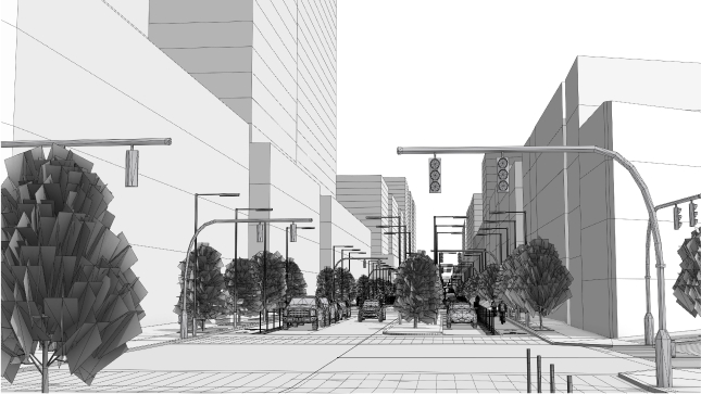
Create 3D immersive visualizations of an urban environment and provide stakeholders and the community with an unprecedented way to collaborate in the design process using extended reality (XR) technologies, including virtual reality (VR) headsets.

ARCGIS BLOG
With the Urban API, you can extend the functionality of ArcGIS Urban, automate data workflows, and create integrations. Enable programmatic access, retrieval of data, and the creation of scenarios for better urban planning workflows.
Leverage the power of the entire ArcGIS system.
Go beyond the planning process with the Urban API.
Connect your existing systems to ArcGIS Urban.
Please share your information and our sales team will contact you soon. We look forward to communicating with you.