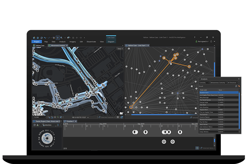
ArcGIS AllSource is intelligence analysis software built for intelligence analysts working in the military and in civilian intelligence agencies, law enforcement, and the private sector. Use link analysis, 2D and 3D maps, timelines, imagery exploitation, and graphs to uncover patterns, trends, and relationships in data to inform decision-making. ArcGIS AllSource scales to meet your mission whether you need to conduct movement analysis, understand patterns of life, or perform investigative analysis. ArcGIS AllSource is interoperable and extensible, supporting your data integration strategy across multiple domains in connected, disconnected, and air gapped networks.