Try ArcGIS Earth
Learn the basics, conduct viewshed analysis, evaluate line of sight and historical events, and re-create the D day battlefield in this tutorial series.

Experience what’s possible with ArcGIS Earth through curated series of tutorials.
Learn the basics, conduct viewshed analysis, evaluate line of sight and historical events, and re-create the D day battlefield in this tutorial series.
Read articles from the ArcGIS Earth team. Connect to ask questions and learn more.
Sign up to receive periodic email newsletters about the latest capabilities, tips, tricks, events, and more.
Discover recently added capabilities.
Resources to lead you through setup and configuration.

A living digital twin improves a port system

What’s new in ArcGIS Earth (Sept 2024)
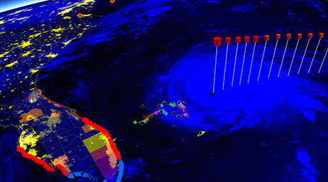
Damage assessment for hurricane response
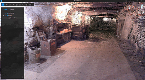
Underground visualization and analysis
Find answers and information so you can complete your projects.

ArcGIS Earth: An Introduction

ArcGIS Earth overview

Take a Trip to the Movies with ArcGIS Earth

ArcGIS Earth: Working Offline
Exchange ideas, solve problems, and build relationships with the ArcGIS Earth community.
Do you have an idea to improve ArcGIS Earth? Many of our capabilities started as suggestions from our users.
Stay informed on ArcGIS Earth and other operational intelligence product updates.