,

Indoor Mapping and Wayfinding

Transform outdated paper maps or CAD files into living indoor maps for enhanced asset tracking and wayfinding

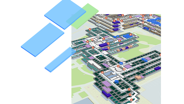
Colored shapes of floor plan elements from an indoor map with assets, spaces, and features of indoor buildings on a 3D map of a building.

Indoor mapping delivers a comprehensive geospatial picture of all building assets and spaces, delivering insight into how you use the physical space you occupy. This allows for confident and informed decisions about operations and overhead expenditures. Digital tools for building and facilities management increase efficiency across departments and deliver new insight into your built environment.

Discover indoor mapping

What is indoor mapping?

Indoor mapping is the first step into a digital transformation for facilities management that ingests any building data format and creates an accurate visualization with key asset locations and points of interest. Creating a living indoor map that is interoperable and shareable throughout the organization enables indoor wayfinding to efficiently locate assets and spaces.

Previous
Next

Improve efficiency with indoor wayfinding

Indoor wayfinding is the ability for users in your facilities—visitors, employees, public safety personnel, or service technicians—to route themselves to a precise point of interest inside a building, using an indoor map with asset locations. This helps direct staff to areas that need attention, without a drain on time and resources that is often experienced with outdated or incomplete paper maps or flat CAD files. Indoor wayfinding empowers individuals to identify, locate, and resolve issues rapidly. Additionally, indoor wayfinding can enable visitors and office employees to quickly identify the best route to their desired destination across entire sites, reducing friction and inefficiencies.

Explore wayfinding
Business user on a cell phone wayfinding to a point of interest with an indoor mapping app

Make data-driven decisions with indoor mapping

Indoor mapping is important to the future of facilities management and sustainable operations. It illuminates more efficient decision-making, resource allocation, and space utilization with a focus on data-backed strategies that provide insight to map users throughout the organization. It delivers a complete operating picture and unifies data in a central system for building management.

Start indoor mapping
A man working on a computer using an indoor map to identify areas in a large campus

STORY

An Indoors Story: Michigan State University

Michigan State University turned to indoor mapping and wayfinding to improve the facilities management experience for all staff.

Read this story

Contact sales

Find out how Indoor GIS can transform your organization.