Esri and Amazon Web Services

Combine GIS with the power and innovation of AWS

A laptop screen displays software analyzing a computer-generated 3D city map.
Vorige
Weiter

Why run ArcGIS in the Amazon cloud?

Leverage world-leading mapping and analytics software with the most comprehensive and broadly adopted cloud platform.

Combine the capabilities of advanced visualization tools to make maps, analyze data, and share geospatial information with the reliability, scalability, and security of cloud computing services from AWS. Esri offers several ways to manage and deploy enterprise GIS applications and services in the AWS cloud. All you have to do is decide whether to manage it yourself or have us manage it for you.

Enterprise GIS cloud operations using AWS

Manage and automate your ArcGIS cloud operations by leveraging cloud builder tools. ArcGIS Enterprise Cloud Builder for Amazon Web Services provides an interactive experience to provision resources and quickly deploy ArcGIS Enterprise on AWS.

Deploy on AWS
A computer monitor displays an overhead city cluster map.

Esri Managed Cloud Services

Esri has vast experience with cloud hosting and managing custom data and GIS apps across different enterprise environments. Assess your cloud readiness and feel confident knowing that Esri can develop an AWS cloud modernization strategy that is based on your priorities and business needs.

Discover managed cloud options
A professional works at a laptop in an office setting.

ArcGIS Enterprise Jumpstart Service for AWS

A high-impact, cost-effective Jumpstart Package reduces the amount of time it takes to install, configure, and administer ArcGIS Enterprise. An Esri consultant will provide on-site configuration support and technology transfer for a smooth transition to the AWS cloud.

View Esri's Jumpstart Packages
Two business professionals sit in an office setting, discussing something on a laptop which the viewer cannot see.

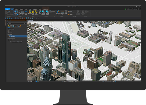
ArcGIS Pro in the AWS cloud

Use the advanced capabilities of ArcGIS Pro on Amazon Web Services. Visualize, edit, and analyze geographic data in 2D and 3D simultaneously, and share your work with everyone.

Learn about ArcGIS Pro
A computer monitor displays a computer-generated 3D city map

Esri provides location services to AWS

Esri is the global and trusted provider of maps and geocoding to Amazon Web Services. Through the Amazon Location Service console, customers have access to various styles of map tiles, multiple geocoding capabilities, and street-level address data. In the future, Esri will also provide AWS with routing capabilities. Learn more about Esri-powered location services.

Explore location services
Learn about Esri GeoEnrichment
Generic dark image of a street map

Common questions

Contact us to get started

Get in touch with us to get started

Chat now

Begin a conversation online.

Start chat

Call Us

Talk over the phone.

1-800-447-9778
(United States)
Outside the United States