With the release of ArcGIS Pro 2.9 and ArcGIS Enterprise 10.9.1, we’ve carried over our emphasis on quality to deliver optimizations that help you work more efficiently, while also delivering on new functionality requested by our user community.
Significant work has been completed across the product to improve performance and provide new capabilities that increase the value of ArcGIS Utility Network in your organization. Many of these optimizations may go unnoticed as you perform your work, but this is by design. ArcGIS Utility Network aims to support and enable your work without getting in the way.
One of the most notable performance improvements might be seen when importing associations through the Import Associations tool or creating and editing associations through attribute rules. This optimization is also showcased during the apply asset package process. Similar enhancements have focused on the user experience during tracing and editing to improve validate consistency and editing performance, respectively, for a more responsive experience.
Migrate utility network data using Copy and XML Workspace Document
One of the more obvious efficiencies introduced with this release is a new capability to support data migration workflows. With 2.9, the utility network can be migrated between geodatabases for staging and testing using the Copy and Paste tools in the Catalog pane or Copy geoprocessing tool. While the Asset Package remains the default and recommended method for staging your utility network, this option will benefit users who want to stage and configure their utility network in a file geodatabase before moving into production with an enterprise geodatabase. With support now available for the utility network on mobile (.sqlite) geodatabases, this simple migration path paves the way for future support of offline workflows in runtime and mobile applications that require a mobile geodatabase.
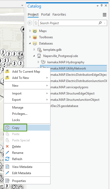
Support for transfer of utility networks using an XML workspace document (Import and Export XML Workspace Document geoprocessing tools) provides another method to migrate your utility network and can be used to transfer across a firewall between internal systems. While this process can be used to transfer data (when working with smaller datasets), this method places an emphasis on migrating schemas. It’s important to note that XML transfer does not maintain the topology state and dirty areas in the destination geodatabase like the copy and paste workflows.
Upgrade Dataset changes
There may be situations where you want to upgrade your utility network to version 5 and take advantage of new capabilities such as named trace configurations, but do not want to perform a geodatabase upgrade. Starting with ArcGIS Pro 2.9, we no longer require that the geodatabase release match the client to perform Upgrade Dataset on the utility network, instead we only confirm that the ArcGIS release of the geodatabase is 10.8.1.2.6 or later to ensure that it can support the network.
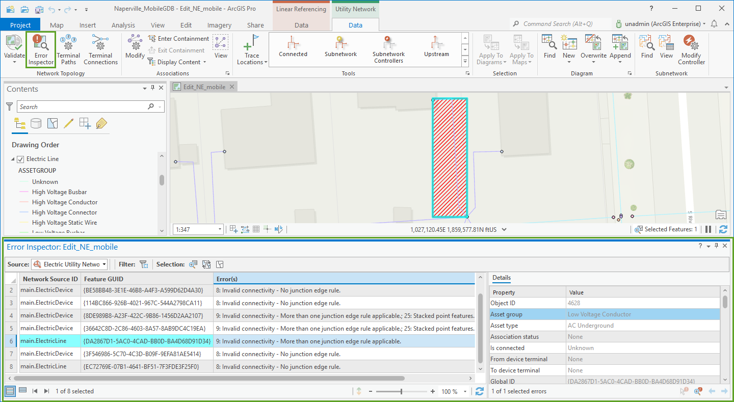
Introducing the error inspector for utility networks
The error inspector has been extended and enhanced to work with the errors in the utility network. This provides a new method to review and work with errors in your network. View error details, filter based upon map extent, and more. With this initial release you have a simple interface to display and work with errors throughout the network or constrain the filter to display only those in the current map extent. Future releases will contain enhancements to the functionality offered here to improve the user experience when working to resolve error scenarios.
Geoprocessing tool updates
The following updates have been made to the Utility Network geoprocessing tools:
Asynchronous processing
Four geoprocessing tools within the Utility Network toolbox have been updated to run asynchronously by default when run against a utility network in an enterprise geodatabase.
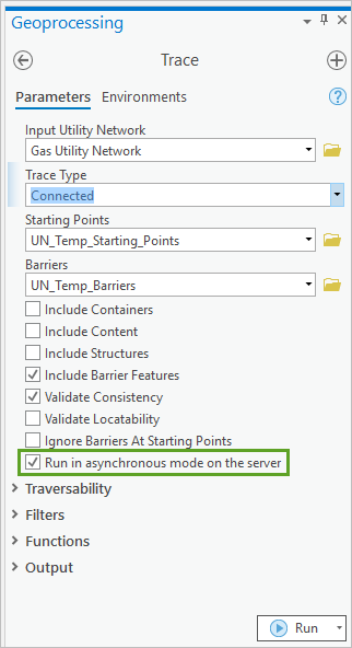
These are enabled through new server capabilities present starting with ArcGIS Enterprise 10.9.1 for Utility Network version 3 and higher. The Trace tool now also provides a Run in asynchronous mode on the server option; however, this is not the default method of execution for the tool.
Prior to this update, the Validate Network Topology and Update Subnetwork (when run against all subnetworks in a tier) geoprocessing tools were the only tools to execute asynchronously by default.
Asynchronous processing allows the computationally intensive work performed by these tools to processed on a separate thread which relieves congestion on the SOCs and allows them to process other requests while they would otherwise have waited for a request to complete.
Export Subnetwork
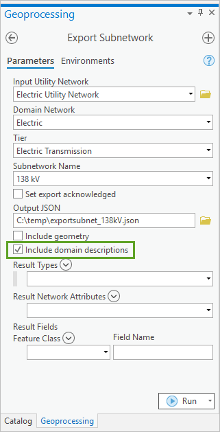
The Export Subnetwork geoprocessing tool has a new Include domain descriptions parameter that enables the inclusion of coded value domain descriptions in the output .json file. This will help to communicate domain mapping for controllers, featureElements, connectivity, and simplify integration processes with third-party systems to prevent additional work to translate and understand the coded values.
Trace
As mentioned above, the Trace tool now allows you to execute trace operations asynchronously using the Run in asynchronous mode on the server option. Additionally, we have extended the options available to control how trace output is returned with the introduction of Connectivity and Elements.
Connectivity result type
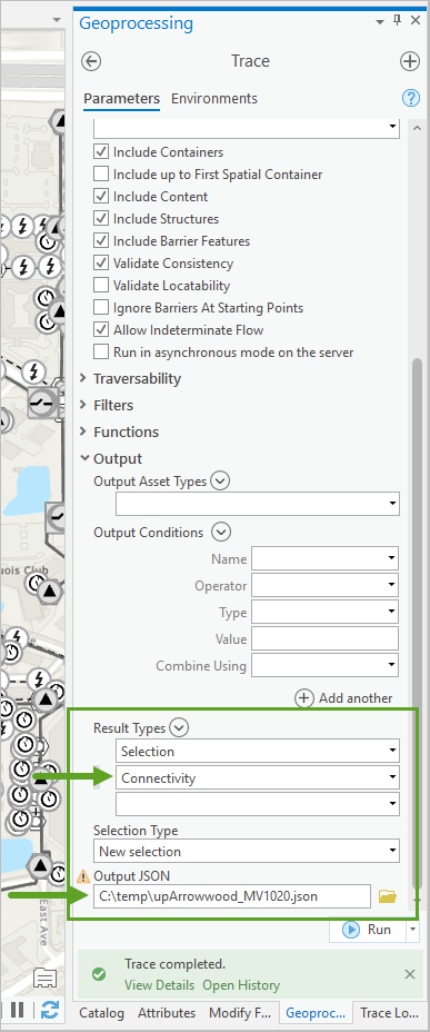
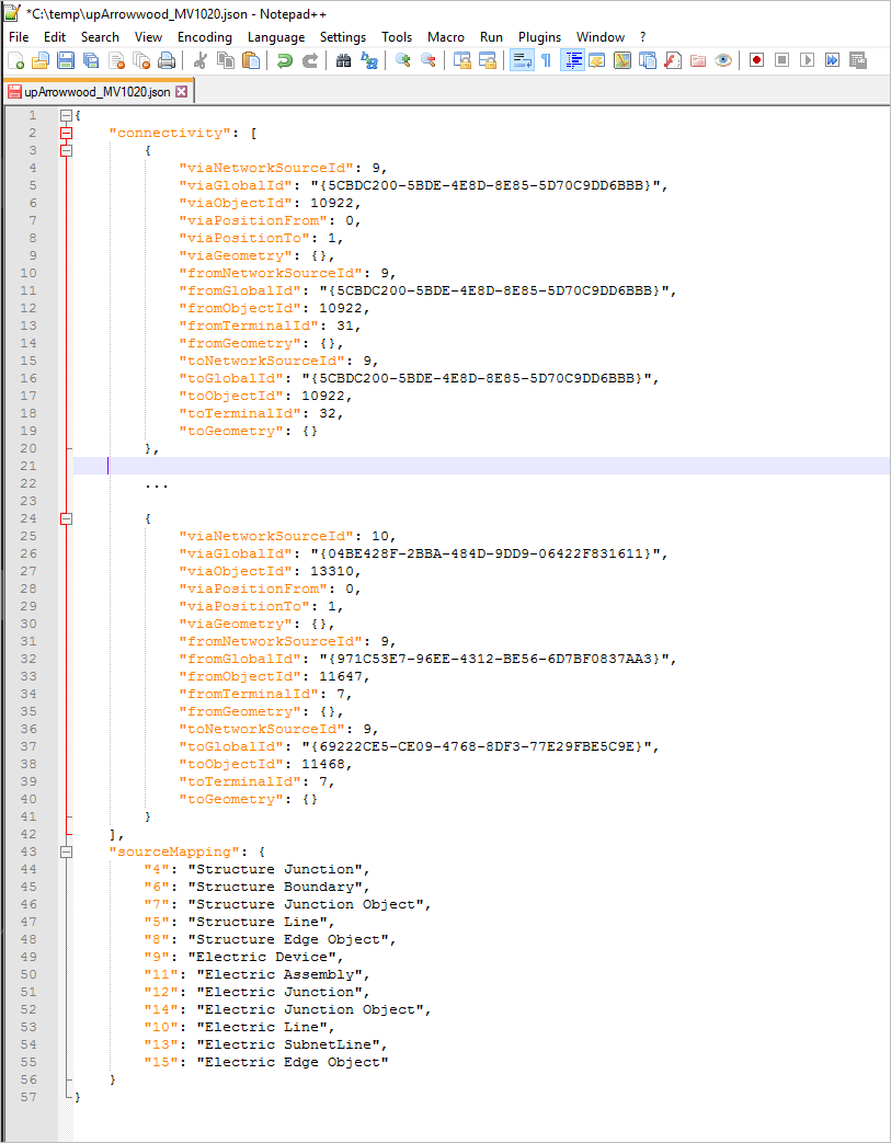
The Connectivity result types option returns trace results as a connectivity graph of network features connected through geometric coincidence or connectivity associations. When this option is selected, connectivity is output to a .json file in the specified location that can be parsed and imported into other 3rd party systems (such as an ADMS or CRM) to facilitate integration. When working with ArcGIS Enterprise, this makes use of a new supportsTraceConnectivityResults capability available with 10.9.1.
Elements result type
Elements returns additional information about the network features that are traversed during a trace operation and outputs this to a .json file for input into other tools or processes for additional analysis.
For example, with the elements option, you can develop an automated process that performs a headless trace in Python and uses the output elements from the trace result to set the values on the network features for reporting or other purposes.
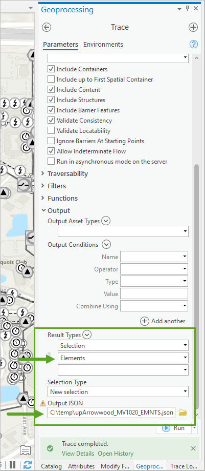
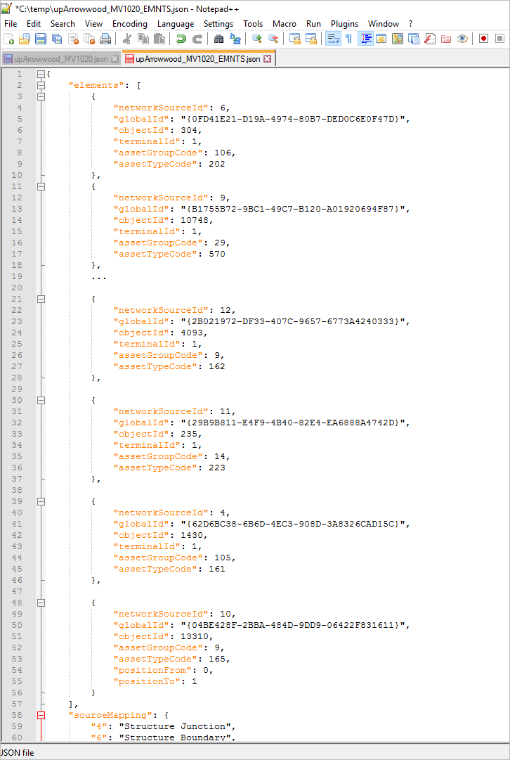
When either of the new Result Types options are selected, a new Output JSON parameter will appear in the Trace tool to control where the output is stored. These outputs may look familiar if you’ve ever inspected the .json created from the Export Subnetwork tool. By extending this capability to trace results, we can constrain the output to a specified subset without the need to parse the output from an entire subnetwork. All Result Types options can be used in conjunction to achieve the results you are looking for.
Network Management Release 2021
Certain ArcGIS Enterprise and ArcGIS Pro releases will be designated as network management releases for customers who have implemented or are planning to implement network management products, including the ArcGIS Utility Network and Trace Network, in an enterprise environment. Our goal is to provide a stable platform on a long-term support release that will allow users to land on the versions that are best suited for utility network solutions with confidence and provide a predictable schedule for upgrade planning.
The ArcGIS Pro 2.9 and ArcGIS Enterprise 10.9.1 versions have been announced as the first designated network management release and will be referred to as Network Management Release 2021.
To learn more, see the Network Management Release Plan announcement.



Commenting is not enabled for this article.