In the October 2023 release of ArcGIS Urban, you can benefit from the new support for coordinate systems to improve the data flow between your urban model and your organization’s GIS repository.
With the new option to choose which coordinate system your model will use, you can integrate existing GIS data that’s already in the same coordinate system without any additional steps or conversions. This offers several benefits to how you handle data for your urban models:
- Use cached layers, such as basemaps, integrated meshes, scene layers and elevation layers, in your own coordinate system.
- Leverage national and regional datasets, such as 3D base layers, available on open data platforms.
- Enhanced data accuracy for editing, analysis, measuring, and area calculations.
Leverage datasets beyond Web Mercator
So far, ArcGIS Urban only supported urban models in Web Mercator. This often led to a detour when preparing data for usage in Urban as all layers needed to be converted to Web Mercator before they could be loaded in Urban.
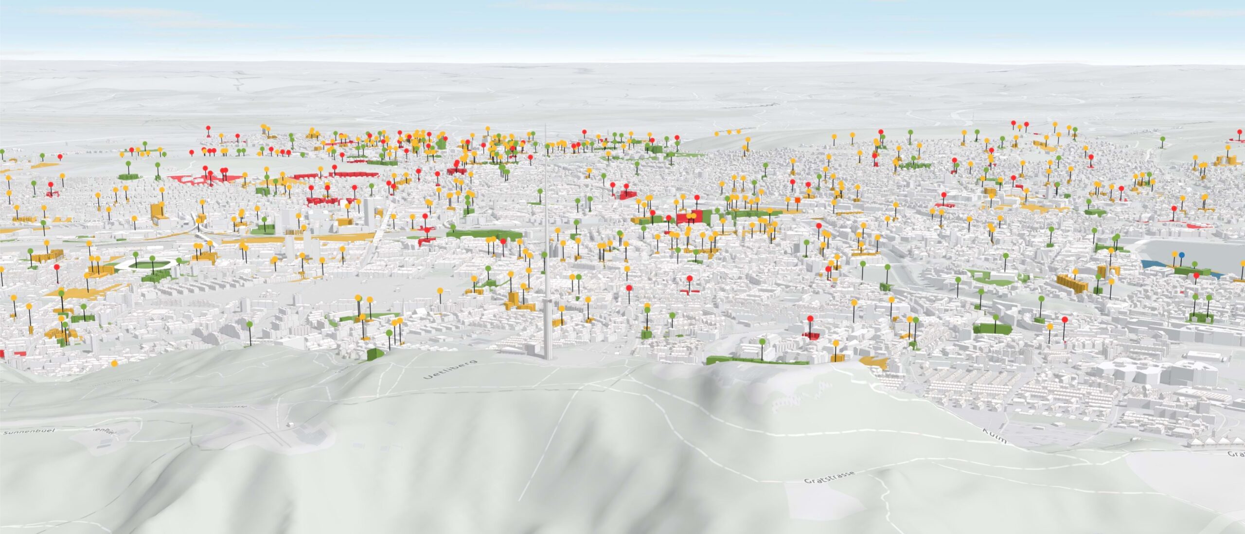
Now you can use all your data layers in the coordinate system you are usually working with. For instance, the city of Zurich can now use the CH1903+ LV95 coordinate system when creating an urban model. You can choose the coordinate system by selecting a basemap of your organization when creating the urban model.
When creating the urban model in a projected coordinate system you can use an elevation layer in the same coordinate system. The elevation layer is essential for your urban model to ensure you have a 3D terrain, so that buildings can be placed at the correct elevation.
The elevation layer should have the same coordinate system and tiling scheme as your basemap. See Preparing custom basemap and elevation layers for ArcGIS Urban for a step-by-step guide on how to set up a tiling scheme for an elevation layer before publishing. You can find detailed steps on how to Create an urban model in our documentation.
Keep data consistent and accurate
Parcels and zoning layers are converted to the coordinate system of the urban model if the coordinate systems don’t match. In case of a coordinate system mismatch, a warning message informs you about a possible conversion.
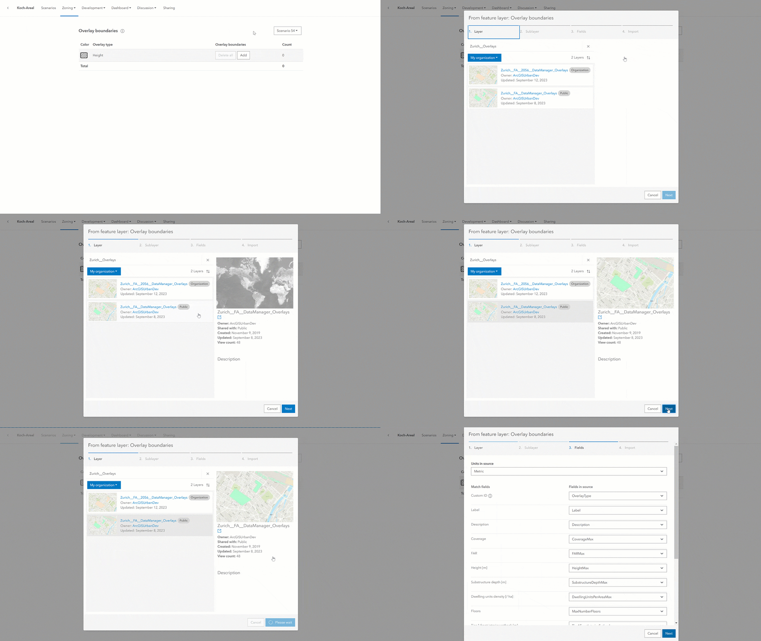
The urban model coordinate system also determines the coordinate system of the urban database and the design feature services of associated plans and projects. All data that is created in or imported to Urban is stored in the urban model coordinate system.
On one hand, this ensures that data consistency and accuracy is provided when editing, analyzing, measuring, and for area calculations. On the other hand, it also improves the performance in Urban because on-the-fly projection can be avoided.
Convert existing urban models
For existing urban models in Web Mercator you can create a copy to another coordinate system so you can benefit from the advantages of the coordinate system support without having to rebuild everything from scratch. After copying the urban model to another coordinate system, the existing urban model remains available as the original copy.
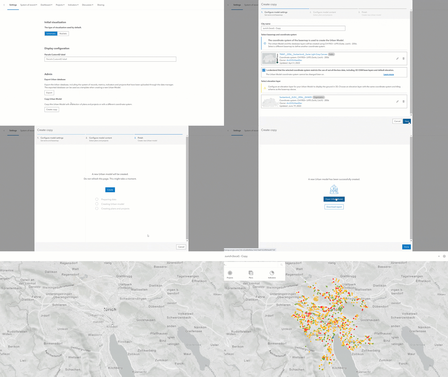
When creating the copy, you can select plans and projects that you want to copy over to the new urban model. You can only copy plans and projects that you have access to and where the owner allowed for non-owners to save them as duplicates. Additionally, the copied plans and projects will initially be owned by you and do not carry over sharing settings. You can make use of the report to reset ownership of plans of projects after copying.
Alternatively, you can also only copy the urban model without plans and projects and then ask owners to copy their plans and projects to the new urban model individually. In this step, the plans and projects will be converted to the coordinate system of your new urban model, but the ownership does not change.
You can use the step-by-step guide in the Copy an urban model section in the documentation to copy your own models.
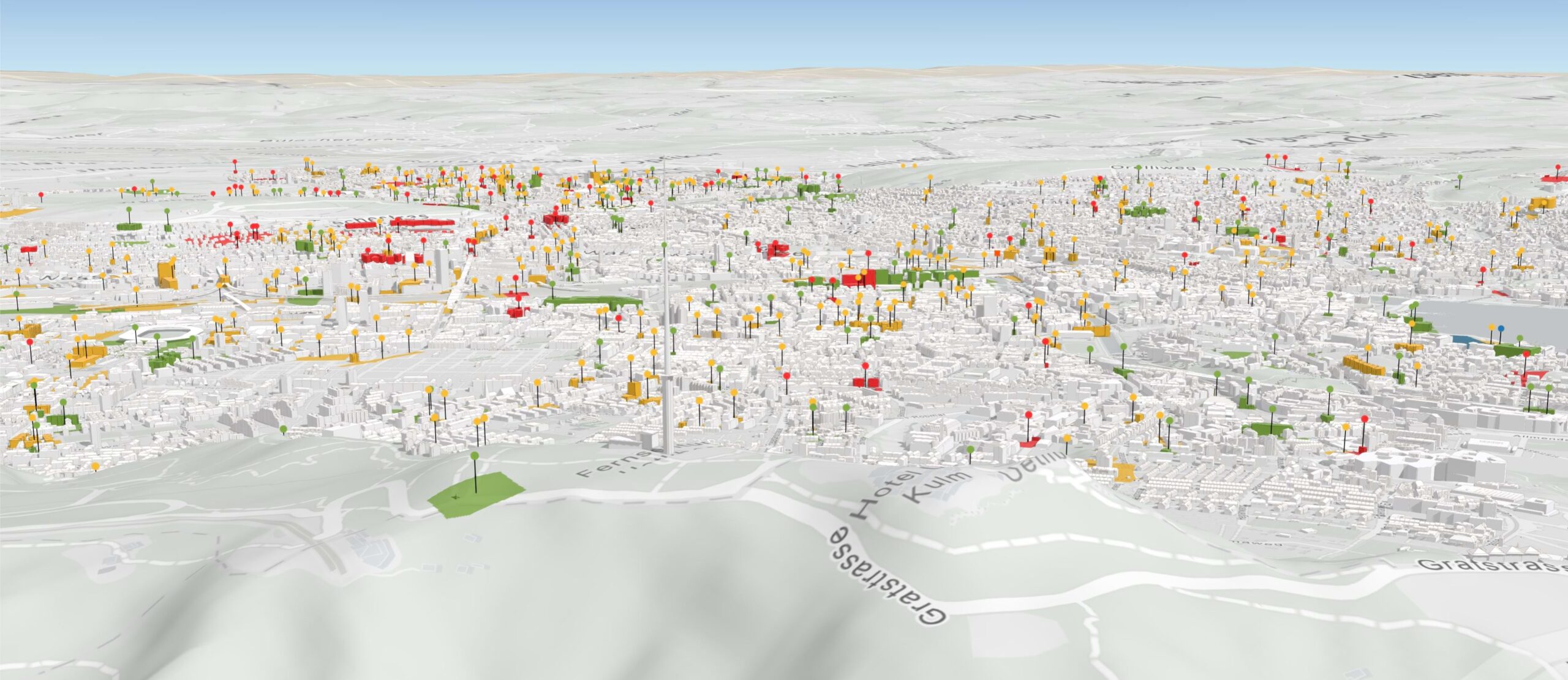
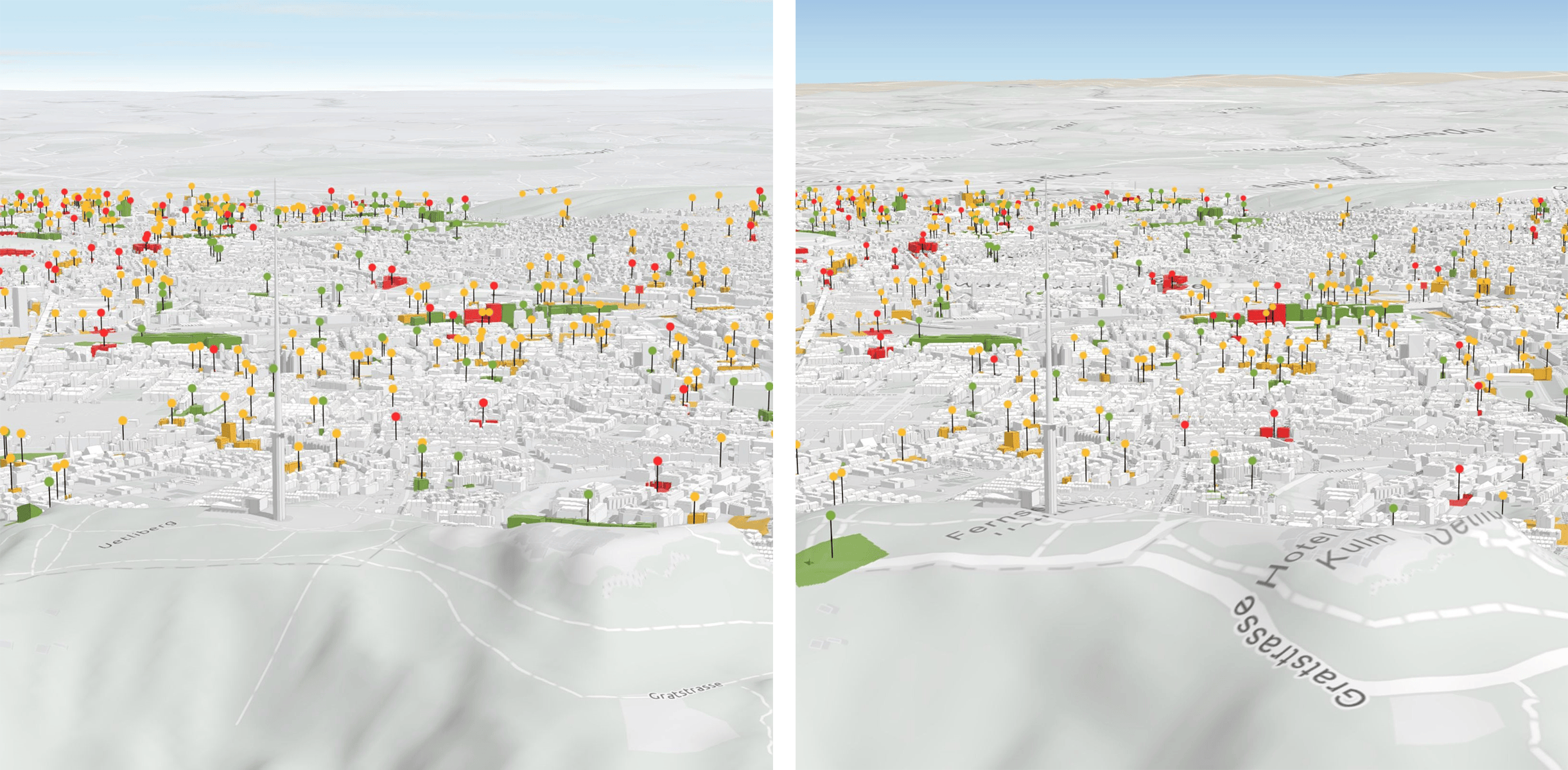
For our example of the city of Zurich, you can create a copy of the Web Mercator urban model in the projected coordinate system. After copying, you will need to replace the Web Mercator 3D base layers in the data manager as they need to be in the same coordinate system as the urban model. The new urban model is now in the CH1903+ LV95 coordinate system and is displayed in a local scene in Urban.
Consider technical implications
As you have learned above, depending on the coordinate system used when creating, the Urban model will be displayed in a local or a global scene in Urban.
- For projected coordinate systems the urban model is displayed in a local scene.
- For WGS84, Web Mercator, and CGCS2000, the urban model is displayed in a global scene.
Layers that are loaded in Urban—such as 3D base layers, context layers, and indicator layers—must match the coordinate system of the urban model, except for noncached layers such as feature layers. Noncached layers can be added in any coordinate system, since they will be reprojected to the coordinate system of the urban model. See Geometry projections to learn more about the impact of reprojecting geometries.
In a local urban model, you cannot use certain functionality due to technical limitations. The following are not available in local urban models:
- Default 3D base layers (for example, 3D OSM buildings and trees)
- Default basemaps
- Default elevation layer
- Street-level imagery
- ArcGIS Living Atlas indicators
Choose between local and global urban models
Before creating an urban model, consider the following:
- If you have 3D base layers such as existing buildings, trees, reality mesh, elevation layer, and context layers stored in a projected coordinate system, it is recommended that you create a local urban model.
- If you don’t have 3D base layers and you want to use the out-of-the-box data in Urban, it is recommended that you create a global urban model.
Learn more about Understanding local and global urban models in our documenation.
Have fun exploring the new coordinate systems support in ArcGIS Urban. And check out all the new features in our release notes.


Article Discussion: