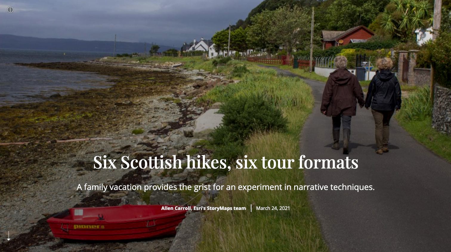
Prominent among the myriad forms and functions of multimedia storytelling is the tour. Tours themselves can take a variety of forms and serve many purposes. But you can probably envision the basic tour formula: a series of locations, featured in sequence, with text description, one or more images (or videos and, occasionally, audio), and a locator map. Tours might document a walk, they might guide people along a trail, they might describe a scenic drive, or they might sum up an entire vacation or expedition.
The immersive blocks within the ArcGIS StoryMaps builder give authors a number of options for presenting tours in a variety of formats. I’ve created an instructional story called Six Scottish hikes, six tour formats as a lesson in telling tour tales.
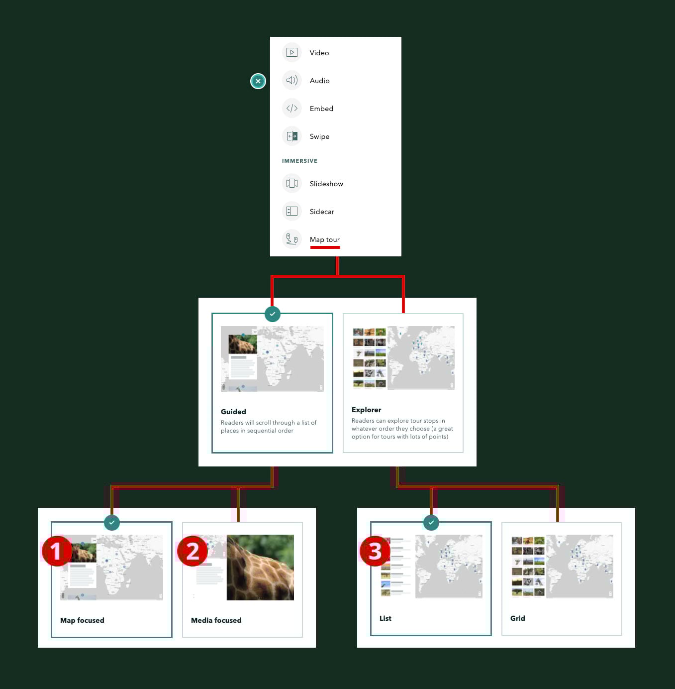
The obvious immersive of choice for presenting a tour is the Map tour block. Within it are four layout options (diagrammed below), three of which I feature in the story (red numbered bullets indicate the order in which I present them). Within the builder you can access these options via a series of simple choices you’re asked to make after you click on Map tour.
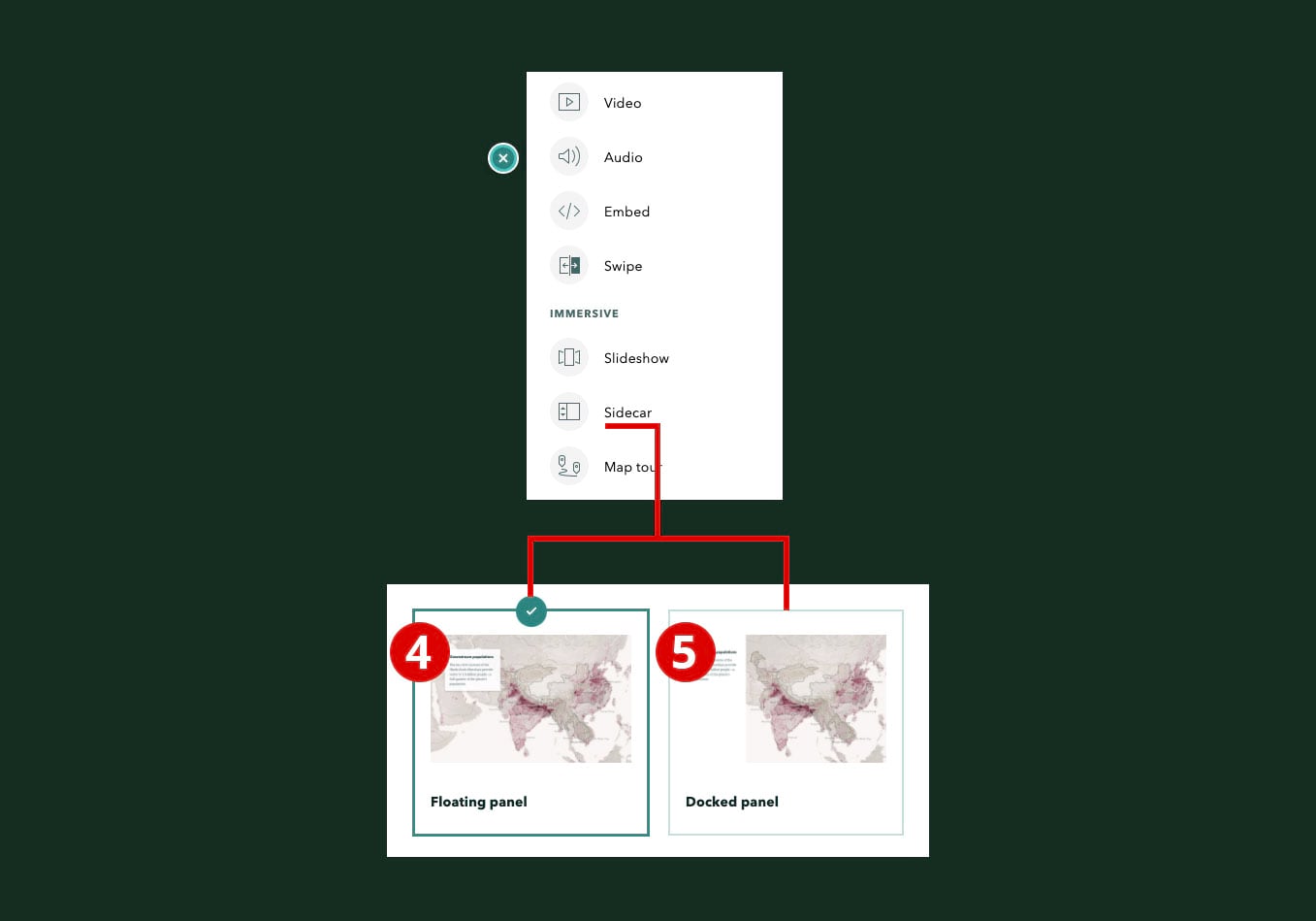
Map tour, however, isn’t your sole option. The Sidecar immersive can be just as effective as a way of describing a tour, and Slideshow nearly so. In the Scotland story I experiment with both sidecar layouts—Floating panel and Docked panel—and the single Slideshow layout.
No need to go into additional detail here. Please peruse the story, and note that the white text describes the outings themselves, while italicized, yellow text describes layouts and techniques. I hope you find this tour of tours to be useful and instructive.


Article Discussion: