As we close out the year, we’re thrilled to highlight the incredible advancements made to Site Scan for ArcGIS. These updates have significantly improved vertical accuracy, streamlined fleet management, and introduced powerful mission area configuration tools, making your drone operations more efficient and effective than ever.

Reality Engine Quality Enhancements
We’re thrilled to announce the latest enhancements to our Reality Engine processing technology, designed to elevate your 3D modeling and imaging experience to new heights! This update brings sharper, more detailed 3D meshes, especially for thin structures like bridges, railings, and antenna towers, ensuring every element is captured with precision. The improved True Ortho color balancing now delivers a more natural appearance, even when input images have inconsistent exposure, making your final outputs look stunningly realistic. You can now define a mission processing area, which allows you to trim the edges of your outputs, focus on specific regions, and maintain consistent extents across multiple missions. Additionally, a new advanced setting lets you enable or disable the use of image orientations, giving you the flexibility to enhance output quality for image sets with unreliable metadata. And for those working with thermal data, we’ve added thermal processing to generate True Orthos using the Reality Engine in Site Scan, opening up new possibilities for detailed thermal imaging.


Treasure Island Administration Building and Yacht Club, San Francisco – 3D Mesh, captured with DJI P1 sensor
Export Fleet Management Data
Fleet management has also seen a major upgrade. Fleet Managers can now export fleet management data as .csv files, which include details on flights, pilots, aircraft, and batteries. This feature makes it easier to perform in-depth analysis using other software like ArcGIS Dashboards or Microsoft Excel. It’s particularly beneficial for organizations that use different flight planning applications, as it helps break down silos and unify fleet management data.
To read more details on this update, check out the blog
Customizable Mission Areas
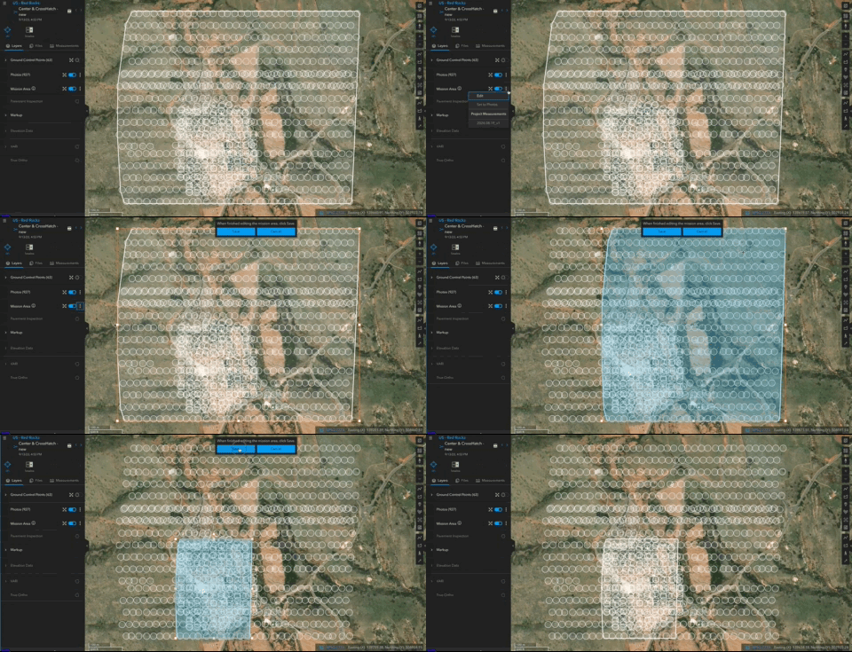
Another highly requested feature was the ability to define and customize mission areas. Site Scan now allows you to view and configure the mission area before processing, ensuring that your processed outputs, such as ortho, DSM/DTM, point cloud, and mesh, are exactly what you need. You can create custom mission areas, which is especially useful for processing only a subset of your mission or for creating outputs with an identical geographic extent for all missions in a project.
To read more details on this update, check out the blog
Full App Translation
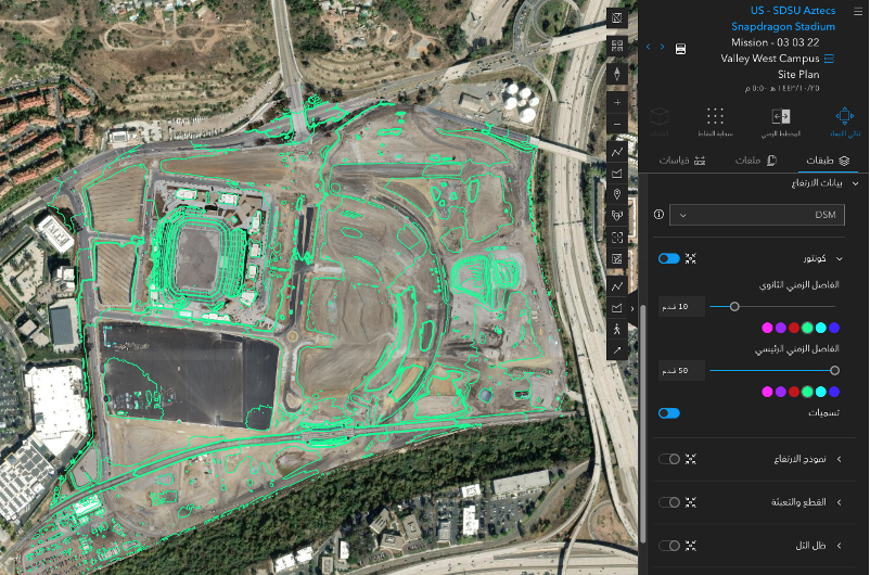
Site Scan has officially gone global with translations into 40 languages! Beyond just string translation, the app now correctly displays number and date formats according to the local language settings. Site Scan will prioritize your ArcGIS Online language settings if you use ArcGIS Online authentication. Otherwise, it will default to your browser’s language, making the app accessible and user-friendly for a global audience.

Mesh Measurements
We’ve added the ability to perform photo point inspections and elevation profile measurements within a mesh. This feature allows you to explore your measurements in the context of a photo-realistic model, providing a more comprehensive and accurate understanding of your data.

Create and Manage API Tokens In-App
For custom subscription organizations, we’ve introduced the ability to create and manage API tokens directly within the app. This feature enables you to build your own experiences around Site Scan and integrate it with third-party applications. For example, you can use the new API Tokens to support the integration between Site Scan and Skydio, creating more automated workflows and enhancing your operational efficiency.
For more details on how to get started, read this article.

Add support for ESRI coordinate systems
We’ve also added support for ESRI coordinate systems, ensuring that all data products, including mesh thin structures, are of the highest quality. These general processing improvements have increased reliability and reduced processing failures, making your data more consistent and dependable.
Looking Ahead
The Site Scan product and development team is excited about the future and looks forward to hearing your feedback on these enhancements. We’re committed to continuously improving our platform to meet your needs. In future versions, we plan to introduce even more features, such as the ability to define a waterbody mask to enhance results over water.
Stay connected
Stay tuned for more updates and improvements as we continue to enhance Site Scan for ArcGIS! Please share your ideas and questions in the Site Scan for ArcGIS community page, and to stay up-to-date on all things Site Scan make sure you’re subscribed to our newsletter.


Article Discussion: