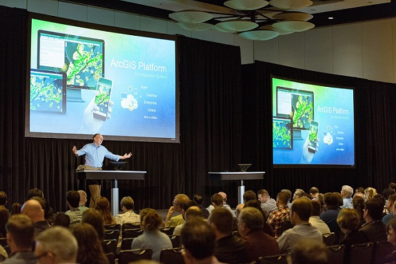
There was a lot of excitement at the 2018 Esri Water Conference. Not just from the attendees, but from Esri staff as well. Where did this excitement come from? Well, there is always a certain level of anticipation from Esri staff but this year it seemed to buzz even before we arrived in San Diego. The water team had so much to share and Jack Dangermond was part of the team this year! Working to present new technology, providing great demonstrations, selecting amazing presentations from water professionals, and organizing an EXPO full of partners created an excitement that the entire water team felt.
I believe this excitement lasted throughout the conference and was also felt by attendees. The plenary session was packed full of content that challenged our norms and demonstrated how strong our community is. Jack Dangermond showed a passion that is contagious. Who didn’t feel excited after listening to him speak? Kathryn Hallberg, from Yucaipa Valley Water District, impressed us with a presentation and demonstration highlighting their work using drones to capture high resolution imagery and creating 3D representations of their facilities. Technical demonstrations wowed the audience. It was an amazing plenary from start to finish with David LaFrance, Chief Executive Officer of the American Water Works Association, speaking about culture and technology.
During the conference I spent time in presentations, technical sessions, meetings, the Expo and enjoyed being a part of the water community. I talked to many people, some I knew and some I had just met. We had so many amazing conversations!
How can this conference get any better? That’s a tough question that we are working on and hope to be able to deliver next year. Join us in 2019 to build a better conference. Without community, this conference wouldn’t exist.
Thank you to all that were able to come to San Diego.
I know I can speak for the whole team when I say we hope to see you next year!
Christa Campbell
Industry Specialist – Esri Global Water Practice
In case you missed the conference this year, below are 5 Key Takeaways.
1. WebGIS Is the Modern Architecture for Water Utilities – The WebGIS pattern is enabling water utilities to make their work easier, open, and more accessible. Learn how water utilities are improving productivity and efficiency.
2. Integrating ArcGIS with the Internet of Things Enables Geospatial Insights – ArcGIS supports your organization in integrating real-time information from SCADA, AMI, and AVL systems with your IoT solution, enabling geospatial insights. Learn more in this story map.
3. Apps Are Bringing the Power of GIS to Everyone – Sharing your work has never been easier—through field apps, business apps, dashboards, and viewer apps. Learn how your organization can benefit from a complete mobile workflow.
4. Advanced Analytics is Taking Water Utilities to the Next Level – Esri offers a new experience in spatial analytics, using Insights for ArcGIS. Learn how you can create valuable information out of your data.
5. ArcGIS Pro Has Many New Features You Need to Start Using Today – Parity with ArcMap is here. In addition, experience new 3D, analytics, and utility network capabilities. See more ArcGIS Pro features here.

Commenting is not enabled for this article.