Originally posted by Dave Johnson, Esri Applications Prototype Lab

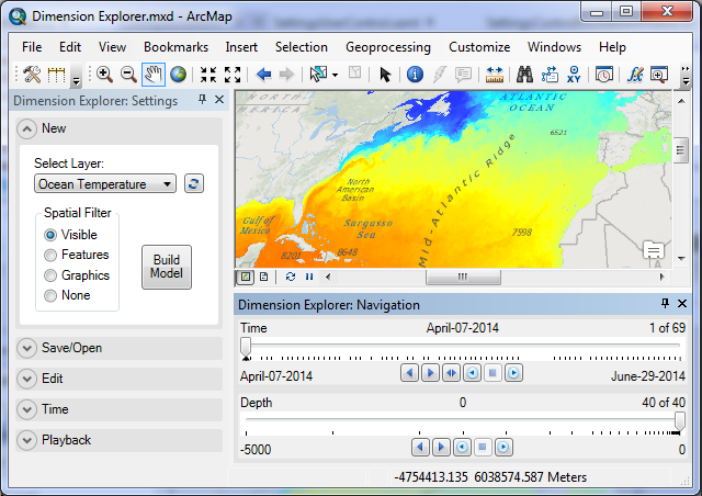
Dimension Explorer, an addin tool for ArcMap, has just been released by the Esri Applications Prototype Lab!
Dimension Explorer 1.0 makes it easier to work with time-aware and multidimensional data in ArcMap 10.3 and above by providing slider controls for navigation. It works by retrieving dimensional information from a map layer to build an interactive dimensional model that can be edited and saved in the map document. Dimension Explorer is the successor to the Timeliner addin for ArcMap, which also works in ArcMap 10.3 and can be downloaded here.
Click here to download Dimension Explorer.
With the 10.3 release of ArcGIS, the mosaic dataset now supports multidimensional data in NetCDF, GRIB, and HDF format. Dimension Explorer supports map layers based on mosaic datasets and image services which are time-aware or multidimensional, and time-aware feature classes.
In terms of data that might be used to test the add-in, try:
- NOAA Earth System Research Laboratory Physical Sciences Division for multidimensional and time-aware climate datasets in NetCDF format. You’ll have to add the data you download from here into a mosaic dataset in order to use it with the addin.
- ArcGIS.com: Try any of the image services published by Esri (e.g., Landsat or MODIS). Most of them, if not all, are time-aware.
Download Dimension Explorer and let us know what you think!

Article Discussion: