The most recent updates to ArcGIS Location Platform are designed to enhance the developer experience and broaden the range of services and capabilities offered. Whether you are a new or experienced developer, this update will enrich the way you work with location data.
Several enhancements are now available to Esri’s Platform-as-a-Service (PaaS) solution, including:
- Improved enhancements to the dashboard.
- Better pricing and expanded free tiers for data hosting services.
- New beta features, such as Last Mile Delivery routing and Batch Geocoding.
- Updated data for some ArcGIS Location Services.
Let’s explore what’s now in store for developers.
Enhancements to the Location Platform dashboard
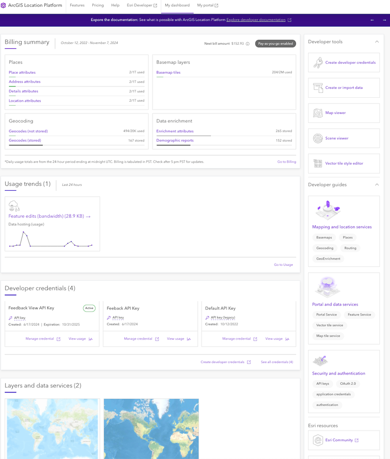
Developers will be pleased to hear that the November 2024 release significantly improves the dashboard for ease of use and workflow efficiency. The enhancements simplify the onboarding process, allowing both new users and experienced developers to start quickly. Overall, the updates aim to provide a more intuitive and efficient experience.
The latest update includes expanded usage reporting capabilities. Users can now generate comprehensive reports that cover all usage for the past billing cycle or a custom date range. This is a significant enhancement for users who need to closely monitor their data consumption and costs. With detailed and customizable reports at your fingertips, managing your projects has never been easier.
To take advantage of these enhancements and see how they can improve your development process, sign in to your account if you already have one. If you’re new to ArcGIS, sign up for a free account today!
Updated pricing and free tier levels for data hosting services
Developers and businesses can take advantage of the new competitive pricing options and expanded free tiers for data hosting services within Location Platform, designed to help stay on budget and test the services. With these services, developers can effortlessly store, manage, and access their authoritative location-based data.
These improvements are not solely about cost reduction; they are about enabling developers to securely store their data as a service while retaining ownership of it. With transparent and flexible pricing, the November 2024 update positions the Location Platform as the leading choice for developers aiming to build location-based applications and business systems.
Exciting new service capabilities available for beta testing
Location Platform has introduced a suite of additional services and capabilities now available for beta testing. These new offerings are designed to address specific challenges and enhance operational efficiency, providing developers with tools to build robust location-based applications and business systems.
ArcGIS Elevation service
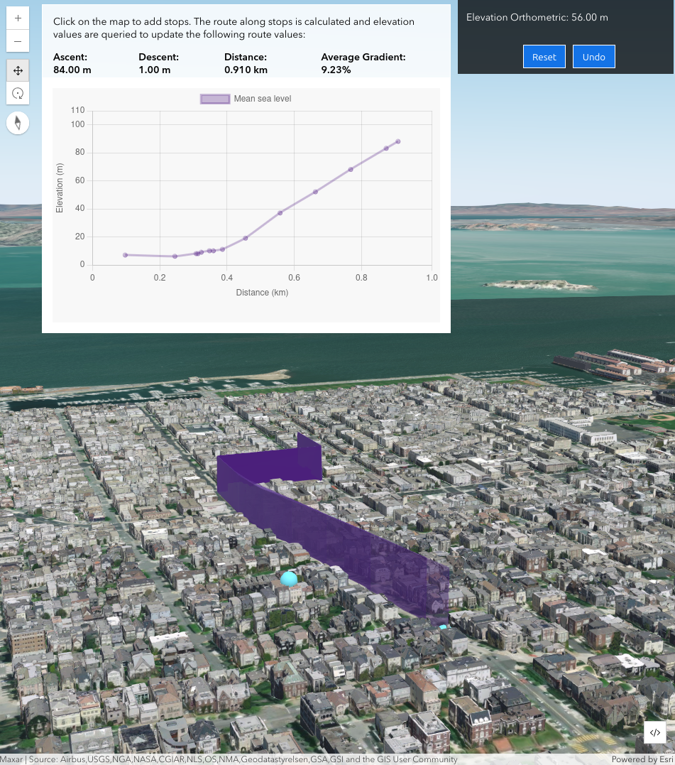
This service is a versatile and developer-friendly tool designed for finding elevations of up to 100 points quickly and efficiently. Developers can use it to determine the elevation of features like weather stations, assess elevation changes along roads and trails, measure depths in lakes and oceans, or even analyze terrain for urban planning and environmental studies. Its precision and ease of use make it an invaluable resource for various industries, from geospatial analysis to environmental science. Check out the “New ArcGIS Location Services: Beta program for Static Basemap Tiles and Elevation services” blog article to learn more about it and how to join the beta program.
ArcGIS Static Basemap Tiles service:
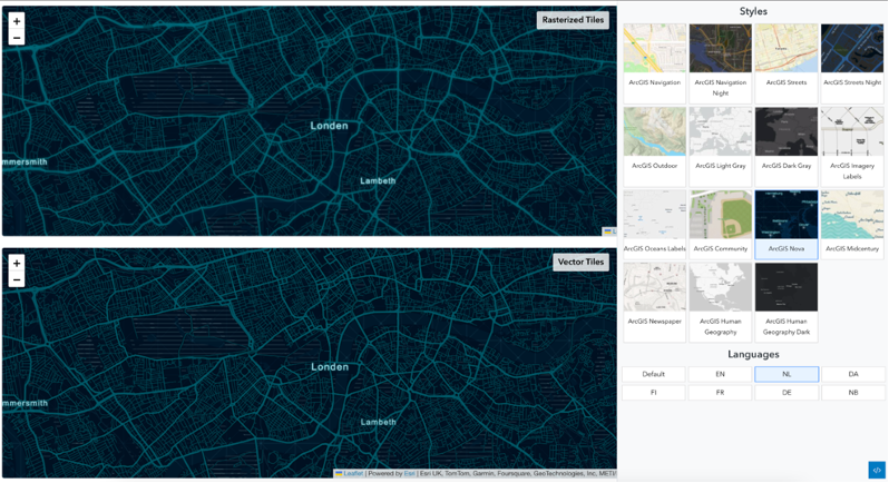
This service enables developers to create high-quality, customizable static maps for integration into a variety of applications. This service is particularly useful for developer technology requiring static map imagery, such as print media, presentations, or static web applications, furthering the capabilities of location-based application and business systems. To learn more about it and how to participate in the beta, see the “New ArcGIS Location Services: Beta program for Static Basemap Tiles and Elevation services” blog article.
Last Mile Delivery solver:
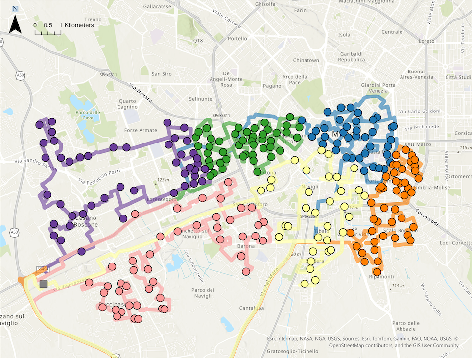
This capability is part of the ArcGIS Routing service which leverages sophisticated algorithms to optimize delivery routes, ensuring swift and efficient package delivery. Whether the goal is to streamline delivery times for a logistics company or to elevate customer satisfaction as a retailer, this service delivers the precision and dependability required to meet the demands of modern delivery. By utilizing the last-mile delivery routing service, businesses can achieve significant cost savings and operational efficiencies within their location-based application and business systems. Explore the “Tackling the Challenges of Last-Mile Delivery with Esri’s New Solver” blog article learn more how it works, explore tutorials or be part of the beta.
Batch Geocoding:
It is a powerful capability available with the ArcGIS Geocoding service for converting large volumes of addresses into precise geographic coordinates. This service is ideal for businesses that need to process and analyze large datasets quickly. Whether you’re a data analyst working on market research or a developer building a location-based application and business systems, the batch geocoding service ensures that data is accurate and up to date. This capability is crucial for applications that rely on precise location data, such as real estate, logistics, and demographic analysis. Explore the “Discover A New Way to Geocode Large Files” blog to learn more about it and how to join the beta.
Join the Early Adopter Community for Beta Access:
Early access to these beta services is available through the Early Adopter Community. Sign-up for an account if you do not have one. Participation in the beta testing phase allows developers to provide feedback and help shape the future of these powerful location services.
Updated data for the ArcGIS GeoEnrichment, ArcGIS Geocoding, ArcGIS Routing and ArcGIS Places services
Since the June 2024 update, Location Platform has introduced numerous enhancements to its core location services. Notably, significant updates have been made to ArcGIS GeoEnrichment, ArcGIS Geocoding, and ArcGIS Places services. These improvements are crafted to equip developers with the most current and precise data, empowering them to construct more resilient and dependable location-based applications and business systems.
To learn detail information on the ArcGIS Location Services release, I invite you to check out the “ArcGIS Location Services – What’s New in November 2024” blog article.
These updates collectively enhance the capabilities of Location Platform, making it an even more robust tool for developers. By providing access to premier on demand location services, maps, and data, along with ready-to-use content, extensive tools, resources, and a flexible pay-as-you-go business model, it enables developers to build and integrate location intelligence into applications and business systems.
To keep up with the latest features and capabilities, sign up to the Esri Developer Newsletter.


Commenting is not enabled for this article.