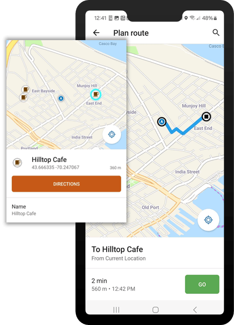
ArcGIS Navigator is a mobile navigation app that uses GIS technology to provide routing for a field workforce. It provides access to global maps by default and allows organizations to use their custom maps and networks. Users can define different travel modes, navigate on private roads, and search for assets. The app is available on both Android and iOS, supports online and offline functionality, and integrates with other ArcGIS field apps.
This release of ArcGIS Navigator introduces significant performance enhancements and bug fixes, including the capability to utilize larger Mobile Map Packages (MMPKs). Read on to discover what’s new and to learn about important information regarding this release.
What’s new in this release
Referencing online layers
This release introduces the ability to reference online layers in Mobile Map Packages (MMPK). This means that when users have connectivity, these layers will be visible, enhancing spatial awareness. Users can select features within the layer and get information or even get directions.

Important to note
If your organization uses custom MMPKs which contain a locator created with the deprecated Create Address Locator tool, they must be rebuilt with the Create Locator tool in ArcGIS Pro. If custom MMPKs are not rebuilt, search results will not be returned. For more information, see the Rebuilding Locators in MMPKs Esri Community post.

Commenting is not enabled for this article.