Overview
ArcGIS GeoBIM delivers an innovative, easy-to-use web-based experience for teams to collaborate on building information modeling (BIM) projects and issues in geospatial context. Architecture, engineering, construction (AEC) and operations teams can make better decisions by securely accessing up-to-date project and asset information between ArcGIS and Autodesk Construction Cloud, including 3D digital models, documentation, issues, and reality capture.
Esri’s ArcGIS is an enterprise geospatial platform that provides a comprehensive set of capabilities for creating, managing, analyzing, and mapping geographic information. Together with Autodesk, Esri is committed to continually evolving connected GIS and BIM workflows between ArcGIS and Autodesk Construction Cloud.
Release Highlight
Improved control over Autodesk project data with folder selection
This release on ArcGIS Online adds a new feature to specify relevant Autodesk project folders for ArcGIS GeoBIM workflows. Users will benefit from faster processing, less clutter, and more control over their project data.
Have a question for our GIS and BIM experts, or want to help us drive new capabilities in ArcGIS GeoBIM? Post your questions, product feedback, and successes in Esri Community.
Folder Selection
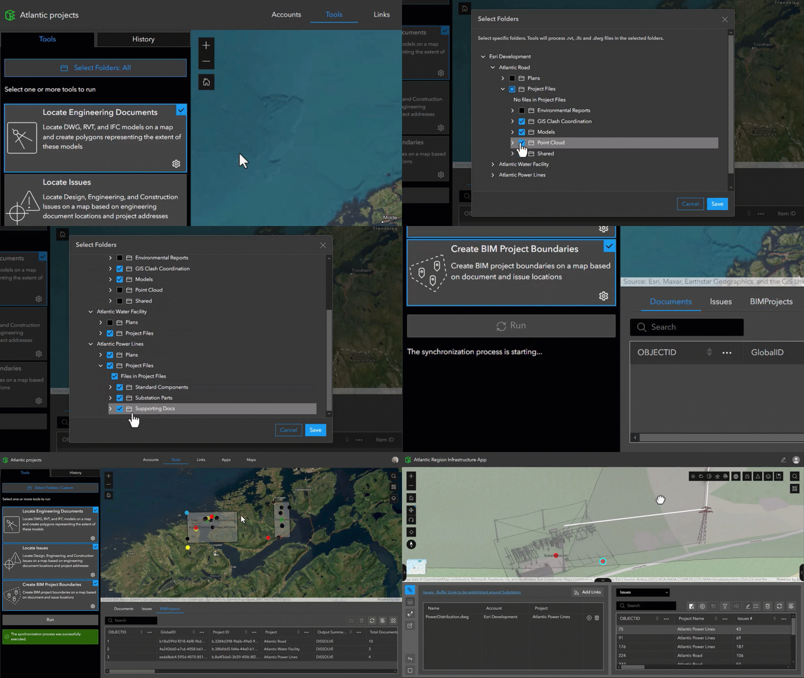
Specify relevant BIM project folders for ArcGIS GeoBIM workflows
Cloud document repositories like Autodesk Construction Cloud can quickly fill up with data that may not be relevant for ArcGIS GeoBIM project workflows. With Folder Selection, users can easily choose BIM project data from a connected Autodesk account for even more control over the data they want to work with.
In the Tools pane, a new button and pop-up window let users select and deselect folders for adding to ArcGIS GeoBIM projects. Doing so results in faster processing and less clutter.
Discover more
Webinar: Transforming Infrastructure Projects: Unleashing Digital Delivery with BIM and GIS

On December 3rd, Autodesk and Esri hosted a webinar for civil engineers in U.S. departments of transportation, other owner organizations, and engineering service providers seeking to advance their approach to infrastructure projects.
Watch this webinar to see ArcGIS GeoBIM in action as you:
- Gain insights into how BIM and GIS workflows can transform transportation projects.
- Learn best practices toward a more integrated approach to infrastructure digital delivery.
- Get updated with the latest advancements in BIM and GIS integrations.
Central San exploring GIS and BIM integration with ArcGIS GeoBIM
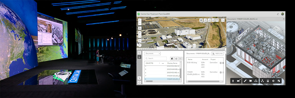
At this year’s Esri User Conference, a California wastewater treatment agency, Central Contra Costa Sanitary District (Central San), took the plenary stage and shared how they use ArcGIS to support operations. See how they are exploring using ArcGIS GeoBIM to connect to CAD and BIM data in Autodesk Construction Cloud to improve collaboration between engineering and operations teams.
Watch the plenary session recording
Enhancing Autodesk workflows with ArcGIS
For Autodesk users, Esri offers ArcGIS which is a suite of powerful tools that seamlessly blend geospatial data with design and construction processes. Discover the capabilities supporting civil engineers, CAD technicians, and project managers as we highlight how ArcGIS can enhance your projects and streamline your operations.
ArcGIS Online achieves FedRAMP Moderate authorization
In July, Esri achieved a significant milestone by securing the Federal Risk and Authorization Management Program (FedRAMP) Moderate authorization for its cornerstone software as a service (SaaS) product, ArcGIS Online. The authorization ensures that SaaS providers like Esri meet stringent security standards that are essential for safeguarding sensitive data, and reflects Esri’s ongoing commitment to software security and compliance.
Access resources about ArcGIS GeoBIM
Learn how ArcGIS GeoBIM can enable GIS and BIM collaboration in your work by visiting this resources page for videos, tutorials, and more.
Get started with ArcGIS
New to Esri and ArcGIS? Get started with ArcGIS for BIM and CAD today.



Article Discussion: