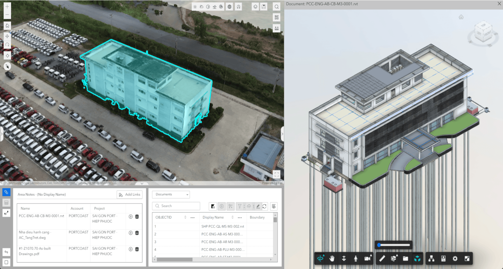
Overview
ArcGIS GeoBIM delivers an innovative, easy-to-use web-based experience for teams to collaborate on building information modeling (BIM) projects and issues in geospatial context. Architecture, engineering, and construction (AEC) and operations teams can make better decisions by securely accessing up-to-date project and asset management information—including 3D digital models, documentation, issues, and reality capture.
The June 2024 release simplifies user administration through the updated user types license model and adds a recycle bin for users to recover recently deleted items.
Release Highlights
ArcGIS is an enterprise geospatial platform that provides a comprehensive set of capabilities for creating, managing, analyzing, and mapping geographic information. Together with Autodesk, Esri is committed to continually evolving connected GIS and BIM workflows between ArcGIS and Autodesk Construction Cloud.
Want to help us drive new capabilities in ArcGIS GeoBIM? Post your product ideas in the Esri Community.
ArcGIS GeoBIM is now included with ArcGIS user types
Esri has updated ArcGIS user types—the primary way to license and securely access the capabilities of ArcGIS from anywhere on any device. ArcGIS user types now offer expanded access to capabilities through apps and services at each role level, simplify license administration, and allow you to scale as the needs of your organization grow.
Starting with the June 2024 release, ArcGIS GeoBIM now comes as an included app with Contributor, Mobile Worker, Creator, Professional, and Professional Plus user types. This means that ArcGIS GeoBIM will no longer be licensed as a separate user type extension that administrators will need to manage.
Creator user types and above can view, edit, and create ArcGIS GeoBIM projects, while Contributor and Mobile Worker user types can only view and edit ArcGIS GeoBIM projects. Customers with the Viewer user type and ArcGIS GeoBIM user type extension will maintain access until the end of their current subscription, after which they can choose to upgrade to the Contributor user type.
Learn more about ArcGIS user types.
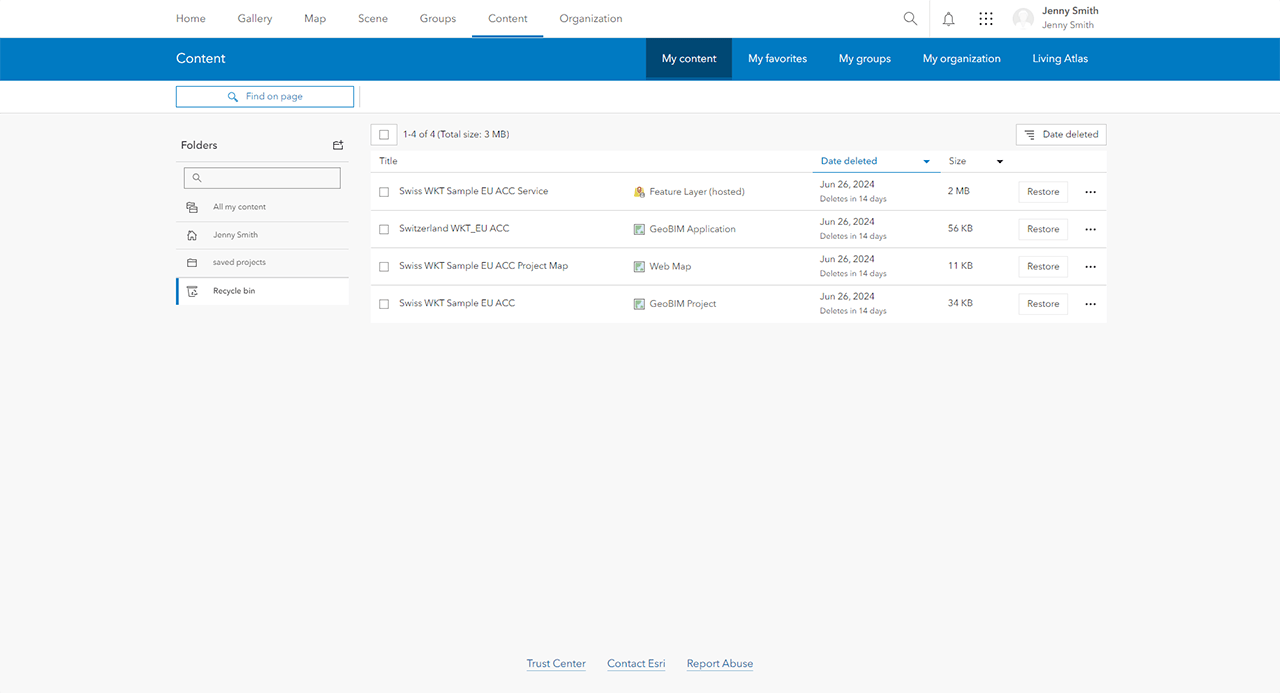
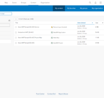
New recycle bin feature in ArcGIS Online
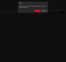
ArcGIS Online organizations using ArcGIS GeoBIM can now take advantage of a new recycle bin feature to restore recently deleted items. When enabled, the recycle bin gives item owners and administrators up to 14 days to retrieve items that may have been accidentally deleted. Existing ArcGIS Online organizations can choose to enable the feature optionally, while new organizations have the recycle bin enabled by default.
Learn more about the recycle bin feature.
In case you missed it
ArcGIS GeoBIM mandatory update for ArcGIS Enterprise 11.2
On June 28, 2024, Autodesk will retire the current version of its Authentication (OAuth) API as part of an essential security upgrade. This API currently provides access to the latest CAD and BIM assets within Autodesk Construction Cloud for ArcGIS GeoBIM users. To ensure uninterrupted service, all ArcGIS GeoBIM deployments on ArcGIS Enterprise 11.2 must update to 11.2.1 before June 28.
Read more in the release notes.
Join the Esri Community
Have a question about this release or want to suggest something new in ArcGIS GeoBIM? Contribute to the discussion by posting your questions, feedback, and ideas in the Esri Community.
Discover more
Access videos, webinars, and more about ArcGIS GeoBIM
You can find videos on GIS and BIM cloud collaboration and more by visiting this resources page and video playlist for ArcGIS GeoBIM. Upcoming webinars and past recordings presented by Esri and Autodesk can be found on the ArcGIS GeoBIM webinars page.


Article Discussion: