ArcGIS Field Maps is a powerful and versatile mobile app solution used to complete a variety of field workflows. Leveraging the power of a map, Field Maps enhances situational awareness, enables simple and advanced capture capabilities, and can record and share where mobile workers have gone, all within a single location-aware mobile app.
The February 2024 release, our first of three major releases in 2024, introduced a new Info form element and several enhancements to the map authoring and and configuration experience.
What’s new in the June release
Our June 2024 release is focused on several key usability improvements in Field Maps Designer as well as stability and performance enhancements to both the iOS and Android mobile apps.
For a quick look at what’s new:
- List of issues addressed in the 24.2.0 release of the Mobile app
- List of improvements in the Field Maps Designer web app for ArcGIS Online
- List of improvements in the Field Maps Designer web app for ArcGIS Enterprise 11.3
Please read below to learn more about each new addition available in Field Maps Designer for the June release.
View maps by folder
Folders are the drawers in your map cabinet. They’re used to organize maps and group related content in your ArcGIS organization.
Within Field Maps Designer, the Maps page provides a list of all available maps you can configure. Now you can view those maps by the folder you placed them in.
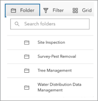
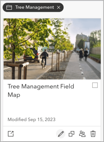
When a folder is chosen, an ornament will appear indicating that the list of maps has been filtered by folder. Clicking the x will remove the filter and return the author to their My maps list.
Map card indicators
From the Maps page, each map is displayed as a card in grid view or a row in table view and there are a set of actions and capabilities shown:
- Actions include: Configure, Duplicate, Edit Sharing, and Delete.
- At a glance, indicators represent the map’s capabilities (Editing or Read-only, Mobile Map Packages).
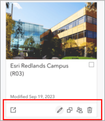
You can use these new indicators to quickly discover the capabilities of a map.
Open Map Viewer
When configuring a map for field use, you may need to open the Map Viewer and make changes beyond what is available within Designer itself. Opening the Map Viewer directly from Designer ensures edits made to a map never get out of sync – a common occurrence if multiple tabs or browser windows are used.
Access to the Map Viewer is now available from the action bar where previously it was only accessible from the Overview page.
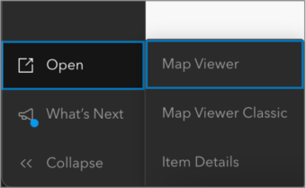
Opening in Map Viewer Classic may be available depending on your organization’s settings. From the Open menu, you can quickly access the map’s Items Details so you can modify additional properties.
Updated Overview page
The Overview page has been updated. Along with visual improvements, the page now includes a Capabilities section so that you can see the capabilities supported in your map. Notice that the “Open in Map Viewer” drop down menu is no longer available in the Overview page and is now located in the action bar to the left.
Mobile Map Package support
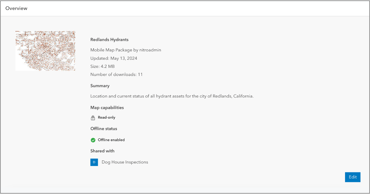
Field Maps Designer now supports viewing as well as limited configuration of mobile map packages.
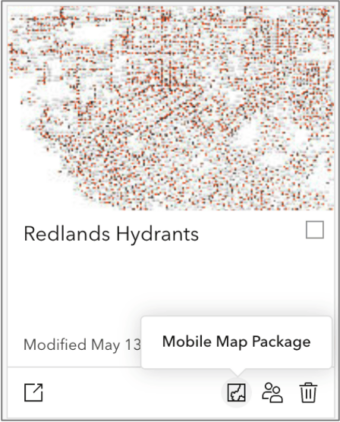
On the Overview page, you’ll now see additional details including the size and number of downloads for a mobile map package.
From this page, you can:
- modify the thumbnail.
- change the name of the mobile map package item.
- update the description.
From the Sharing page, you can:
- modify how the map is shared.
- generate a link and QR code.
- exclude from display in the Field Maps mobile app.
Mobile map packages are created using ArcGIS Pro. Map capabilities are contained within the package and most configuration requires re-packaging the map.
Offline improvements
For the past 3 releases, Field Maps Designer has included validation checks that highlight error and warning issues in your map so you can understand why content is preventing your map from being taken offline. For the June release, we’ve added new checks and all checks are now available from the web map item details page as well as in Designer.
New error condition checks:
- Missing fields in feature layer including GlobalID field, Subtype field, Relationship primary or foreign key fields, Editor tracking fields
- Location sharing layer
- Invalid index name
- Multi-source basemaps
- Map notes stored as an item
- Esri basemap that is not using the tiled equivalent (also available in ArcGIS Enterprise 11.3)
- Several fields with names matching sqlite reserved keywords
- select, commit, set, then, foreign, group, index, unique, intersect, join
New warning condition checks:
- Esri tile layers that have been deprecated with a vector tile equivalent
- Esri tile layers that are not using their export equivalent
- Feature layer requires a true curve client for editing
What’s coming next
We have one more major release planned for the fall of 2024. This update will include enhancements to the offline experience and getting started experience in Field Maps Designer.
The Field Maps team has been busy building new and enhancing existing capabilities in the mobile apps for release in 2025. This includes support for planning and coordinating field tasks, offline viewing and tracing of utility networks, a new and improved personal markup experience, forms support for Edit Multiple, a refreshed user experience, and much more.
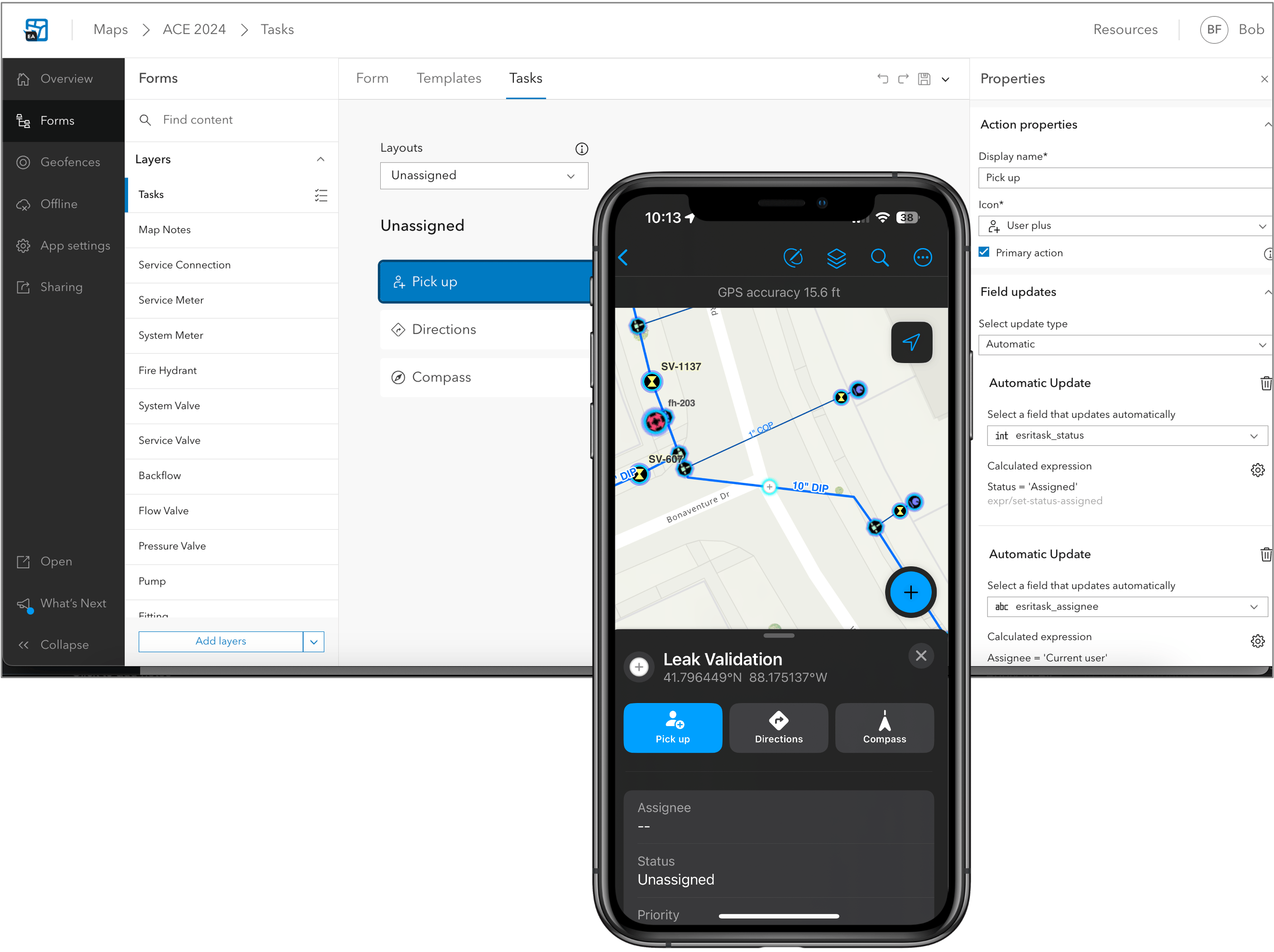
If you’re interested in testing early previews of these new capabilities, email arcgisfieldmaps@esri.com.


Article Discussion: