2024 was a significant year for Field Maps, marked by three key releases that introduced a wave of new capabilities, all guided by your invaluable feedback. This blog will cover the key capabilities introduced and provide a preview of what’s coming in 2025. For those using ArcGIS Enterprise, be sure to check out the ArcGIS Field Maps Enterprise Matrix to explore the versions in which the capabilities you’re interested in were added.
Field Maps Designer
Field Maps Designer is packed with features designed to enhance the efficiency of authoring and deploying maps for field use. Additionally, it offers tools that can be configured to improve workflow efficiency for users in the field.
Template Gallery
If you’re unsure where to begin when building a map for the field, take a look at the new Template Gallery introduced in the November release. This initial offering features three popular workflows:
- Ground Control:Capture ground control points before a drone flight to serve as precise reference points.
- Field Notes:Equip field teams with the ability to document observations for follow-up analysis.
- Asset Inspections:While I may not want to play favourites, this template stands out as it provides an optimal data model for asset inspections, including the asset layer along with a related table to store inspection data.
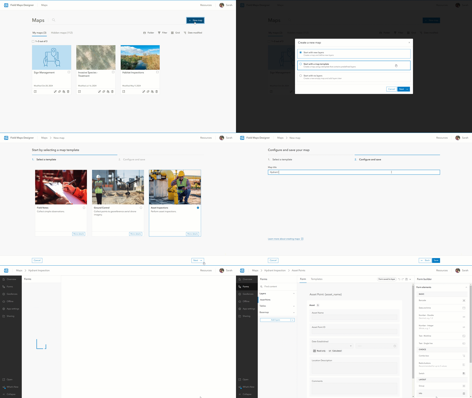
What makes these templates powerful is that they provide a solid starting point, allowing for customization to meet specific workflows and needs. For instance, although a sample form is provided, you can easily add additional fields, behaviours, and calculations to optimize it for your unique workflow.
Looking ahead, we have big plans for the Template Gallery, including the addition of more default templates and allowing organizations to define their own.
Coordinates and M-Values
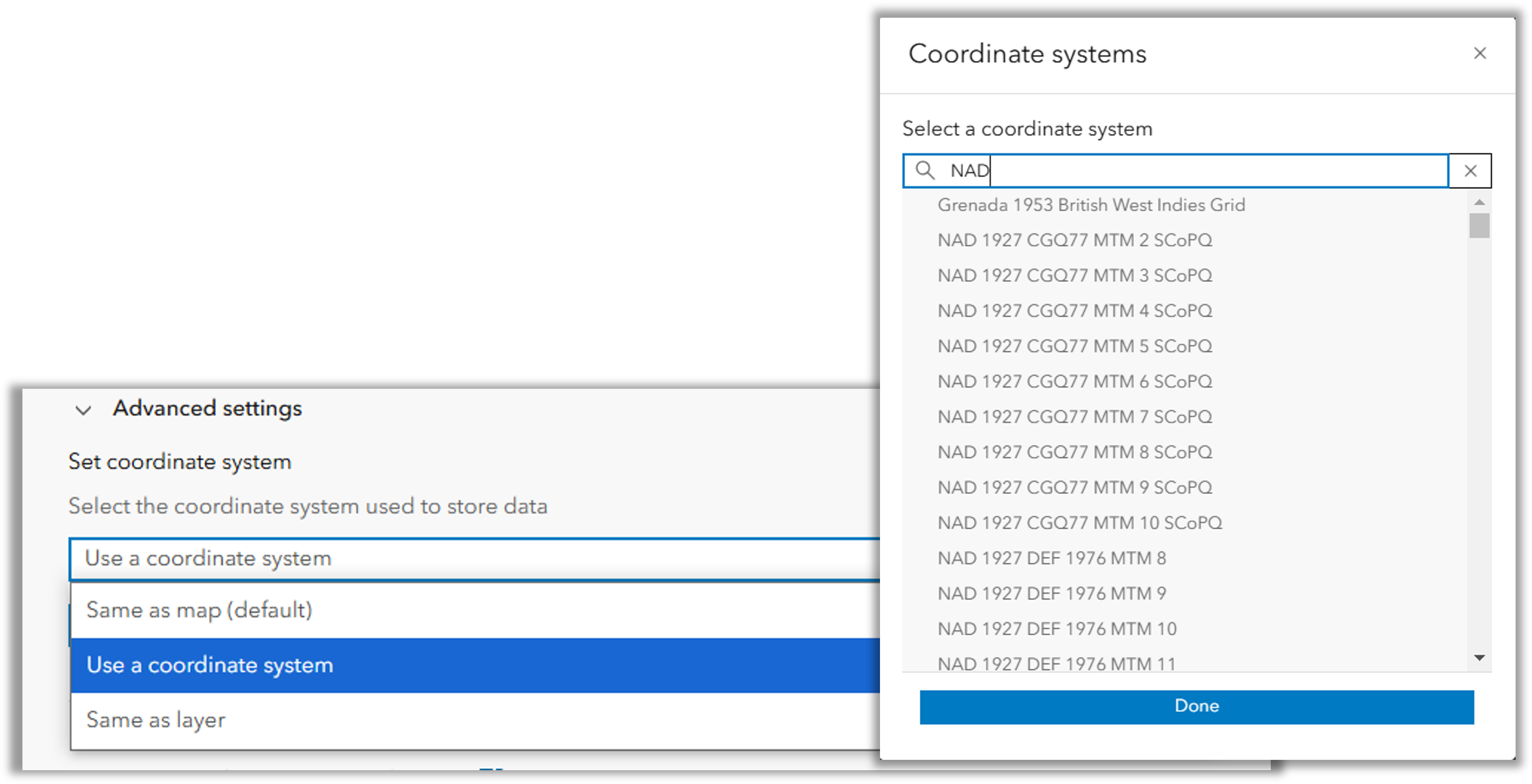
When configuring maps for the field, there may be a need to create a new layer for field teams to utilize. This capability was initially introduced in 2023, and the February release in 2024 brought an exciting enhancement: the option to select a coordinate system for new hosted layers.
In addition to this, you can enable m-values on these new layers to support linear referencing workflows. This option is conveniently located in the layer settings when creating a new hosted layer.
Configure
Forms
Forms have never been more popular, and we love hearing from you about how you’re using them and your ideas for future elements. Don’t worry—we’re currently working on the highly requested multiple choice feature, so keep your eyes peeled for updates and future beta testing opportunities!
Info Element
Do your users need information while filling out the form, such as links to documentation or safety measures? You may want this information to be dynamic, based on their input or specific conditions. Previously, achieving this required adding a field and using Arcade, leading to extra schema changes and clutter that necessitated post-capture cleaning.
Enter the Info Element! This new form element allows you to add messages directly to the form without saving them to the data schema. It takes advantage of form capabilities, such as conditional visibility and dynamic messages using Arcade, all while keeping your schema clean. Additionally, because the Info Element is purpose-built, it can be formatted using headings, bold, italics, code font, bulleted and numbered lists, and URL links.
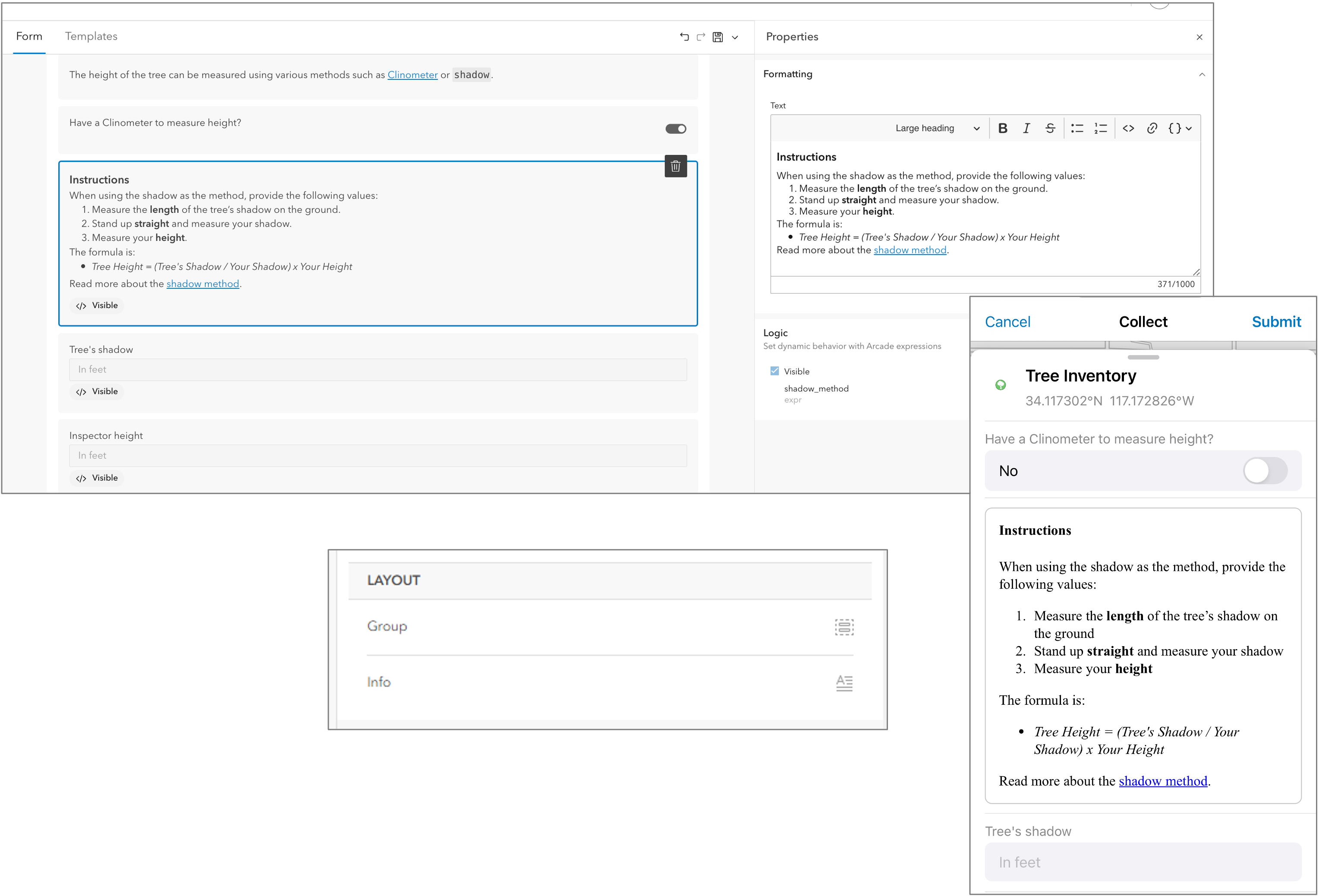
This flexibility provides an intuitive user experience, making it easier for users to access the information they need without affecting the schema. Find out more in this blog and this Tips from the Team.
Lists
In the February 2024 release, alongside the Info Form element, we introduced the ability to add or replace list items using a CSV file. This enhancement streamlines the process of managing lists, making it easier for authors to update and maintain their schemas for data integrity.
Streamlined Layer Management
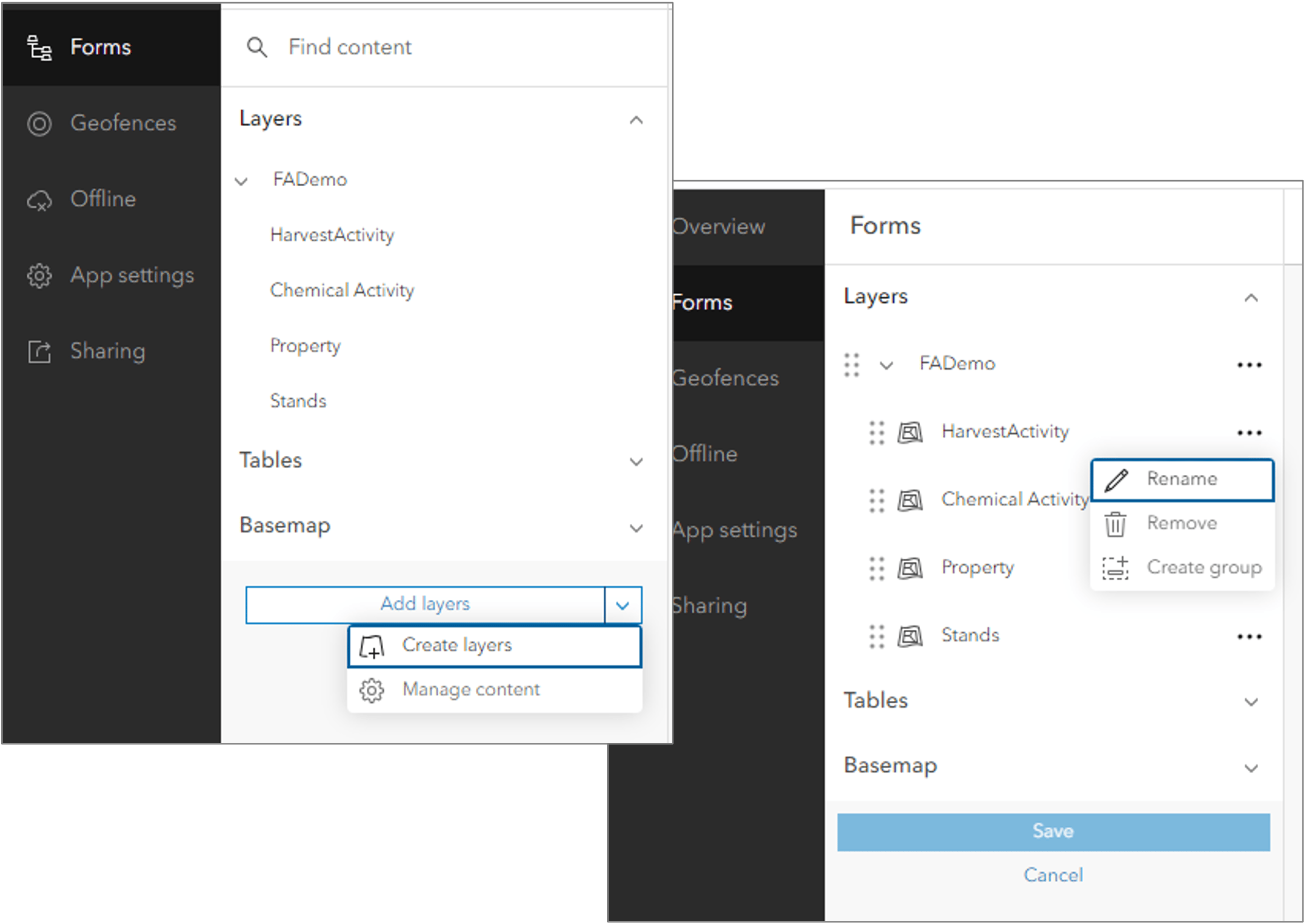
Adding layers, altering workflows, and creating new content often necessitate adjustments to how layers are displayed in Field Maps. You may want to rename, remove, or create groups to organize layers, making it more intuitive for your teams in the field. With the February 2024 release, you can easily manage your layer content by navigating to the Form section. Simply select the Add Layers dropdown and click on Manage Content.
Configuring the Map
If your changes extend beyond layer ordering, you may need to configure the map itself. The June 2024 release made this process much easier. You can now access Map Viewer directly from the action bar by selecting Open, whereas previously, it was only accessible from the Overview page.
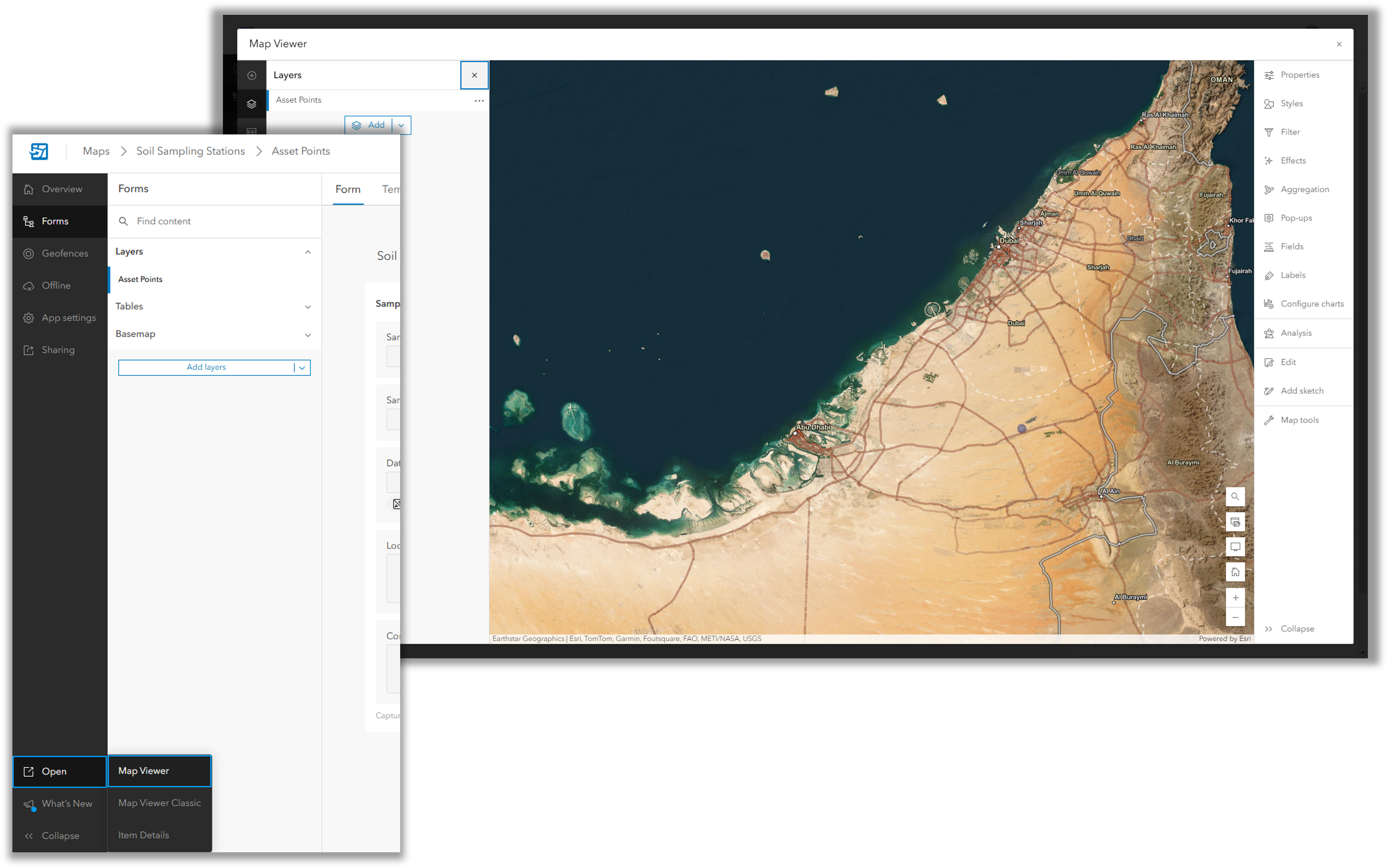
This enhancement streamlines the workflow and ensures that edits made to a map never get out of sync—a common occurrence when multiple tabs or browser windows are used.
Map Settings
Offline
Being able to work offline is essential for many users, and we have focused on enhancing this capability with each release to improve the speed and efficiency of offline workflows.
Offline Validation Checks
If your field team is going offline now or plans to in the future, it’s important to ensure that the map meets the requirements for offline use. You can check your map’s compliance by opening Field Maps Designer and navigating to the Offline tab in the Content section. Here, Field Maps Designer will highlight known errors and warnings, helping you understand why certain content may prevent your map from being taken offline. If the issue can be resolved within Field Maps Designer, you will be provided with an option to do so directly.
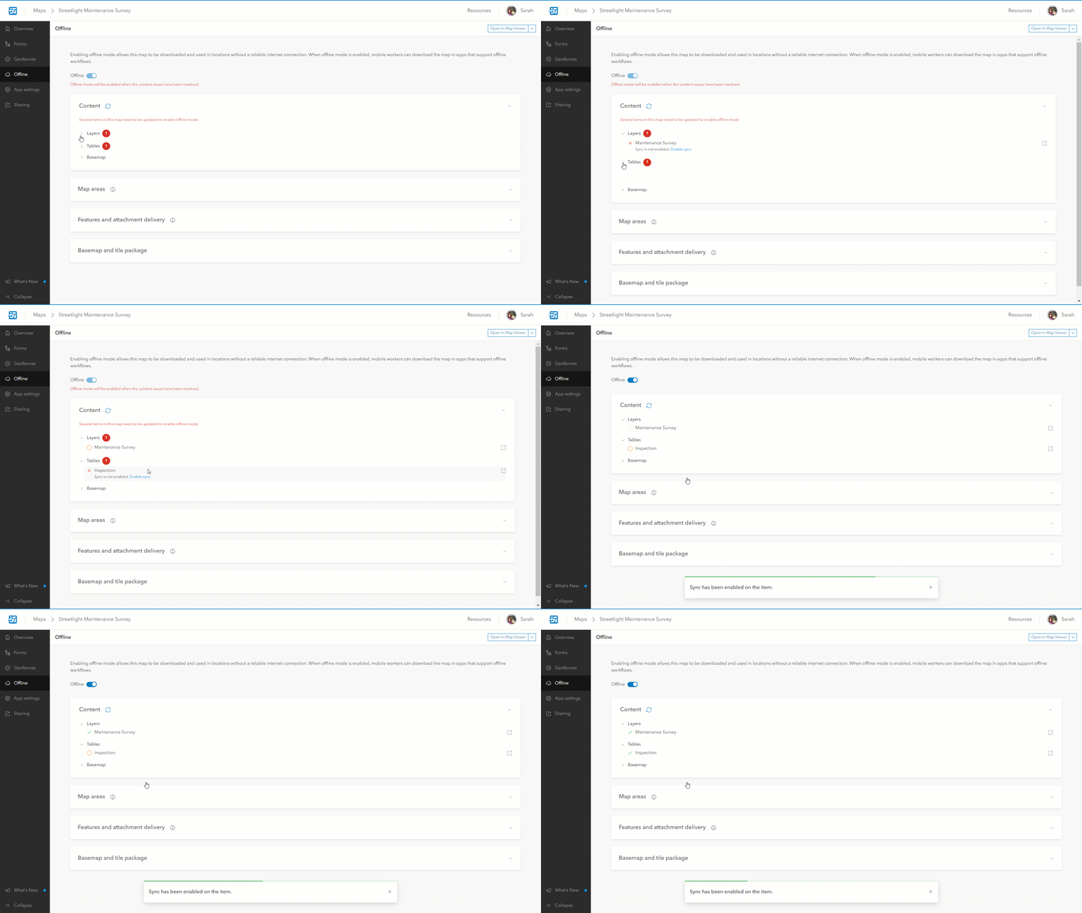
For more information, refer to the documentation that explains common warnings that may impact offline workflows.
Offline Patterns
There are multiple patterns for going offline to allow for flexibility. In the November release, we enhanced the offline settings to allow for a more customizable user experience.
Within the App Settings section in Field Maps Designer, you will find two new options under the Map section: Online Map and New Offline Map Areas.
When these options are enabled, users can choose to work with an online version of the map or create their own offline areas. If you prefer that users always work with an offline map or want to restrict them from creating their own offline areas in favour of predefined ones, you can easily disable these settings.
Disable Markup
Markup allows users to sketch and annotate maps while in the field, with their work saved directly to their device. However, there are instances where workflows do not require access to markup. To streamline the user experience, you can now disable Markup for users in Field Maps Designer. Simply navigate to the App Settings section, select the Map tab, and use the toggle to enable or disable Markup.
Mobile Map Packages
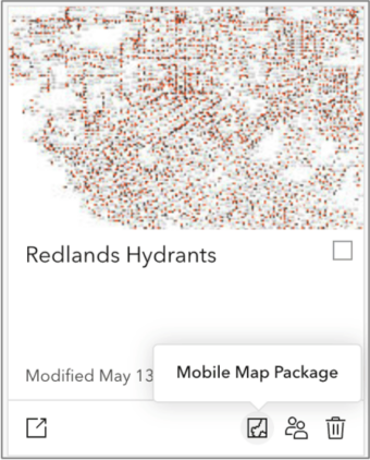
Mobile map packages created with ArcGIS Pro enable field users to access large datasets or local data that isn’t published online. In Field Maps Designer, you can now make limited configurations, including:
- Modifying the name and thumbnail of the package.
- Deciding whether the package should be visible to users in Field Maps.
These enhancements streamline the user experience and improve accessibility to essential data in the field.
Quality of life enhancements
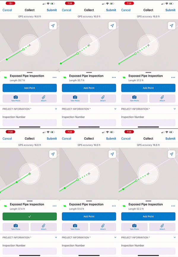
These small enhancements significantly improve the overall usability of Field Maps. In February, based on user feedback, we introduced the ability to see the cumulative length of segments while collecting linear features. The measurement now includes the length of the proposed geometry, which is the distance from the last captured vertex to the target location.
In the June release of Field Maps Designer, you can now easily view visual indicators of the map’s capabilities at a glance. Actions such as configure, duplicate, edit sharing, and delete are readily accessible. Additionally, this release introduced a search feature that allows you to find your folders directly in Field Maps Designer, making it easier to identify the maps you want to access.
What’s coming next
February 2025
Enhancements to Feature Templates in ArcGIS Field Maps
In this release, we will add support for aligning Feature Templates to match the layer’s symbol style. When changes to a layer’s style create discrepancies between the layer’s feature templates, it can affect the ability to easily create features with the correct symbols and values. To address this, we will notify the author when such discrepancies occur and provide options to align the templates with the layer’s style by adding, updating, or removing templates. This enhancement brings a capability that was previously only available in Map Viewer Classic.
Later in 2025
Plan and coordinate work in the field
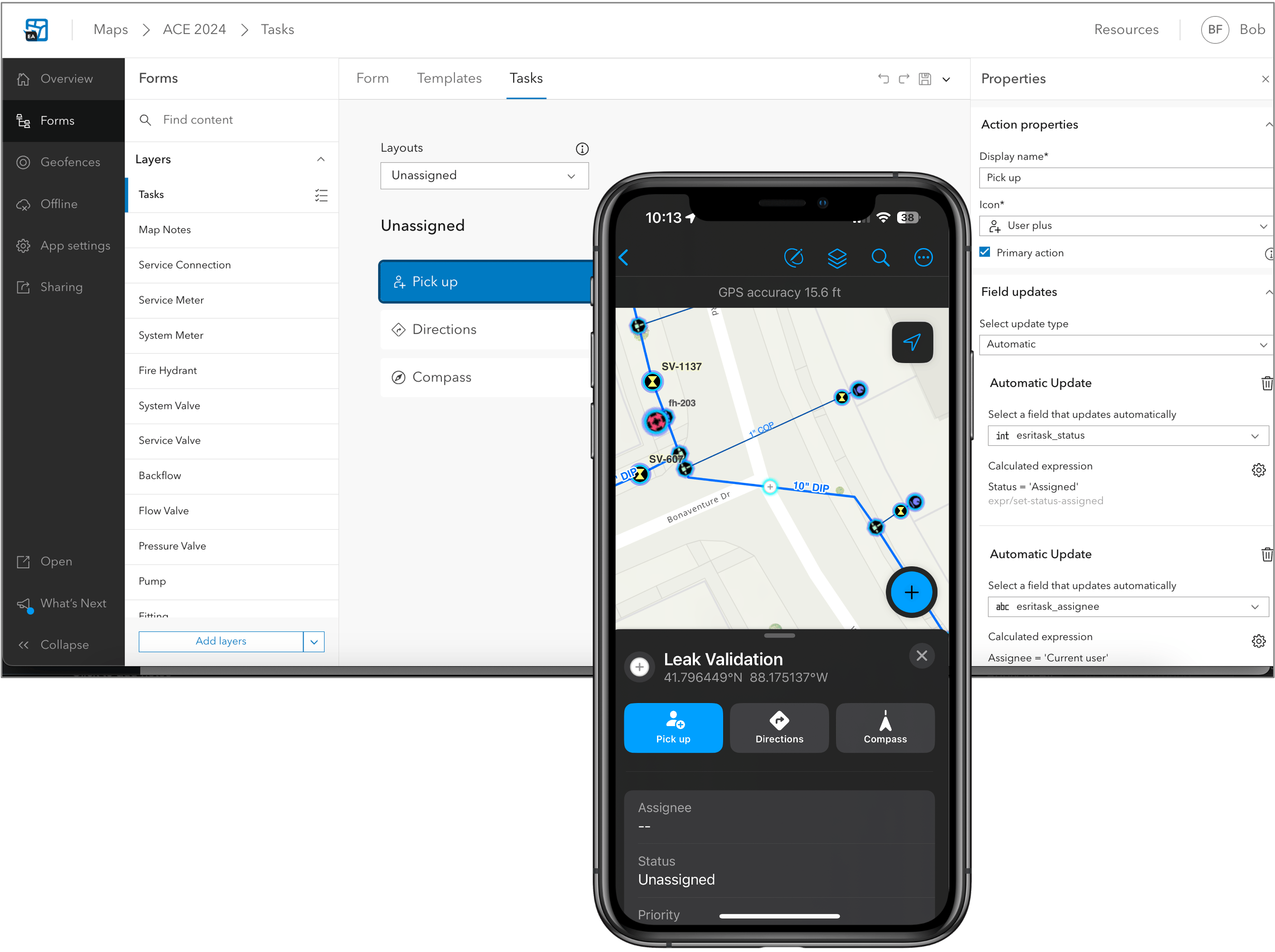
Field Tasks is an exciting new capability set to be introduced in Field Maps for field operations in 2025. The initial release will allow:
- Users to view their assigned work through a digital to-do list.
- Users can update the current status of their tasks, providing visibility into progress.
- Optional features that allows users to create and assign work directly within the mobile app.
Working with the Utility Network
We want to ensure that you can complete your field workflows while fully utilizing the capabilities offered by the Utility Network. Coming soon, you will have the ability to view and trace utility networks even when offline. In addition to these new offline capabilities, exciting features are being introduced to connected workflows, such as the ability to specify a named Branch Version for a map. Whilst viewing and tracing workflows are important to teams in the field we are introducing the ability to edit subtype group layers, enhancing the editing experience for utility networks. There’s much more to come in this area and if you would like to provide your feedback please get in touch arcgisfieldmaps@esri.com.

We plan to share much more about the capabilities we are introducing to Field Maps closer to the release, which will include the following features and even more:
- Improved indoor positional accuracy.
- Forms support within the Edit Multiple tool.
- Support for related pop-up elements, enabling easy navigation of associated features.
- Enhanced visibility of related records through feature actions.
- Geofence alerts that update automatically with changes to the underlying feature layer.
- Use GPS devices as the location source for location sharing.
- A new and improved personal markup experience.
- A new collaboration experience for Apple devices.
How to get access:
In the near future, a beta version will be available through our Early Adopter Program. We will share further details via our blogs, Esri Community, and our social media channels, including the LinkedIn Esri Field Operations User Group.
To try these features in advance, please contact us at arcgisfieldmaps@esri.com.
Where to find out more
This article highlights the new functionality released in Field Maps throughout 2024. To learn more, refer to the provided resources for each release. The archived What’s New offers a historical view of all the past functionality releases.

Will field task creation and other Workforce features be available in Field Maps before spring 2025? Any release date announced?