If you use census data, then you are likely aware that the Census Bureau is applying a new form of privacy protection to Census 2020. What will it look like? How will it impact your existing workflows? To help answer these questions Esri has built feature layers for eight levels of geography so that you can explore how census data are likely to change for 2020. As the Census Bureau works diligently to fine tune their methods for privacy protection, they need feedback from data users like you! Your input can help improve the Census 2020 data products.
The 2020 Census brings a new era of privacy protections with the implementation of differential privacy. Differential privacy is a “formal privacy” approach that provides proven mathematical privacy assurances by adding uncertainty or “noise” to the released data. This disclosure avoidance technique determines the amount of noise necessary to balance privacy loss and accuracy via mathematical formulas. Census 2020 will be the first large-scale application of this new privacy system. View this blog for more information on the reasoning behind the implementation of this new privacy technique and how Esri is helping data users prepare for the impacts of differential privacy.
To help data users prepare for this shift, the Census Bureau is currently releasing Census 2010 Demonstration Data Products that provide the public with a sneak peek at what the 2010 raw data would look like after being pushed through the Disclosure Avoidance System (DAS). As this new system is still under development, different versions of the demonstration products have been released. These releases are planned to continue periodically until the 2020 DAS is finalized. This gives the public the opportunity to perform analysis and provide feedback to the Census Bureau.
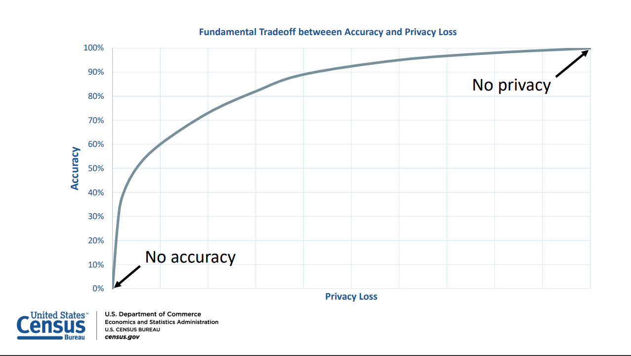
This graph illustrates the goal of the DAS – finding a balance between between
two desirable but incompatible features: accuracy and privacy

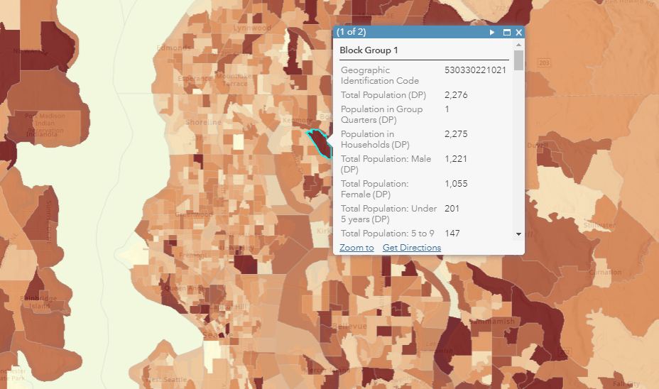
To better facilitate analysis from the public, Esri has published the demonstration products as feature layers. Each set of layers is designated based on the corresponding data release dates from the Census Bureau. The provided layers contain select critical variables from both the original Census 2010 Summary File 1 (SF1) release and Census 2010 with differential privacy applied.
Census Demonstration Products v1 October 2019
Census Demonstration Products v2 May 2020
Census Demonstration Products v3 September 2020
Census Demonstration Products v4 November 2020
Census Demonstration Products v5 April 2021
Census Demonstration Products v6 June 2021

Data are shown in Census 2010 boundaries for the following geographies:
- States
- Counties
- County Subdivisions
- Tracts
- Block Groups
- Places
- Congressional Districts 110th-112th (CD)
- American Indian Areas (AIA)
We strongly suggest you run your high-priority workflows using both the original Census 2010 SF1 and Census 2010 with differential privacy applied to determine how the new system may impact your work. If you have concerns, please let the Census Bureau know by sending an email to 2020DAS@census.gov. As additional versions of the demonstration data products are released the data will be made available so that users can ensure their priority use cases are minimally impacted.
Visit the Census Bureau’s website to learn more about the implementation and ongoing development of the differential privacy system for future Census Bureau data releases.
Tabulated data was obtained from IPUMS NHGIS. David Van Riper, Tracy Kugler, and Jonathan Schroeder. IPUMS NHGIS Privacy-Protected 2010 Census Demonstration Data, version 20200527 [Database]. Minneapolis, MN: IPUMS. 2020. https://www.nhgis.org/privacy-protected-demonstration-data


I am curious about the congressional district boundaries shown in the September 2020 version of the map. For Iowa, they are different from both the current and previous congressional district boundaries. Where did the district boundaries used in the AGOL demonstration maps come from?