Just in time for the festive season, the ArcGIS Runtime team brings you Update 7. Continuing the track-focused development introduced with Update 6, this release expands capabilities for Utilities, Defense & Public Safety, as well as providing some more platform driven functionality.
As before, much of the functionality that’s driven by one of those tracks is usable in a broad range of scenarios. Read on to see what’s new.
Utilities
Network Trace
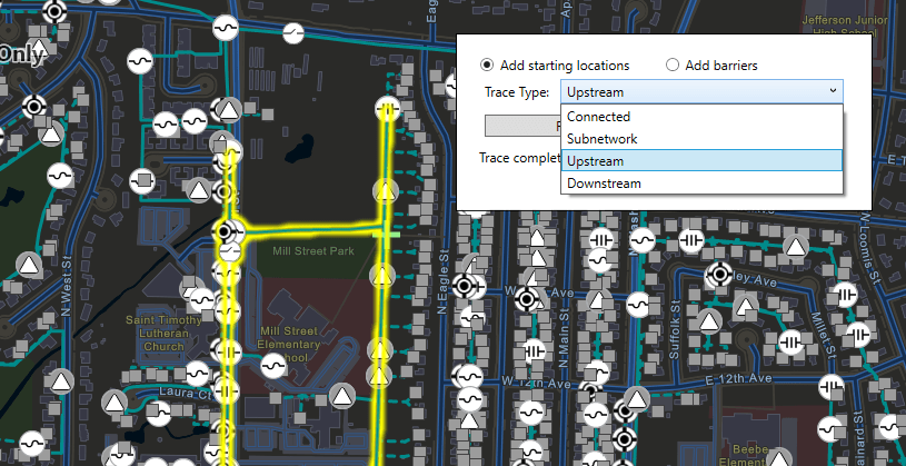
At 100.7 we’ve added the following utility network traces to give you a full suite of options:
- Subnetwork: Trace a logical subset of the network (e.g. a circuit or a zone).
- Downstream: Find out what is being fed from a particular part of the network.
- Upstream: Useful to see what’s feeding a particular part of the network.

Building on the foundation introduced at 100.6, Runtime now supports a much richer collection of tracing options. Traces can be configured to stop based on complex attribute expressions or function barriers. Advanced attribute propagation is also supported, enabling the authoring of phase-based electrical traces. Connectivity associations and structural attachment associations can now be queried, and additional utility network schema information is available. ArcGIS Runtime can now serve as the basis for truly powerful utility network field apps.
Subtype Feature Layer
An ArcGIS utility network maintains real world network element types (fuses, transformers, switches etc.) as subtypes in a single feature class. This is good for performance but can be challenging when customizing how each of these subtypes is presented to the user (think popups, visible scale ranges, etc.).
The new SubtypeFeatureLayer provides a clean solution: point it at a single feature class and it acts as a group layer that automatically includes a feature layer for each subtype in the source feature class. These sublayers can be configured independently of one another and queries are optimized across all sublayers. For example, a pan of the map sends a single request to the source feature class to cover all the sublayers (manually creating a feature layer for each subtype would have resulted in a query per feature layer).
As you can imagine, while this is important for utility network, you can also make good use of it anywhere subtypes are found.
Augmented Reality
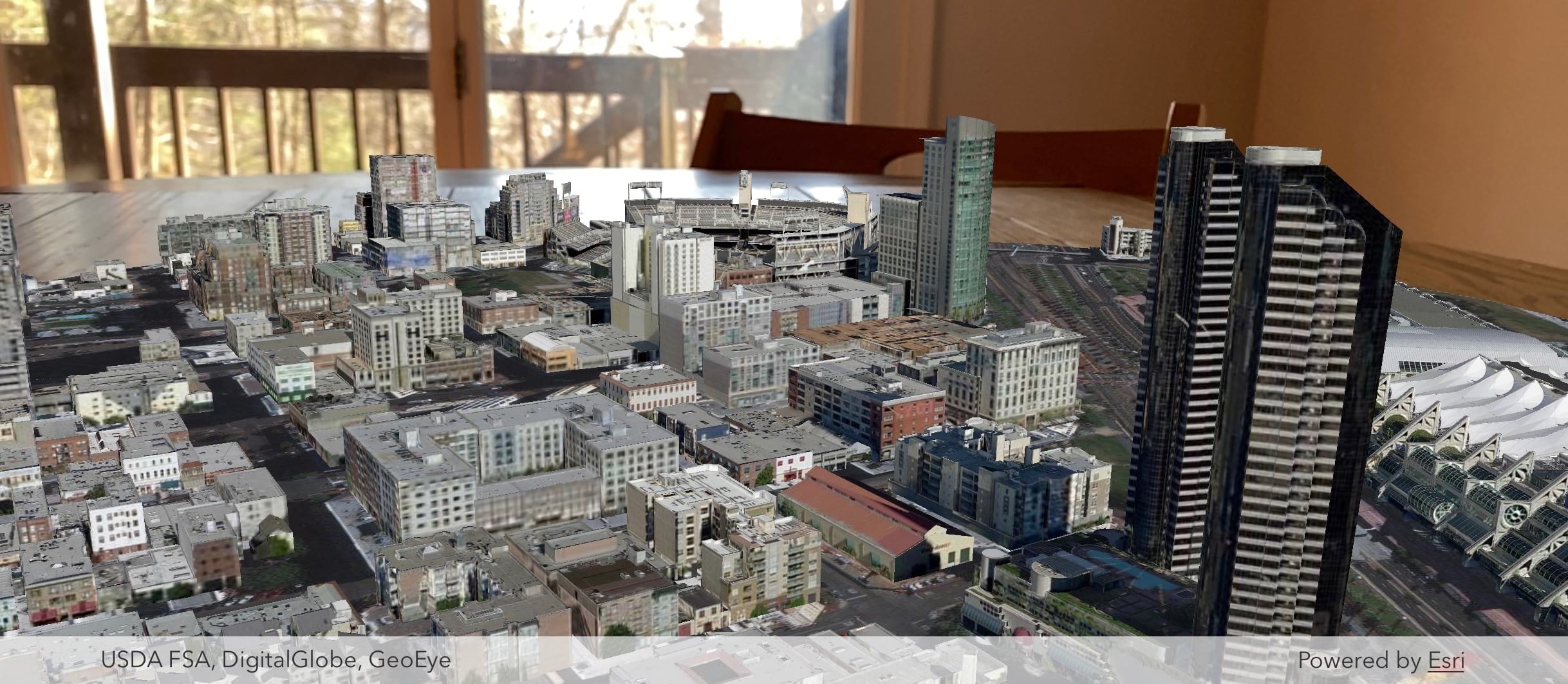
One of the three AR modes introduced with Update 6 was Tabletop: you provide a scene to the ArcGIS Runtime SDK Toolkit’s AR component and determine the surface on which to place it. Runtime now allows you to clip that scene so that it will better fit on top of the surface.

While we were at it, we incorporated various optimizations to download scenes quicker and more efficiently.
Other improvements:
- Use a map’s reference scale with graphics overlays
- Scale-based symbol classes for layers delivered via MMPKs
- Work with Preplanned Areas defined by polygons
- Use custom styles for VTPK based layers in MMPKs
Utility network licensing
Access to utility network data and analysis (eg tracing) now requires an extension license. For named users, the Utility Network user type extension (available with ArcGIS Enterprise 10.8) can be added to a named user. For license keys, a new Utility Network extension can be purchased for Runtime deployments. In either case, the extension enables licensed access to utility network functionality in Runtime. See the Licensing by User Type section below for more details on enhancements to Runtime licensing with named users. As always, you don’t need this extension during development, only when deploying an app for production use.
Defense & Public Safety
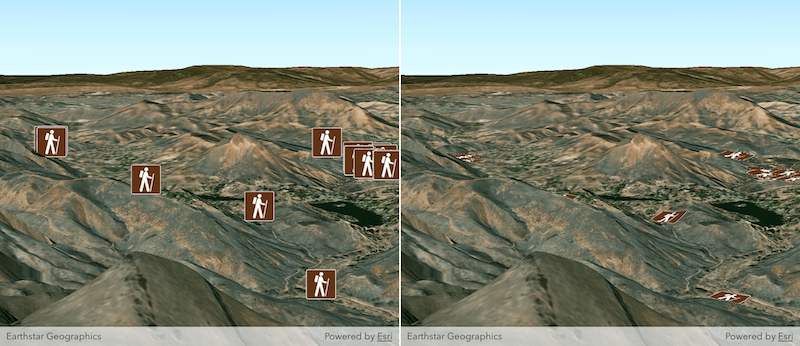
When draping marker symbols on the ground in 3D scenes, you can now choose whether to display them billboarded or flat.

Runtime apps can now create and edit KML screen overlays (previously you could just display them).
We’ve made various improvements to MMPKs and MSPKs for working offline:
- Rasters can be read directly from a MMPK or MSPK without unpacking it
- MSPKs can include rasters as elevation sources
- MSPKs can now include transportation networks
Platform
Licensing by User Type
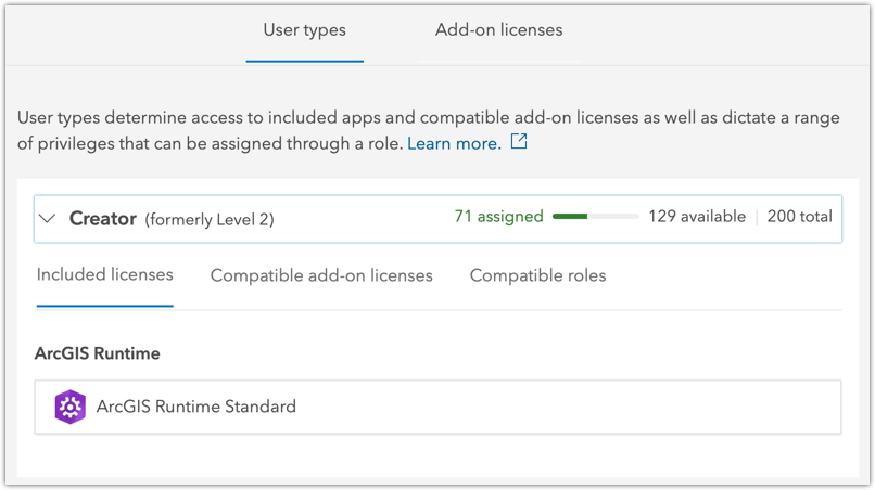
The big one here is that you can now license Runtime apps at all levels via your ArcGIS Online or ArcGIS Enterprise named user login. No longer limited to Lite and Basic, named user logins now also enable Standard and Advanced levels.

Here’s what included with ArcGIS user types and Partner user types:
| User Type | Runtime Level |
|---|---|
| Viewer / Lite [partner] | Lite |
| Editor / Field Worker / Basic [partner] | Basic |
| Creator / GIS Professional Basic / Standard [partner] | Standard |
| GIS Professional Standard / GIS Professional Advanced / Advanced [partner] | Advanced |
Extension licensing for User Types
A new Runtime Analysis extension can also now be assigned as an add-on to Creator and GIS Professional users (user types that include a Runtime Standard or Advanced license).
With the upcoming release of ArcGIS Enterprise 10.8, a new user type extension will be introduced for utility network. This covers capabilities of utility network across the platform and we’ve simply rolled Runtime utility network licensing right into that. The Utility Network user type extension is included with GIS Professional Standard and GIS Professional Advanced user types and can be assigned as an add-on to all other user types (Viewer user type will be limited to viewing and tracing utility networks).
All the rest
There are many more new features dotted around the Runtime in 100.7, and as ever we’ve also fixed a number of bugs and made various improvements and optimizations under the hood.
But a good SDK is not just about the code:
- New samples have been added to the SDK Samples apps.
- The guide and reference docs have been updated.
- The Open Source Apps team has updated the Data Collection .Net WPF app with new functionality to bring it into line with the Data Collection iOS app. And as an added bonus they’ve released a UWP version too.
Please note: There is no update to Local Server at 100.7.
See the release notes for each individual SDK for more details: Android, Qt, .NET, Java, and iOS.
We’re really proud of how 100.7 builds upon the foundations of 100.6 where we introduced the Utility, Defense & Public Safety, and Platform tracks and we’re already hard at work on 100.8.
Download and get started
To get 100.7, go to the ArcGIS for Developers web site, browse the ArcGIS Runtime SDK page of your choice and download the SDK. You can also reference the Runtime SDK through NuGet, Gradle, or CocoaPods. If you’re new to developing with ArcGIS Runtime and don’t have an ArcGIS Developer subscription, simply sign up for a free account and you’ll be able to access everything you need to develop your app.


Commenting is not enabled for this article.