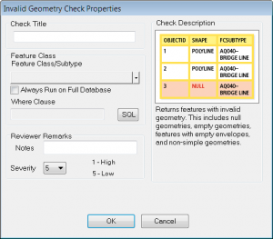
What exactly does Data Reviewer’s Invalid Geometry check find? Before I provide an answer, let’s explore how invalid geometries are introduced in your geodatabase in the first place. Typically loading data from shapefiles or CAD files can introduce invalid geometries. When data is migrated into an enterprise geodatabase using the simple loader invalid geometries such as empty, null, and no envelope will be filtered. However, if you’re using a third party data migration tool, all features including invalid geometries could be migrated. Similarly, when importing data into a personal or file geodatabase all geometries will be copied over. While the Check Geometry geoprocessing tool reports such geometry problems, it only works on shapefiles and personal or file geodatabases, and not on enterprise geodatabases. That’s where Data Reviewer’s Invalid Geometry check is helpful.
The check returns features that meet one of the following conditions:
1. Nothing
2. Empty
3. Has an empty envelope
4. Not simple
Okay, so what do these conditions mean?
Let me address the first three conditions as they are somewhat related. You might ask, “if they are related why is Data Reviewer reporting these issue(s) independently?” For each feature the three conditions have different meanings. Furthermore, the issues could have been caused by different workflow errors. As a user, all you really need to know is that the feature has no geometry. However, I’d like to explore these conditions a bit more and provide a brief description of each.
Nothing
The feature has nothing in the SHAPE field (SHAPE = <Null>). This type of error is returned when Data Reviewer is unable to retrieve the geometry information for that feature.
Empty geometry
The geometry of a feature is considered empty if it has zero or no points and it does not contain geometric information (represented by SHAPE _LEN and/or SHAPE_AREA fields) beyond its original initialization state.
Note:
- A point/multipoint geometry type contains point(s) as its geometry information.
- A line/polyline geometry type contains line segment(s) as its geometry information which is again represented by points.
- A polygon geometry type contains rings (formed by line segments) as its geometry information which is again represented by points.
Empty geometries can be introduced when editing or creating data programmatically and when importing bad data into your GIS.
Has an empty envelope
This condition occurs when a feature’s envelope (bounding rectangle) does not have any geometric information. This is similar to empty geometry.
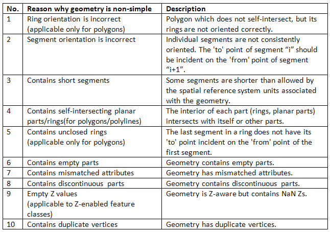
Not simple
Geometry is considered non-simple if any of the below are true.
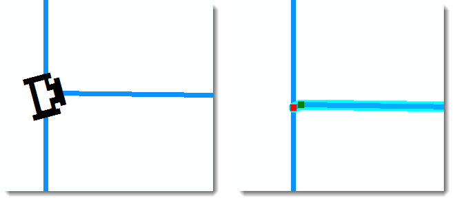
Short segments seem to be the most common non-simple geometry users find in their data. This occurs when the vertices in a polyline or polygon boundary are too close; but still are within the database’s XY tolerance. Depending on the type of data, this may or may not be a critical issue for you. In the case of a utility, for instance, this type of error could have a huge impact. An utility may be basing the rotation of point features (i.e. tees) on the angle of its connected lines (i.e. pipes). In the screenshot on the left you can clearly see the tee is not rotated properly. What you can’t see, but illustrated in the screenshot on the right, is the extra vertex at the end of the pipe which is affecting the angle of the tee.
Content contributed by Michelle Johnson


Commenting is not enabled for this article.