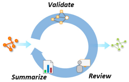
To perform accurate spatial analysis and create high-quality information products, your source data should meet a defined level of quality. Data of an unknown quality reduces the value of your work and may negatively impact decision-making or other business operations that rely on accurate analysis results.
ArcGIS Data Reviewer, an extension to ArcGIS, reduces this risk by implementing workflows that highlight data that does not meet your quality requirements, leading to increased confidence in your data, enhanced productivity, and reduced costs. It reduces data management costs by providing a unified set of capabilities that supports detection, management and reporting of errors in your data. It enhances productivity by automating the detection of common errors in GIS data and simplified workflows for identifying poor-quality data that cannot be detected in an automated manner. By identifying and addressing errors that impact decision-making overall confidence in the information products and services is increased.
We have so much more confidence in our data with ArcGIS Data Reviewer. We can walk into a room and feel good about having a conversation with someone because we know exactly where our data stands and what we need to do to fix it.
________________________________________
Terri Bunting, Tucson Water Department

Automate the detection of poor-quality data
Automated data review is a capability that evaluates a feature’s quality without human intervention. For resource-constrained teams, automation enables you to implement data quality assessment with minimal impact to staffing while improving data quality. For large organizations, automation enables consistency in data production across multiple teams and increases knowledge management by integrating quality requirements into repeatable workflows.
"We're in a position now where we can run mass checks against our entire system during the workday. By implementing ArcGIS Data Reviewer, we went from taking hours to find and fix errors to minutes."
________________________________________
Daniel Johns, Clay County Utility Authority
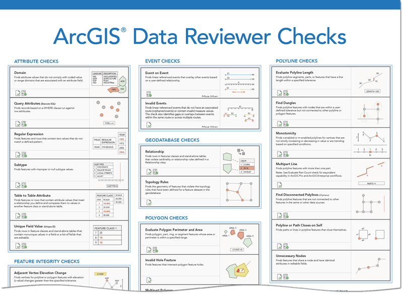
Data Reviewer provides a library of checks to validate data based on your unique quality requirements. The checks are designed to assess various aspects of a feature’s quality, including its attribution, integrity, or spatial relationship to other features. For example, utilities need to maintain accurate positions of their assets because incorrect information can affect their completion of construction or repair projects and outage notifications to customers.
Reviewer’s automated checks are a configurable/no-code capability that does not require specialized programming skills to implement. In many cases, GIS professionals with a good understanding of their organization’s quality requirements can implement automated review workflows using Data Reviewer with minimal training.

Automated review can be integrated in multiple ways:
- Assessing a feature’s quality during creation or modification when editing. This prevents the creation of features that do not meet quality requirements and reduces the need for rework.
- Assessing a feature’s quality after it is created. This can be useful when existing data is of unknown quality and a baseline assessment is needed to identify the effort required to achieve quality requirements.
Learn more about automating data review using these resources:
- Identify data quality requirements (documentation)
- Reviewer rule design (documentation)
- Implement automated quality control (tutorial)
- Enhance quality assurance during editing (tutorial)

Implement a comprehensive quality review
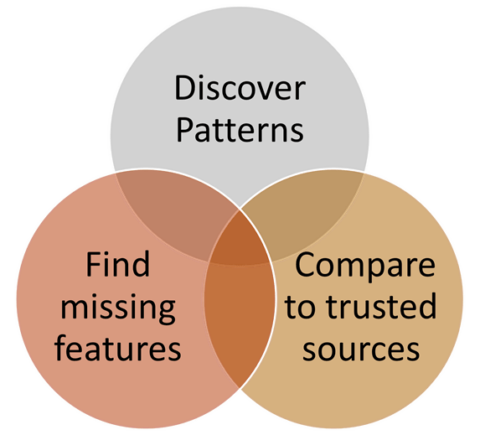
Not all errors in your data can be detected using automated methods. Semiautomated review assesses data quality using human interaction and input. Visual review is the most common form of semiautomated review and is used to evaluate quality in ways that automated methods may not support. This includes finding missing, misplaced, or miscoded features.
These types of errors are routinely found by subject matter experts and other data consumers who leverage GIS data in their daily work. By leveraging Data Reviewer’s workflows to harness this feedback you can further improve the quality of data you produce and share.
Learn more about integrating feedback from subject matter experts and other data consumers using these resources:
- Identify errors on existing features (documentation)
- Identify missing features (documentation)
Track and report progress on data quality goals
Data Reviewer enables the management and tracking of errors through a defined lifecycle. This workflow includes the tracking of errors detected using automated checks, as well as, those reported by data consumers. Information collected during data review includes the source and description of the error, its location, who found the error and its severity.
This information can be useful to multiple communities who manage and use GIS data. For data editors, this information helps them get their work done more quickly and avoids duplication of effort when multiple teams are working to improve quality. For data consumers, this information can help in identifying risks that impact decisions that depend on high-quality data.
Data Reviewer also tracks the details of who, when and how errors are corrected and whether the correction has been verified as acceptable. This additional information enables you to report progress on data quality goals and forecast when quality goals will be achieved.
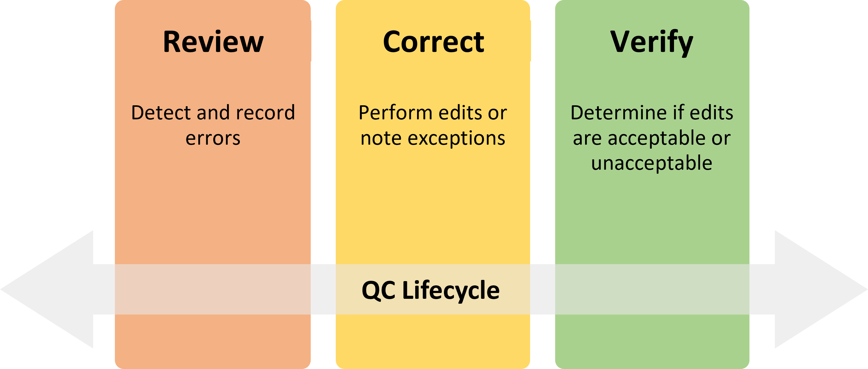
Errors detected during the data review process are tracked through a defined lifecycle that consists of three phases (Review, Correction, and Verification).

Learn more about error management workflows using these resources:
- Error results and their life cycle (documentation)
- Evaluate features with attribute rules (tutorial)
If you have questions or would like to share your experience in implementing Data Reviewer, please visit the ArcGIS Data Reviewer place in the Esri Community.


Commenting is not enabled for this article.