During an emergency event, being able to deploy field solutions that aid response and recovery efforts are not only mission critical but extremely time sensitive.
Debris Reporting is a configuration that supports Emergency Management organizations in collecting and monitoring debris. You can find details of this configuration on the ArcGIS for Emergency Management site.
This blog article will illustrate, step-by-step, how you can build and deploy a debris reporting field solution with Collector for ArcGIS in minutes using a template within ArcGIS Online.
Step 1: Create A Debris Reports Feature Layer
We have included Debris Reporting as a template within ArcGIS Online, so when you sign into your ArcGIS organization, click on Content and then click Create Feature Layer.
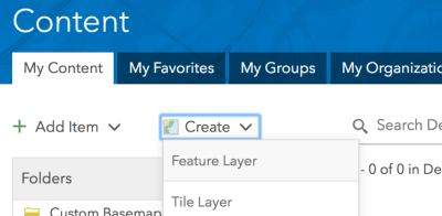
From the New Hosted Feature Layer dialog, type debris in search, click to select Debris Reports and then click Create.

The wizard will ask you a number of questions. With the Debris Reports layer selected, click Next, set the working area of your field collection work, click Next, provide a name for the feature layer like “Debris Reports,” and click Done.

Step 2: Author a Debris Reporting Web Map
Now that you have created your Debris Reports layer, you are ready to create a web map that Collector can open. Click Add layer to new map with full editing control to author your Debris Reporting map.

With the map open, click on the Debris Reports layer in the TOC to see the list of report types. Each of these types will be a feature type entry in Collector. Zoom into the area that you would like to start collecting debris and consider changing the basemap using the Basemap tool.
Set a layer refresh interval for the Debris Reports layer so that you can see new reports that come in from the use of Collector.

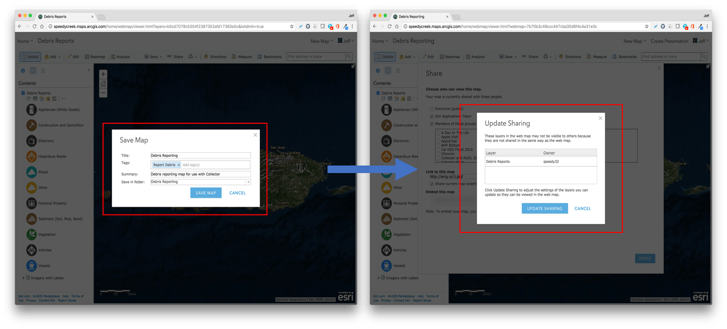
Finally, you need to save your web map and share it into a group so that others can access it using Collector. Click the Save button and then enter a title, tags, summary for your map, and then click Save Map.
Next click the Share button and Share the map with a specific group that your responders are a member of. Note that you should be prompted to update sharing for the Debris Reports layer, click the update sharing button.
Step 3: Open Map and capture reports using Collector for ArcGIS
On your smartphone or tablet device, with Collector for ArcGIS installed from either the Apple App Store, Google Play, or the Windows Store, sign into your ArcGIS organization and then search for the map you just created.
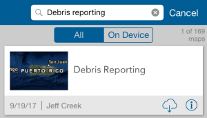
Once found, you can either tap on the map itself to open it directly and start capturing debris reports while connected or you can tap on the download button, download a map area to your device and then collect data when you are offline.
Tap on the map thumbnail to open the Debris Reporting map. With GPS enabled, the map will zoom to your current location and use that location for the collection of reports. Press the + button to start the capture process and then tap on the Vegetation report type.
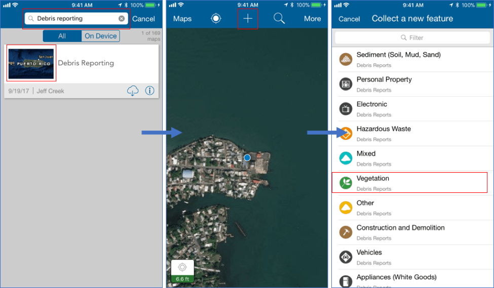
With the Vegetation feature type chosen, Collector will automatically use your GPS position as the location of the debris report. You can then fill out the Type of Debris, Details, provide a name, set a submission date, etc. Tap the camera button to open the camera on your device and take one or many photos of the damage and then tap Done when complete.
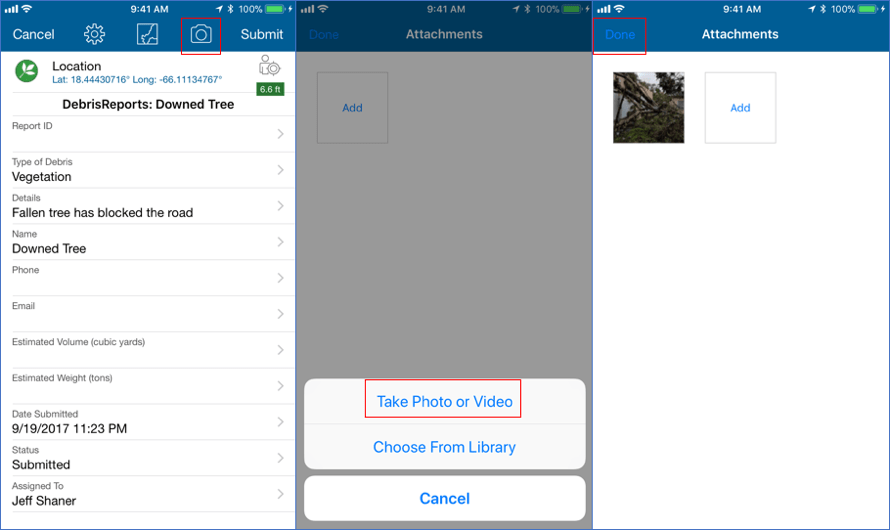
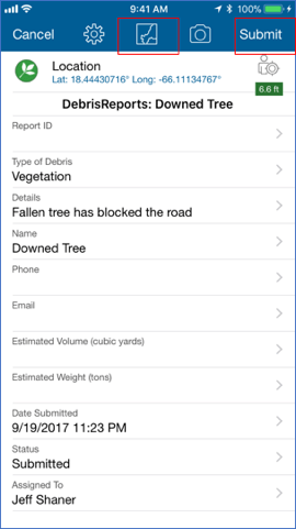
Once you have completed the form and taken appropriate photos, you can either tap on the map button to ensure the location is correct or simply press the Submit button to send your changes back to the EOC.
Once submitted you will return to the map screen on your device and back in the office you will see the new debris report appear when the layer refreshes itself.
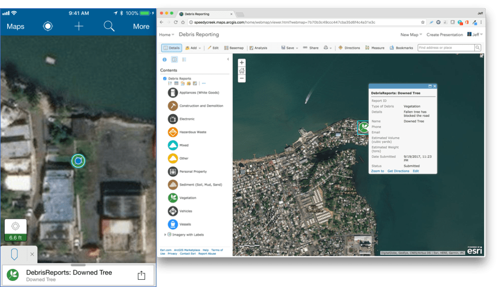
These 3 simple steps of creating a feature layer, creating a web map, and using in Collector can be completed within minutes. The solution configuration includes details for configuring an Operation View for use with Operations Dashboard for ArcGIS. Dashboards enable real-time decision making as each time a report is collected and submitted, it will appear in the Emergency Operations Center (EOC).
Note: In addition to using the feature templates within ArcGIS Online, you can use the Solution Deployment tool to deploy the feature layer, web map, and debris reporting Dashboard.
Collector Team
Commenting is not enabled for this article.