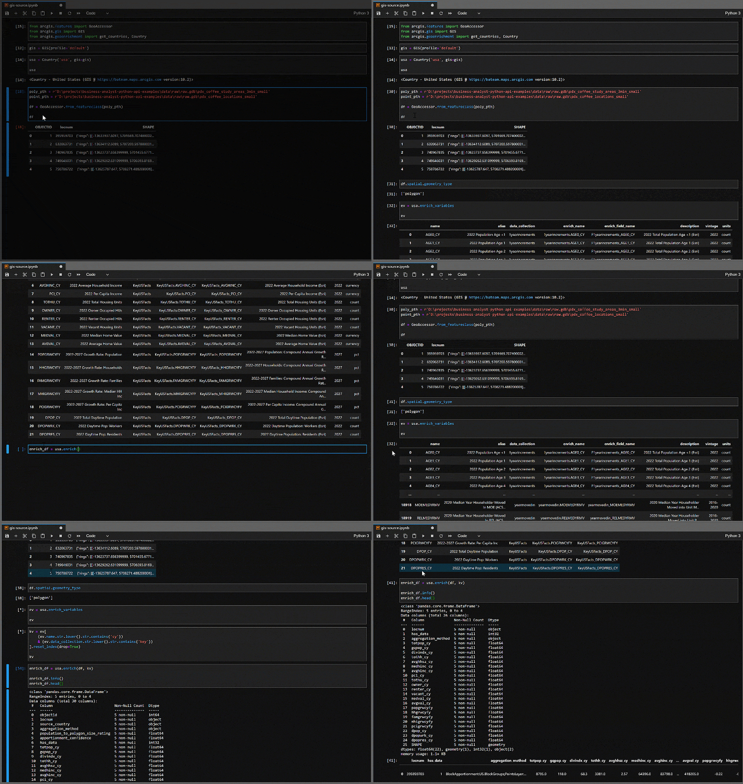
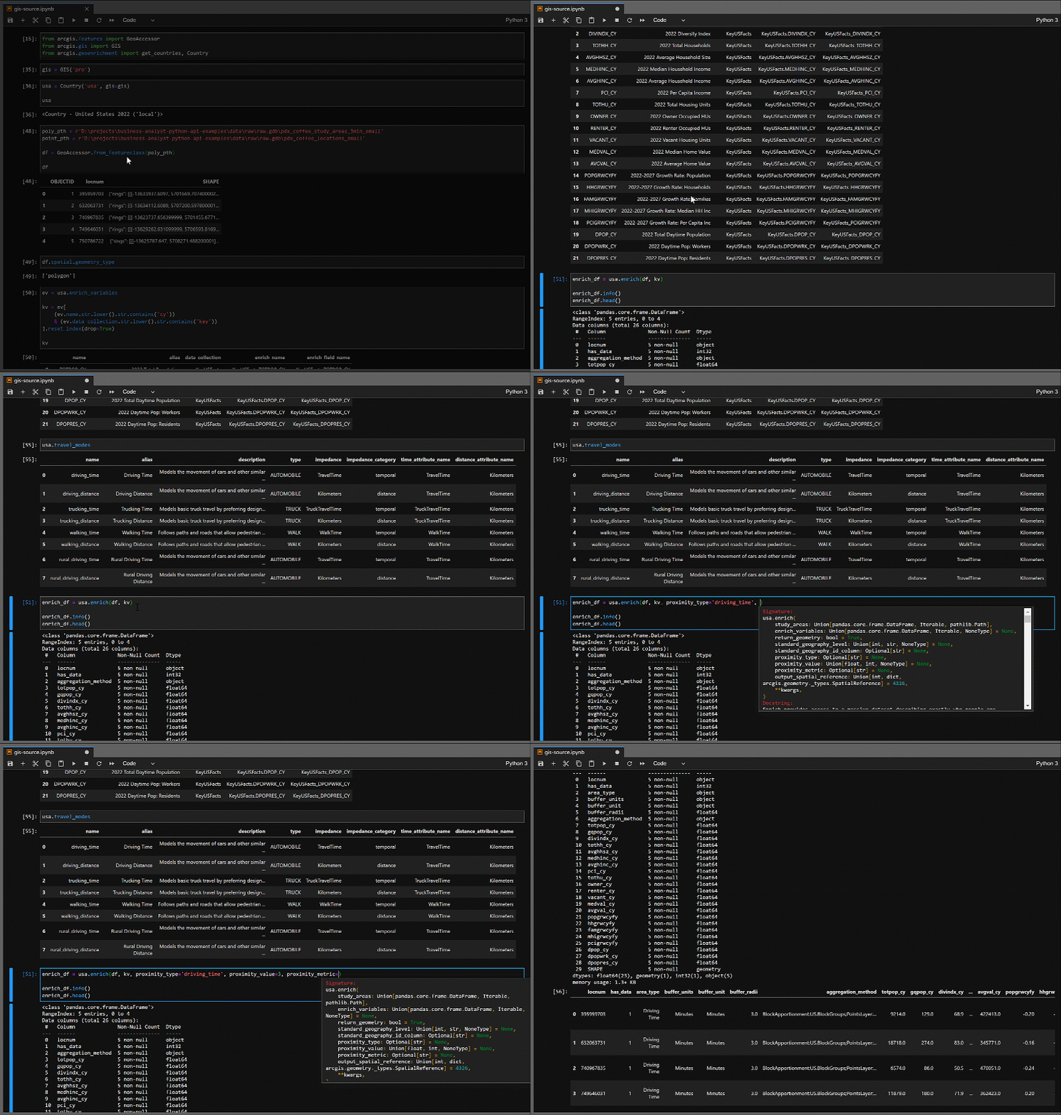
Esri, through Business Analyst, provides access to over 15,000 demographic variables in over 130 countries around the world. The most recent update to the ArcGIS API for Python puts all this data at your fingertips, no matter how you access Business Analyst, and makes discovering available resources dramatically easier. These improvements enable the integration of Esri demographic data into workflows and pipelines to support data-driven decision-making.
Bringing More Data to Data Science
The hardest part about data science is the data. Access to the technology and tools streamlining and automating the creation of models is rapidly accelerating. Hence, it is easier than ever before to create clustering and forecasting models…if you have good data.
With the most recent release of the ArcGIS API for Python (version 2.0.1), Esri provides access to this data through a single Pythonic interface. This interface tightly integrates with the full ArcGIS Platform, enables exploratory development in Jupyter, and facilitates tight integration into data pipelines built using tools such as Sci-Kit Learn.

Accessing Business Analyst data is accomplished through the Geoenrichent module in the ArcGIS API for Python. Business Analyst functionality can be accessed locally through ArcGIS Pro, or remotely through ArcGIS Enterprise or ArcGIS Online. If using local resources, ArcGIS Pro, the Business Analyst extension, and at least one country data pack is required. If using remote resources, either ArcGIS Enterprise with the Business Analyst extension and at least one data pack is needed, or ArcGIS Online with a user who has geoenrichment permissions is required.

Intuitive Data Exploration and Pipeline Development
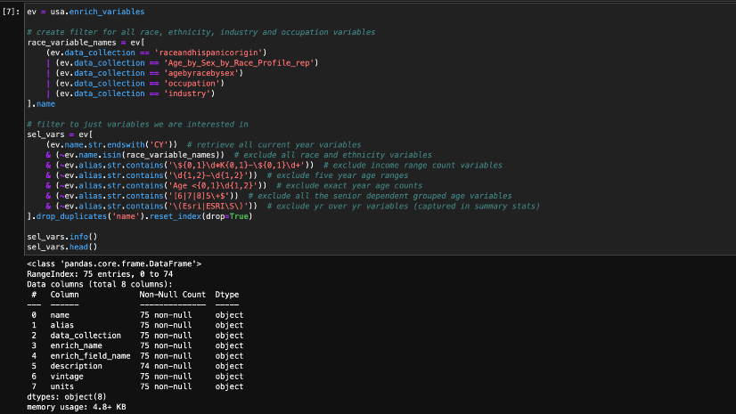
Jupyter, especially when paired with Pandas, provides an excellent interface for exploratory development for data-driven decision-making. The Geoenrichment module tightly integrates into this environment to support exploratory development with introspection capabilities to discover available countries, data, and travel modes for dynamically creating study areas. Further, all the functions are designed to use Pandas data frames whenever possible. This enables intuitive and exploratory development.

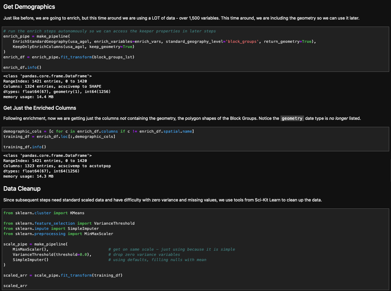
As workflows migrate from one-off exploration toward iterative model tuning and production, the Geoenrichment module is easily integrated into streamlined workflows, such as Sci-Kit Learn custom Transformers. The example below is utilizing a few custom Transformer objects in a data processing pipeline preparing data for dimensionality reduction using Principal Component Analysis and clustering using K-Means. This example is available in a public GitHub repository, Business-Analyst-Python-API-Examples. Please feel free to use the examples in this repository to jump-start your next project.

This latest release of the ArcGIS API for Python provides an intuitive Python interface making it much easier to utilize the data available through Business Analyst as part of data-driven decision-making workflows in Python. Right in Jupyter, it is much easier to explore and discover what data is available and move these workflows into streamlined data pipelines for model development. This is all part of Esri’s ongoing efforts to enable you to provide actionable information for data-driven decision-making.


Article Discussion: