This 4-part series rounds up the latest features related to data interoperability, enterprise integrations, ArcGIS extensibility, and open source analytics. We’ve looked back through the past several months of blogs and videos and picked out the most important announcements highlighting ArcGIS’s open platform architecture. With the distraction of global pandemics and all the other feature goodies, we wanted to make sure you chief data officers, data scientists, developers, educators, and others didn’t miss these new features and how-to’s from across the ArcGIS platform. Part 1 focuses on how data flows in and out of ArcGIS and open, standards-based interoperability. If you want all the recent updates by product instead, see this Q1 ArcGIS Release Roundup.
Data Flow – Bringing Data In and Sending it Out
With ArcGIS, you can bring virtually any type of data into the platform for analysis and visualization, including data from real-time IoT sensors, satellite navigation systems or specialized drone cameras. And data can be exported from the platform into industry and internationally recognized standard formats. This interoperability gives your organization the flexibility and assurance to grow and adapt without worrying if new projects can integrate with the rest of your organization’s location data.
Ingest Real-Time Data from Internet of Things Sensors – New Product!
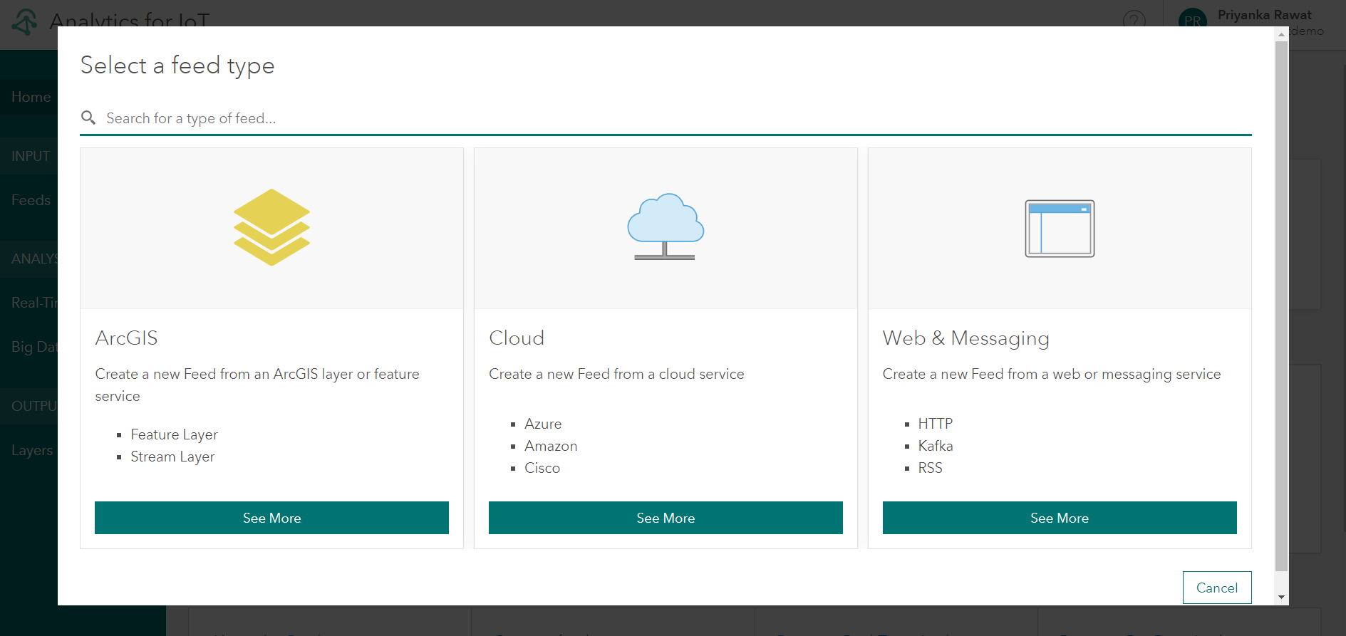
With ArcGIS Velocity, you can now ingest and process IoT sensor data feeds directly into ArcGIS Online. This new SaaS extension uses distributed cloud processing to scale tasks, enabling you to ingest, visualize, analyze, store, and act upon massive velocities and volumes of IoT sensor data. You can create feeds and extract data from:
- Messaging brokers such as Kafka, MQTT, and RabbitMQ
- Other configurable HTTP, RSS or Web Socket endpoints
- IoT cloud service providers such as Azure IoT and AWS IoT, and
- Your own ArcGIS layers (of course!)
Previously, these capabilities were available in ArcGIS Enterprise for hosting in your own organization’s IT or cloud infrastructure. You can still deploy this option if you need even more messaging or API ingest support. Check out the ArcGIS Geoevent Server SDK documentation on how to write an extensions for custom data real-time data feeds. Learn more about the new, simpler SaaS approach.
Driving BIM Interoperability with International 3D Standards
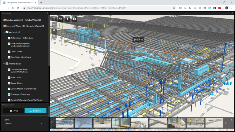
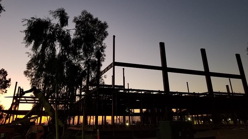
Building & Information Modeling data is becoming increasingly easy to integrate from architectural design and construction management tools with GIS. Now ArcGIS users can stream 3D BIM data on the web with Building Scene Layers using the open Indexed 3D Scene (I3S) specification v1.7. This approach does not require unnecessarily complex data model transformations and management processes. Esri led the development of this Open Geospatial Consortium (OGC) Community Standard in 2017, which was updated earlier this year with performance improvements and support for Point Cloud Scene Layers (e.g. streaming Lidar). Companies and partners can rest easy knowing they can build tools around this highly performant 3D streaming data approach using an open, standard format.
This standards-based approach complements Esri’s enterprise integration approach with BIM software industry leaders like Autodesk (see more in Part 2 of this series). Learn more about streaming BIM data and the 5 Myths and 5 Realities of BIM-GIS Integration. Learn more about the most recent OGC I3S updates.
Supporting New Sensors
Data flows from all kinds of sensors these days. ArcGIS continually adds native support to those most commonly requested and provides ways to customize to your needs.
- ArcGIS Image Server for ArcGIS Enterprise 10.8 supports new sensor types—Sentinel-3 and Sentinel-5, in addition to supporting the HDF5 (4d) format and OPeNDAP protocol to help scientific organizations easily access their data. Learn more.
- Ortho Maker, a tool to create map-quality imagery and terrain maps using drone imagery, also now supports additional multispectral cameras (RedEdge and Altum) to give users greater flexibility to use their sensors of choice. Learn more.
- Collect locations with external devices. Developers can customize any mobile application developed with AppStudio for ArcGIS, ArcGIS’s low-code app development platform, to read location from any external device connected to a Global Navigation Satellite System. This ensures your organizations can use the right devices for your field operations without having to worry about interoperability with ArcGIS. The open source GNSS Discover sample app provides a collection of QML components to connect with and configure external GNSS devices. Learn more about What’s New in AppStudio for ArcGIS 4.1.
- Bring drone imagery in with new or unique cameras. The new “Camera Model Editor” tool in Drone2Map for ArcGIS 2.1 allows you to configure your own unique camera settings if they are not already available in the product. Esri maintains an internal camera database with updates several times per year. With the Camera Model Editor tool, users can also now edit existing cameras from the internal camera database and store the modified camera models in the user camera database. Learn more about What’s New in Drone2Map.
- Work with standard Bluetooth and WiFi devices. This blog surveys indoor location technologies and shows how the ArcGIS Indoors solution team connects with the most widely used devices and standards. Learn more about what technologies on the horizon they are monitoring for potential integration.
Sending Data Out of ArcGIS Insights
ArcGIS Insights, Esri’s premier location analytics product, now let’s you export datasets right from the data pane into open standard formats, such as shapefile, CSV, or GeoJSON. Instead of needing to go back into item pages within ArcGIS Enterprise or ArcGIS Online, you can now more easily then share these datasets with others to use in other applications. Learn more about What’s New with ArcGIS Insights.
Support for OGC Standards Receive Updated Certification
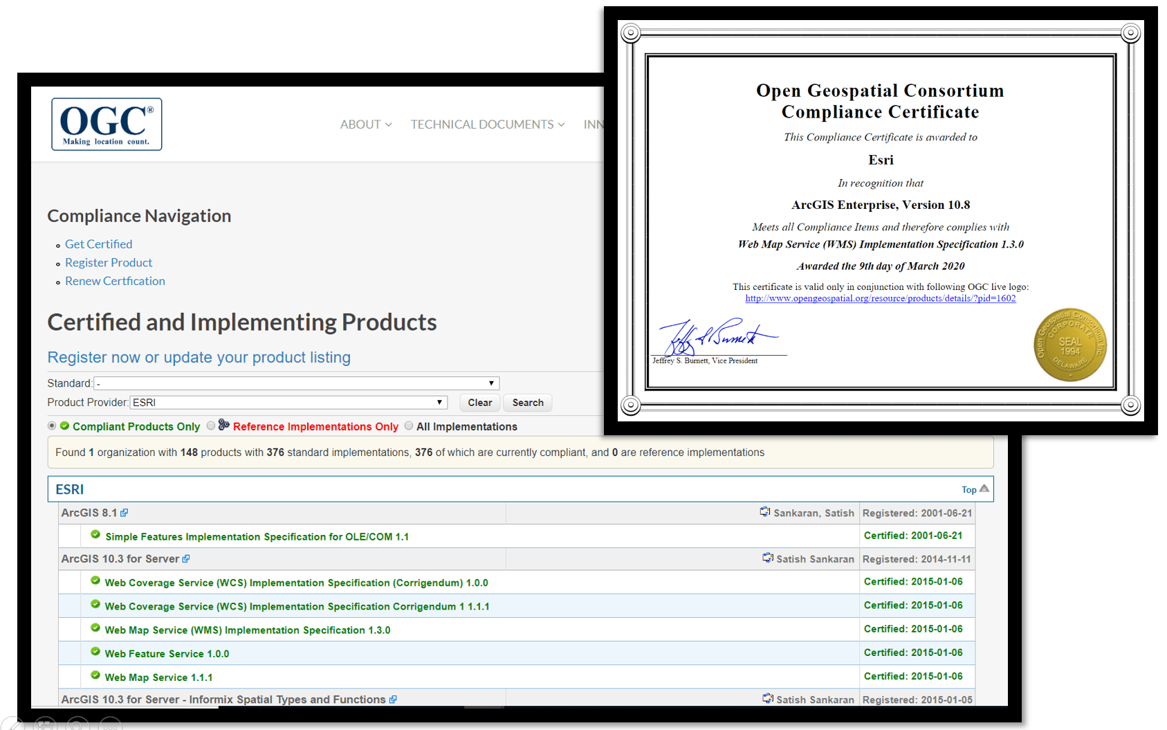
The latest releases to our core platform—ArcGIS Enterprise 10.8, ArcMap 10.8, and ArcGIS Pro 2.5— have received new OGC compliance certificates as part of our ongoing support for OGC standards for data access formats and data services. This includes certificates for OGC Web Map Services (WMS), Web Feature Services (WFS), Web Coverage Services (WCS), OGC Simple Features, Keyhole Markup Language (KML), and Geopackage (GPKG). ArcGIS Online uses the same underlying publishing and client technologies as ArcGIS Enterprise and therefore are also compliant. While many OGC standards do not have associated compliance tests, our products are certified in 376 OGC standard implementations across ArcGIS product versions. A full listing of Esri products implementing OGC standards is available at OGC’s website.
Something not working? Try the Data Interoperability Extension.
What is the Data Interoperability Extension? It’s our extension for ArcGIS Desktop and Server that helps you wrangle data, automate data pipelines and integrate systems in a no-code visual studio. Check out this Q&A to find out more. Here’s a preview:
Q: Data Interoperability is ETL, but I see cloud vendors promoting ELT, do you have comments?
A: Extract Transform & Load (ETL) is where the transformation of data is done before sending it to a system of record, Extract Load & Transform (ELT) is where data is first sent (or already exists) in a system of record and is manipulated within that, for example by using SQL or using a view and/or a SQL mimic language in a JSON store technology. While Data Interoperability has first class manipulation capability, it also has query connectivity within cloud platforms, letting you work on the data where it is and not hauling it up and down. Don’t fight data gravity, do what works for you, Data Interoperability lets you do this from within ArcGIS as either ETL or ELT.
Up Next
So that rounds out Part 1. Stay tuned for the rest of the series.
- Part 1: Data Flow – Bringing Data In and Sending it Out
- Part 2: Streamline Workflows with Enterprise Integrations
- Part 3: Customize to Meet Your Unique Needs
- Part 4: Save Time on Advanced Analytics Projects

Commenting is not enabled for this article.