Advanced AI workflows, seamless imagery data management, and enhanced spatial insights, now accessible to more users on the desktop, online, and in the enterprise
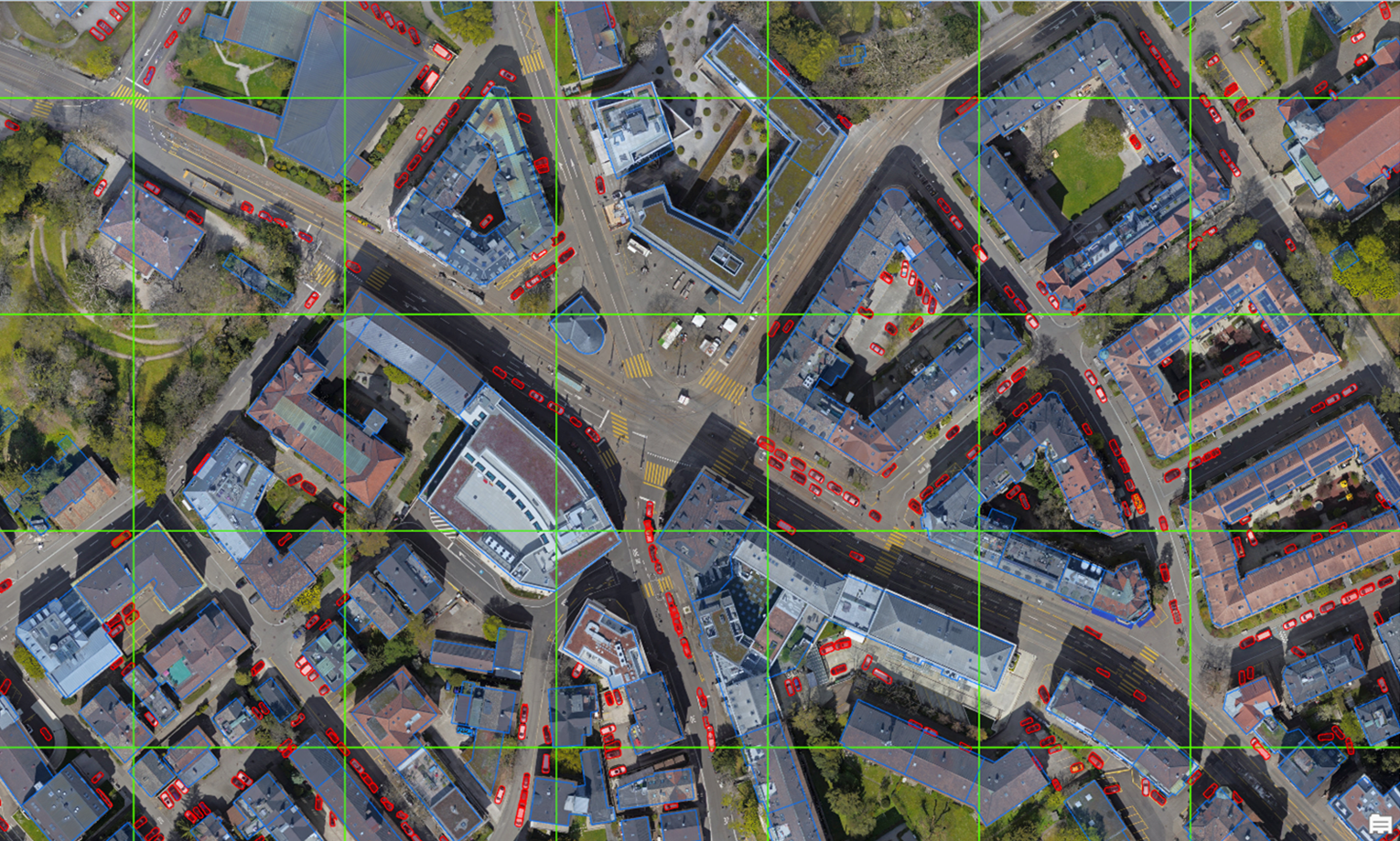
Building on its commitment to empower users, ArcGIS has elevated your imagery capabilities with its recent updates. With the update to ArcGIS user type licensing this year, you have more access than ever to imagery capabilities. The fall releases of ArcGIS include advancements that deliver a seamless imagery management and analysis experience across desktop, online, and enterprise environments within ArcGIS to meet your growing organizational needs. We understand that not all enhancements apply to you and are here to help you find what you need most.
- If you work primarily in the desktop and are looking for simplified deep learning workflows, improved oriented imagery layer support, or to manage newer data types for advanced analysis, such as Synthetic Aperture Radar (SAR) or hyperspectral data, check out What’s New in Image Management and Analysis in ArcGIS Pro.
- If you work primarily in the web and have cloud-based access to imagery tools such as Map Viewer, and you are looking for an improved raster function editor, to conduct detailed attribute analysis, and access to oriented imagery features for better spatial awareness, check out What’s New in Image Management and Analysis in ArcGIS Online.
- If you have comprehensive company-wide access to imagery data and are looking to leverage extensions that bolster image management, visualization, and analysis with tools such as ArcGIS Image Server, ArcGIS Video Server, and ArcGIS Excalibur, check out What’s New in Image Management and Analysis in ArcGIS Enterprise.
ArcGIS Pro
ArcGIS Pro comes equipped with powerful imagery management and analysis tools, making it easy to integrate and work with imagery in your GIS projects. Here’s what’s new for fall 2024 —all accessible to Professional and higher user types:
ArcGIS Pro
ArcGIS Pro comes equipped with powerful imagery management and analysis tools, making it easy to integrate and work with imagery in your GIS projects. Here’s what’s new for fall 2024 —all accessible to Professional and higher user types:
Enhanced visual experiences
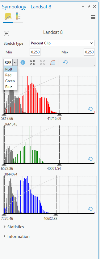
- This release features enhancements to the interactive histogram, making it more engaging and insightful for users. You can now interactively zoom in for a magnified view of the histogram and examine each histogram band individually for RGB data. These improvements enable more precise adjustments for accurate visualization.
- To help you visualize and explore SAR imagery more effectively, we’ve introduced new raster symbology featuring two stretch types for SAR rendering. These enhancements highlight subtle variations, making your SAR data easily interpretable and even more impactful.
Enhanced support for STAC for easier data management and discovery
- The SpatioTemporal Asset Catalog (STAC) is an open global standard that simplifies the discovery and access of cloud-based geospatial data. Enhancements in this release allow for seamless integration of STAC-referenced data collections within mosaic datasets. This means organizations can efficiently publish and consume rich geospatial data as web services (image services) through their ArcGIS Enterprise environments.
Enrich imagery workflows with information in more formats and from more data sources
- ArcGIS Pro’s latest release continues to enhance its data and format support, expanding from over 70 sensors and data providers to include eight additional sources. The new additions feature advanced hyperspectral and aerial sensors, including EMIT, SWOT, Satellogic, MOPITT, S102, Vexcel, and AVIRIS. Expanding supported sensors is vital for accessing diverse data types and enhancing analytical capabilities. Incorporating emerging technologies ensures you can leverage the latest innovations, while promoting collaboration across disciplines.
More oriented imagery updates for increased spatial awareness
- Enhanced schema for camera orientation: You can now more easily manage intrinsic camera parameters (like camera focal length, lens distortion, and affine parameters) using separate attribute fields, and add images with omega, phi, kappa orientation to an oriented imagery dataset.
- Visualize 360-degree and panoramic images: Expand the imagery modalities you can visualize in your GIS to add new perspectives and improve workflows by visualizing 360 and panoramic images in Pro before publishing an oriented imagery layer. This release supports equirectangular 360 images stored as JPEGs (the most common format).
- Leverage floor filters: If you’re working with oriented imagery in the context of a floor-aware map, explore your imagery more intuitively. The oriented imagery viewer now honors the level defined by the map floor filter when the floor level is defined for your images. If you are looking at features on the 2nd floor in your map, all oriented images are on the 2nd floor, too.
- Display the popup for the current image: The “Show Pop-Ups” tool in the oriented imagery viewer displays the pop-up for the current image, allowing you to view the image and its attributes at the same time to better understand the image.
- Improved performance of the Add Images to Oriented Imagery Dataset tool: When adding images to an oriented imagery dataset from cloud storage, you can take advantage of parallel processing to rapidly speed up the process.
- Visualize MRFs stored locally in ArcGIS Pro: Previous releases of ArcGIS Pro could only visualize images stored as MRFs if they were in the cloud; now you can visualize these files in Pro when they’re stored locally, simplifying storage considerations and streamlining image management workflows.
- Oriented imagery layer support in the Detect Objects Using Deep Learning Tool: The Detect Objects Using Deep Learning geoprocessing tool now supports oriented imagery layers as input, leveraging the oriented imagery image-to-ground logic to project the location of the objects detected in an image into mapspace. In this release, the tool will work best for features on the ground, such as fire hydrants, and with deep learning models that produce points or bounding boxes as output such as YOLOv3.
ArcGIS Image Analyst for ArcGIS Pro
ArcGIS Image Analyst for ArcGIS Pro transforms ArcGIS Pro into a powerful image analysis workstation. It offers tools for advanced interpretation and analysis across various imagery types. The Image Analyst extension is available through the Professional Plus user type for both ArcGIS Online and ArcGIS Enterprise versions. Here’s what’s new for fall 2024:
- Synthetic Aperture Radar (SAR) enables continuous monitoring of vast areas and can detect surface changes regardless of weather conditions. This release introduces new coherent change detection tools to help you integrate SAR into your workflows effectively. These tools enable users to compare SAR images over time by co-registering multiple images for alignment and calculating coherence to measure similarities. This process highlights areas of change, enhancing analysis and decision-making capabilities.
Deep learning tools for improved feature extraction and classification
- ArcGIS Pro 3.4 enhances the AI support for imagery with improvements in 3rd party data support, labelling enhancements, intuitive user experiences, and more.
New AI Models for enhanced insights
- A new model leveraging Microsoft’s ClimaX performs predictive modeling on climate data, enabling smoother and more accurate workflows like predicting crop growth, coral bleaching, landslide predictions (susceptibility) and more.
- Additionally, Prithvi-100m, a cutting-edge temporal Vision Transformer trained by IBM and NASA, is now available in this release. This model effectively delineates floods and fires using spatial and temporal attention mechanisms from freely accessible harmonized sentinel imagery, assisting first responders and disaster response workflows.
Simplified feature extraction
- The ‘Extract Features Using AI Model’ tool, now available in the Imagery tab, makes it easily accessible and discoverable. This allows for easy feature extraction from imagery. It includes ready-to-use models, options for custom models, and a variety of inferencing and post-processing options for enhanced output quality.
Object detection enhancements
- Oriented imagery, useful for analyzing images from various angles, presents challenges for orthorectification. Our latest enhancement in the ‘Detect Objects using Deep Learning’ tool enables accurate detection of objects within oriented imagery, projecting them onto a map for effective analysis and visualization in GIS environments.
- The Train Deep Learning Model tool now supports a wider range of training data sources for object detection. In addition to data from the Export Training Data for Deep Learning tool, it can now integrate external data from third-party providers like SageMaker, enhancing versatility and efficiency of data collected in 3rd party systems that can be used for training models in ArcGIS.
New motion imagery support and tools to unlock dynamic perspectives
- Object Tracking: New tools for object tracking and editing such as Move Object, Remove Object, Delete Object
- Video Search: Now supports point-based searches on georeferenced videos, making it easier to find information around a specific area of interest.
- GoPro Support: Processes GoPro’s GPS metadata for georeferencing.
- Video Metadata: There is a new capability to support exporting the video metadata and VMTI data as JSON files. For data science, scripting, and further processing.

ArcGIS Online
The recent introduction of new user types has democratized access to a range of imagery workflows, enabling more users to benefit from enhancements like those being introduced in the latest release of ArcGIS Online, including an improved raster function editor, detailed attribute analysis, and oriented imagery features for better spatial awareness. Note: management capabilities can be accessed by users with Creator and higher user types, while analysis capabilities are available to those with Professional and higher user types. Here’s what’s new:
User experience enhancements for efficient visualization and analysis workflows in the Map Viewer.
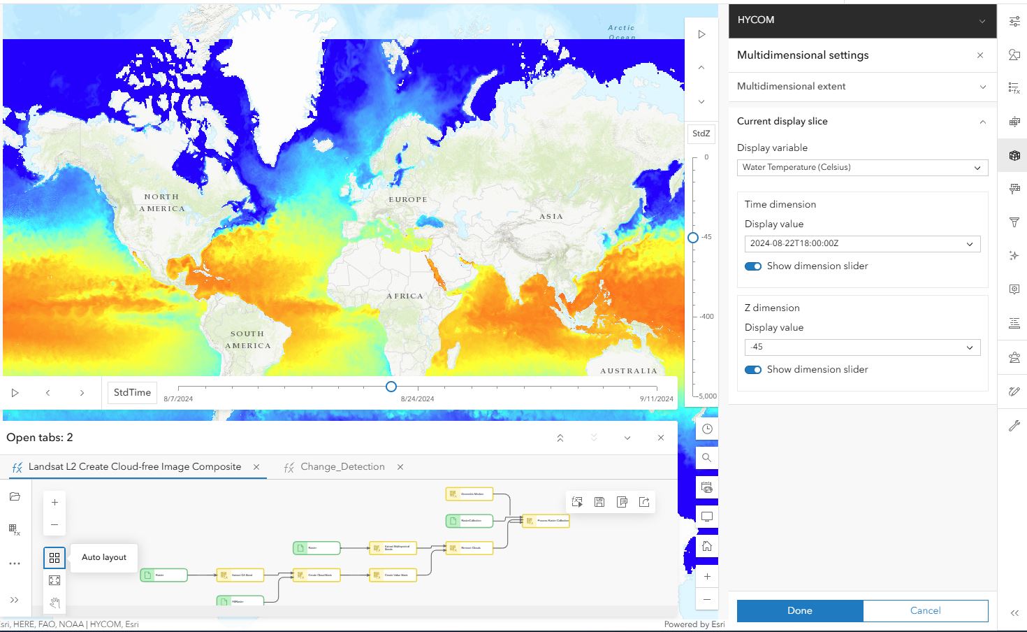
- ArcGIS Online now allows seamless integration of the time slider and multidimensional slider within the central panel, enabling multiple workflows to coexist effortlessly.
- You can now open multiple raster function templates and tab across workflows streamlining the editing process.
Increased spatial awareness with more oriented imagery features
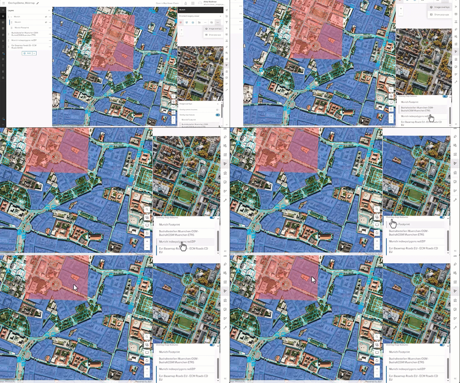
- Overlay feature layers in the oriented imagery viewer: With feature overlays, you can now project feature data directly into the oriented imagery viewer to better understand exactly how your vector data intersects with an image, adding great context and understanding to both.
- Use Scene Viewer to publish a web scene with oriented imagery layers: You can now use Scene Viewer to bring your 3D datasets and oriented imagery layers together in a published a web scene, providing the foundation for creating a 3D oriented imagery web app. (Watch for the oriented imagery viewer to be added in a future release.)
- Create a 3D oriented imagery web app ArcGIS Instant Apps 3D Viewer template: Create and share a 3D web app using oriented imagery to visualize full-resolution images in context with your 3D data, enhancing situational awareness and inspection workflows.
- Enhanced footprints for 360 imagery: Footprints for 360 imagery are now more precise, with curved edges that better illustrate the camera’s field of view.

ArcGIS Enterprise
With the recent updates to ArcGIS Enterprise, ArcGIS Image Server, ArcGIS Excalibur, and ArcGIS Video Server, you’ll find continuous enhancements that bolster image management, visualization, and analysis capabilities across enterprise organizations. These ongoing advancements ensure you can efficiently manage and leverage your imagery data. The introduction of user types in recent releases has made these imagery workflows more accessible to a wider range of users. The following are the latest imagery updates you’ll find in each ArcGIS Enterprise product.
ArcGIS Image Server
ArcGIS Image Server for ArcGIS Enterprise provides a fast, scalable way to host, analyze, and stream massive collections of imagery and raster data in the enterprise. Here’s what’s new for fall 2024:
Streamline imagery visualization and analysis workflows across an organization
- ArcGIS Image Server users can now leverage the raster function editor in ArcGIS Enterprise to create, edit, and share raster function templates (RFTs) with other enterprise users within the organization.
- RFTs are image processing chains that consolidate multiple raster functions (or image processing algorithms) into one, making complex workflows like distance modelling, creating suitability maps, hydrology maps, more accessible to GIS and imagery users of all skill levels.
Search, discover, and use images from large image collections
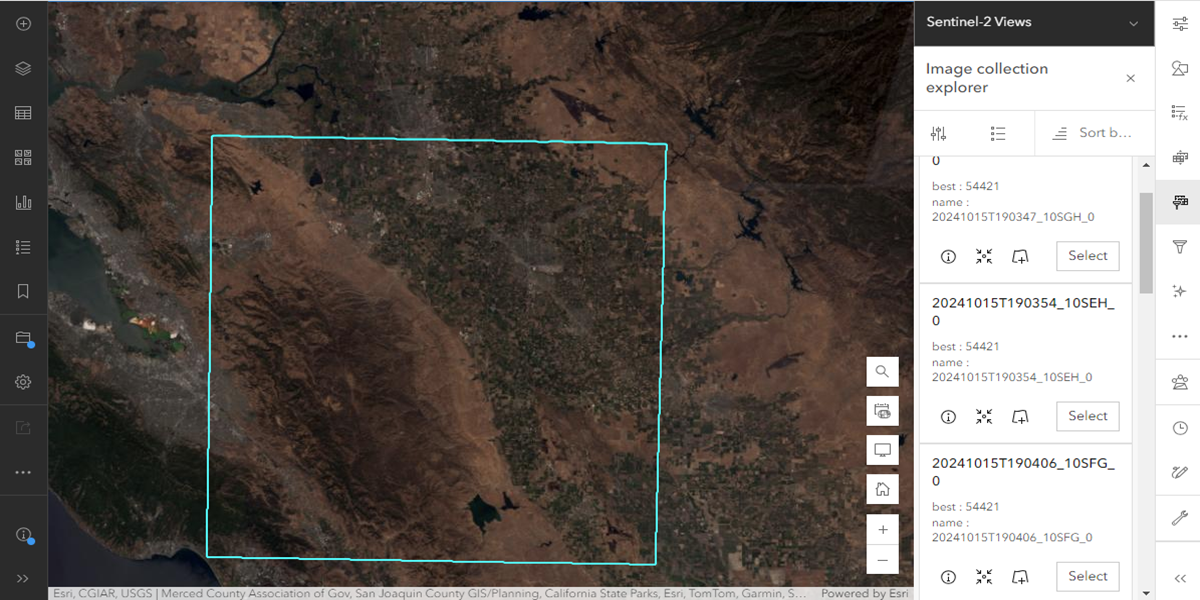
- The image collection explorer tool enables users to efficiently search through large imagery collections using metadata to quickly identify images based on acquisition date, quality, cloud cover, or resolution. This capability enhances image discovery and interpretation, making it easier to find specific images needed for analysis, such as conducting simple change analyses across two time periods. Users can dynamically visualize their imagery of interest on a map or further exploit them with ease.
ArcGIS Excalibur
ArcGIS Excalibur is a web-based software integrated with ArcGIS that makes powerful imagery and video analysis simple. Here’s what’s new for fall 2024:
An out-of-the-box enterprise web application for image analysis
- If you’re an ArcGIS Enterprise user with Creator user types or higher, you can now access ArcGIS Excalibur from the app launcher with no additional license needed as it is now an embedded Enterprise application. This removes the barrier of entry if you want to leverage light weight image analysis.
Place videos in geographic context even without metadata
- You can now leverage previously unmappable videos in their GIS by manually adding location data, expanding the range of videos that can be accurately displayed on a map.
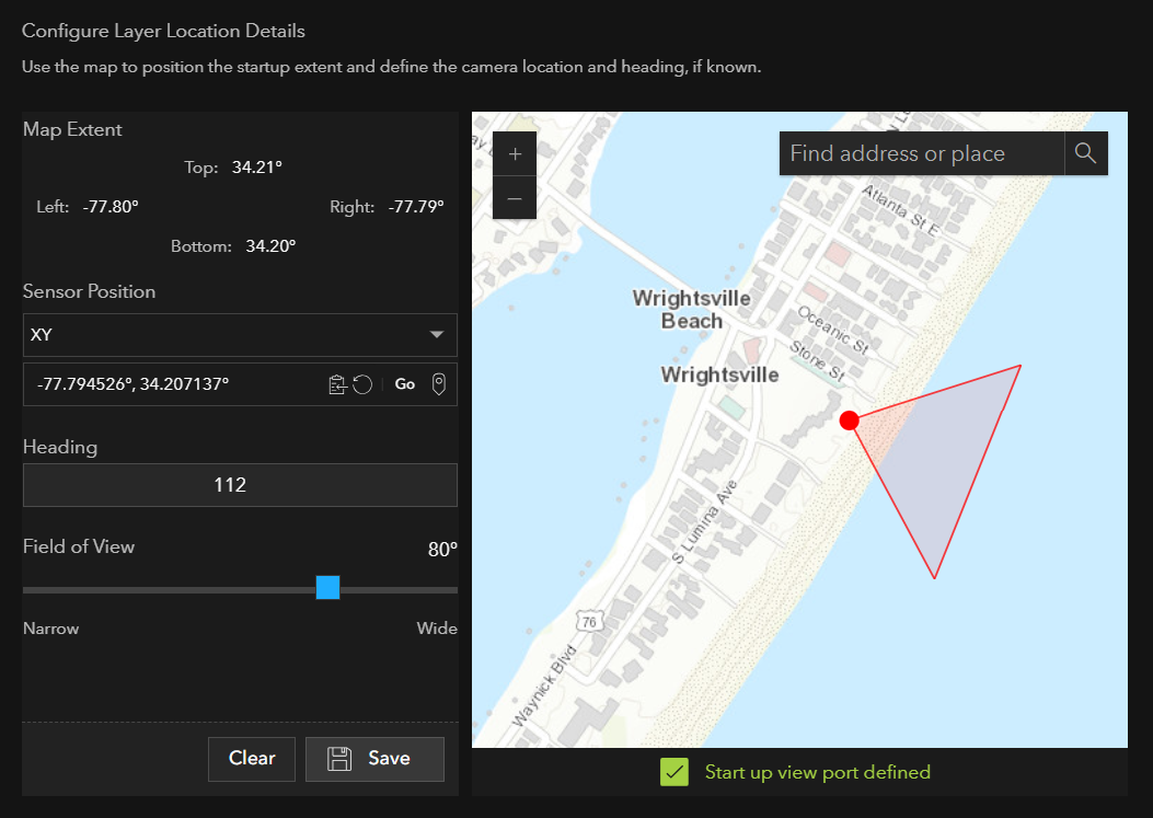
- When publishing on-demand video layers or using external URLs, you can now set key location details like sensor position, heading angle, and field of view. This enables video telemetry to be overlaid on a map, providing richer context and deeper insight into the video content.
ArcGIS Video Server
ArcGIS Video Server allows you to expand ArcGIS Enterprise with web-based geospatial videos by enabling indexing, searching, publishing, and streaming video within the context of a GIS. Here’s what’s new for fall 2024:
Streamlined video data workflow and enhanced geospatial integration
- There is improved compatibility with a variety of video sources like GoPro, iPhone, and GPX files, facilitating a smoother workflow if you’re dealing with diverse video data sources.
- We’ve introduced enhanced quality for stability and efficiency, with Video Server supporting multi-site, high availability, disaster recovery, and security features. This allows enterprise organizations to recover their video data more quickly should an issue occur.
Looking for more about the latest update in ArcGIS?
Check out these blogs:
What’s New in ArcGIS Enterprise 11.4


Article Discussion: