Imagery enables real-time insights
We live in a visual world that is vibrant and dynamic.
From the moment we awaken, our brains automatically start processing everything we see. Imagery plays a crucial role in this process because it’s the primary way we perceive and interact with the world around us. Before we’ve even pulled back the covers or set our feet on the floor, we’re already processing in 2D, 3D, and even 4D. Instantly, we begin to benefit from the intelligence provided by the data in the objects we see, such as color and dimensions like width and length (aka 2D or x & y). But our brains aren’t finished processing just yet. We automatically process the images we see, adding depth and distance instantly awakening our spatial understanding abilities (aka 3D or x, y,& z). Imagery is not just about what we see; it’s about how we interpret and understand our environment, making it a vital component of our daily experiences and interactions.
Even before we’re fully aware, our intuition kicks in, providing rapid, subconscious insights into changes over time—this is the realm of 4D perception. Ever experienced that moment when you glance at something and instantly know that something’s different? That’s your brain processing temporal changes in the environment, all before you’ve even had your first sip of coffee. Truly, imagery is foundational to how we navigate and make sense of the world.

There is power in using imagery.
Our innate ability to perceive and interpret visual data isn’t just a fascinating aspect of human cognition; it’s a powerful tool that, when amplified by technology, can revolutionize how we understand and interact with our world. Remotely sensed imagery, captured from cell phones, traffic cameras, drones, aircraft, satellites and much more, provides unprecedented views of our planet, enabling us to monitor and analyze changes – theoretically even in real-time.
This constant stream of visual data is transforming industries and driving innovation. In the following paragraphs, we’ll explore how remotely sensed imagery is being harnessed to create Geographic Information Systems (GIS) that operate at the speed of life. By seamlessly integrating and analyzing up-to-the-minute imagery, these dynamic systems empower us to address real-world challenges with precision and agility, shaping a more responsive and resilient future. Let’s dive in and discover the transformative power of imagery in the realm of GIS.


Remotely sensed imagery opens up the art of the possible
Building upon the foundation of remotely sensed content, we can establish a comprehensive philosophy and framework for the entire lifecycle of imagery combined with real-time sensors. This approach is optimally a locally independent, regionally coordinated process that treats all data as interconnected assets essential for governance or any sector-specific needs. This philosophy establishes and maintains repeatable processes that include defining the applications to be served, planning the capture of necessary data, acquiring the data, organizing, storing, and cataloging the data, processing, analyzing, and visualizing the data, applying and publishing the data to gain knowledge and wisdom for informed, dynamic, and sustainable action, and archiving the data to make way for newer data, repeating the process.
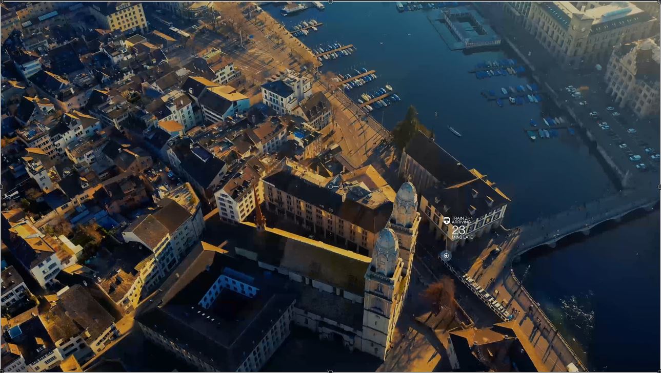
By leveraging imagery as our foundation and integrating all essential data, we activate near real-time situational awareness within an interactive digital model. This isn’t merely about observing the present; it’s about anticipating and molding the future. Using the video below we can delve into what’s possible when we have an imagery foundation, in this case harvested properly from a satellite so we could process to present a resilient 3D representation of our reality using a gaming engine. Now we can bring it all together and:
- Track Transportation in Real-Time: Tap into our knowledge of transportation schedules and current location and travel variables to reveal that an incoming train is running 23 minutes late. If additional data were available, we could also utilize it to determine capacity and identify who will be affected by the delay.
- Monitor Service Disruptions: We identify the start of an evolving situation where 38 people have lost essential services such as electricity, internet, or water.
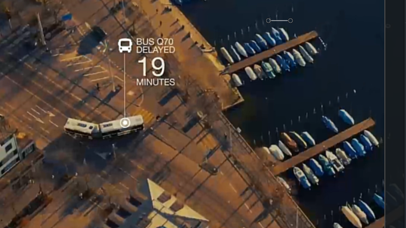
- Keep Public Transportation on Schedule: We note that bus number 70 is now 2 but stretching to 19 minutes late, impacting public transportation timetables.
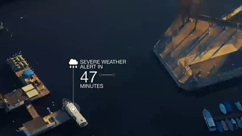
- Stay Ahead of Weather Alerts: We receive a weather alert for a departing watercraft, ensuring timely and safe navigation.
- Respond to Unfolding Incidents: We detect an incident affecting train ZH26. Perhaps we deploy drone-in-a-box functionality for first responders to enhance their response capabilities.
Lets shape a responsive, resilient world together.
Just think! What could be accomplished if our organizations could achieve such a level of fluency in observation, analysis, and prediction? By integrating all essential data and leveraging remotely sensed content: that is to say by using enterprise wise information needs to amplifying our means to acquire, publish, and apply imagery and remote sensing content; we’re not just comparing the past with the present we’re stepping into the future. This dynamic, digital representation of reality is more than a tool—it’s a shared vision, a philosophy, requiring collaborative effort, among organizations, agencies, and individuals committed to real-time visualization at the speed dictated for a sustainable world. What do you see that would have to be true about the way your people and systems work together at the pace and scale needed for GIS at the pace of life? As we work together to refine and expand this approach, the possibilities are endless. These new measures of collaboration and action within your organization must also extend to partners and the public as we include their content and participation in the digital representations of reality. So, let’s embrace this innovative journey by preparing each of our enterprises, to shape a more responsive, resilient future together. The best is yet to come!

Article Discussion: