Join us both in-person and virtually for the 2024 Esri User Conference (UC), taking place July 15-19 in San Diego, California. Be a part of the world’s largest GIS conference and see how GIS, through using the common language of geography, is uniting the world.
We can inspire collaboration, approach challenges holistically, and empower individuals and organizations to make a difference in the world through GIS. In this blog post, you will find a personalized agenda for sessions focused on integrating ArcGIS and uniting it with the world of building information modeling (BIM) and computer-aided design (CAD), building better collaborative workflows, informing design decisions, and seeing projects with real-world context.

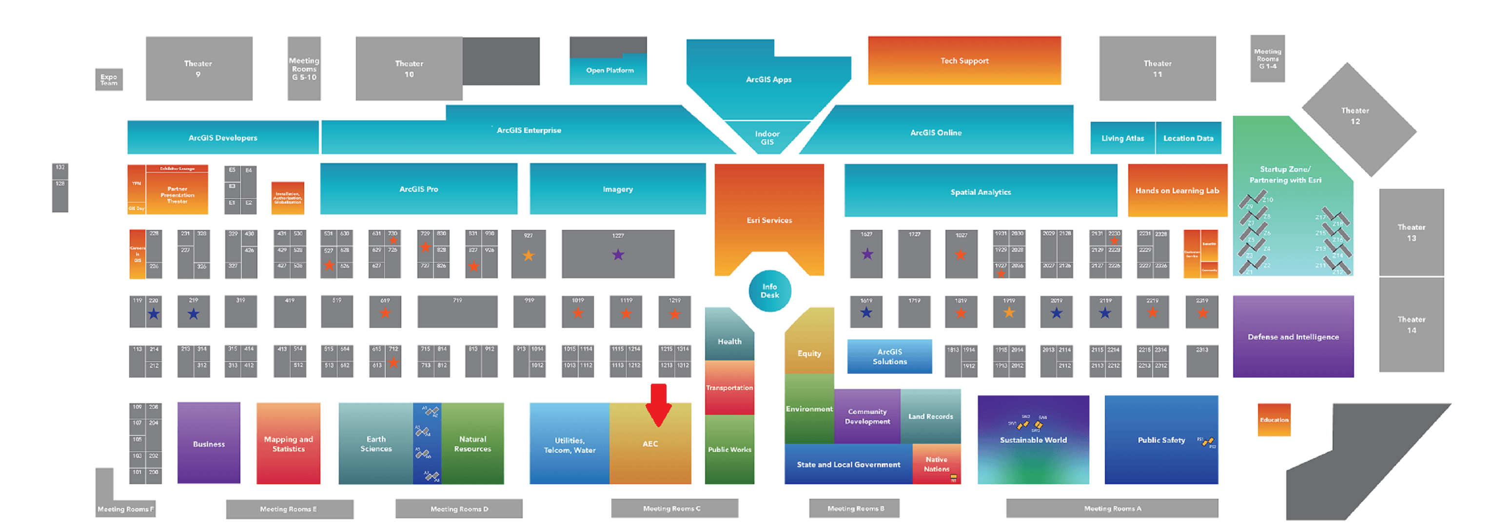
Interested in seeing the latest updates in ArcGIS GeoBIM, ArcGIS for AutoCAD, and other GIS and BIM/CAD integrations, or looking for answers, our experts are available to help! We are located in the Architecture, Engineering, and Construction (AEC) area within the Esri showcase. Check out the map below for where we our located. We look forward to seeing you in the expo!
Showcase Hours
- Tuesday, July 16, 9 am–6 pm PT
- Wednesday, July 17, 9 am–6 pm PT
- Thursday, July 18, 9 am–4 pm PT
Sessions on GIS and BIM/CAD Integration
For 2024, we have created a curated list of GIS and BIM/CAD integration sessions including tech workshops, user presentations, and demo theater presentations. Check out a few of our must see sessions below! Use the link to add these sessions plus many more to create your own custom agenda from our curated list of sessions.
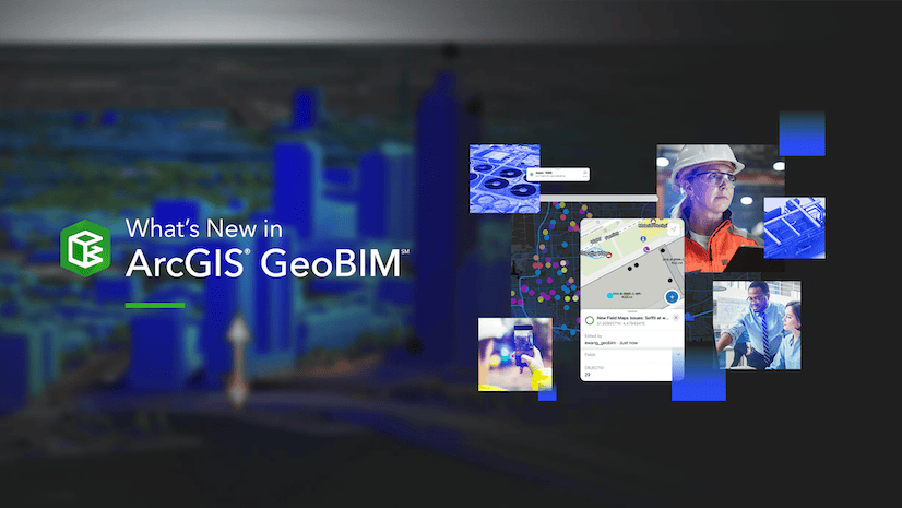
ArcGIS GeoBIM: An Overview
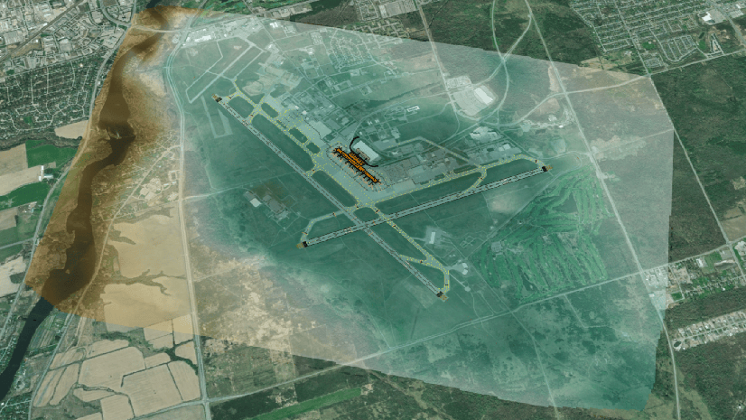
Explore how ArcGIS GeoBIM delivers an easy-to-use web-based experience for teams to collaborate on building information modeling (BIM) projects using data from multiple systems in a geospatial context. Architecture, engineering, and construction (AEC) and operations teams can work with linked data from multiple systems in configurable web apps that simplify communication and collaboration with stakeholders. Learn how to create ArcGIS GeoBIM apps that reduce file conversion, increase access to evolving data, and share project information securely for better decision-making. Also, find out about recent product updates and what’s coming next.
Tuesday, Jul 16 | 4:00 PM – 5:00 PM PDT
ArcGIS for AutoCAD: An Overview
The free ArcGIS for AutoCAD plug-in builds a bridge between computer-aided design (CAD) and GIS professionals for information sharing and decision-making. Learn how this extension enables direct editing of GIS data and precise geolocation of drawings within AutoCAD. Explore how it informs the design process with rich geospatial context and ensures that drawings are consumable within ArcGIS. See workflows that show how edits made in ArcGIS are fed back to AutoCAD, enabling ArcGIS and AutoCAD teams to work with the same data synchronously.
Wednesday, Jul 17 | 2:30 PM – 3:30 PM PDT
ArcGIS Pro: Working with BIM Data
Building information modeling (BIM) files are read directly as native ArcGIS feature data in ArcGIS Pro. Learn how ArcGIS Pro helps you not only visualize this information but also access the rich attributes and 3D content in your GIS by directly reading Industry Foundation Classes (IFC) files and Autodesk Revit files. See how to construct building scene layers from BIM models, and learn how to share digital models in web scenes. This presentation describes key methods for using your BIM files as part of a broader geospatial environment earlier in the design process.
Tuesday, Jul 16 | 8:30 AM – 9:30 AM PDT; Thursday, Jul 18 | 8:30 AM – 9:30 AM PDT
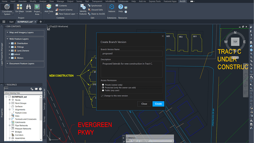
Autodesk Integration with ArcGIS Using CAD and BIM Data
Explore techniques for using Autodesk CAD and BIM data, such as Civil 3D files, to support your GIS workflows in ArcGIS Pro. In this presentation, learn how to geoposition your data, convert it to a geodatabase for visualization, analysis, and publishing to ArcGIS Online for sharing with your organization.
Tuesday, Jul 16 | 1:00 PM – 2:00 PM PDT; Wednesday, Jul 17 | 8:30 AM – 9:30 AM PDT
Digital Transformation in AEC: Integrating GIS and BIM for Efficient Project Management
This session will explore how organizations in the Architecture, Engineering, and Construction (AEC) industry are leveraging the integration of GIS and Building Information Modeling (BIM) to streamline project management processes. Presenters from Caltrans and HNTB will discuss projects that highlight the benefits of this integration in improving data management, interoperability, and visualization in infrastructure projects.
Thursday, Jul 18th | 08:30 am – 09:30 am PDT
Add the above sessions and more GIS and BIM/CAD sessions to your schedule. See available dates, times, and room locations. Please note that the UC 2024 agenda is subject to change.
Add sessions to your schedule
Booking Appointments and Registering for UC 2024
Looking for guidance and feedback on how best to design, implement, and strengthen your organization’s geospatial solutions? From July 12-14, we are offering in-person attendees the opportunity to connect one-on-one with Esri experts through service appointments.
Sign up for an appointment by choosing your appointment type and completing the form. An Esri staff member will follow up with you to schedule your appointment. Please note that while appointments are complimentary, availability is limited and we are currently offering one appointment per in-person attendee.
It’s Not Too Late to Register for UC 2024
Register today to attend in-person, virtually with digital access, or for the plenary only. We look forward to seeing you in-person in San Diego or online and wish you a wonderful User Conference 2024!
Join the plenary session on July 15, 2024 to explore why a holistic, location-based understanding of our world can both unite and empower us to affect positive change.

Article Discussion: