The ArcGIS Motion Imagery Team is excited to announce the release of the new ArcGIS Video Server. This new server role for ArcGIS Enterprise is designed to expand video capabilities across ArcGIS.
What is ArcGIS Video Server?
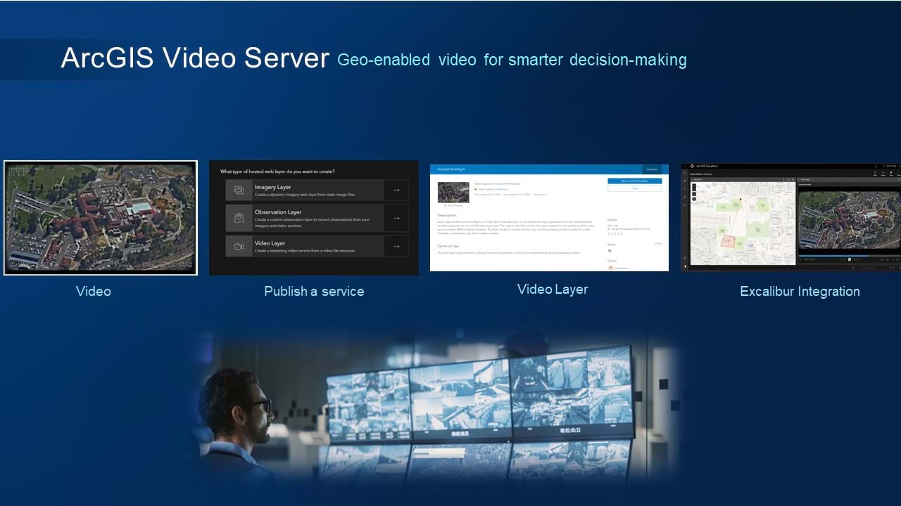
The new ArcGIS Video Server enables indexing, searching, publishing, and streaming video as a service with geospatial and temporal context. In other words, you can now service–enable your videos and use them inside of your enterprise GIS, the same as other types of data.
Many different industries collect video data, and it can be a crucial resource for uses like remote inspection and situational awareness. The number of sources and volume of video are expanding and becoming more affordable. Now it is feasible for an organization to have video from satellites, aerial cameras, stationary cameras and handheld cameras. As Esri moves towards incorporating these types of data into analysis workflows, we needed more ways to use the geospatial attributes of video to make it a true asset of an enterprise system.
How to use it in ArcGIS
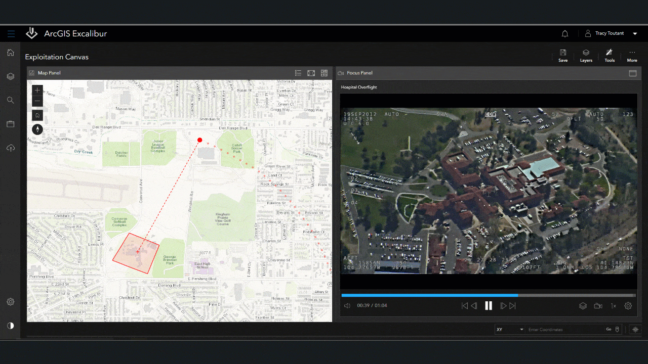
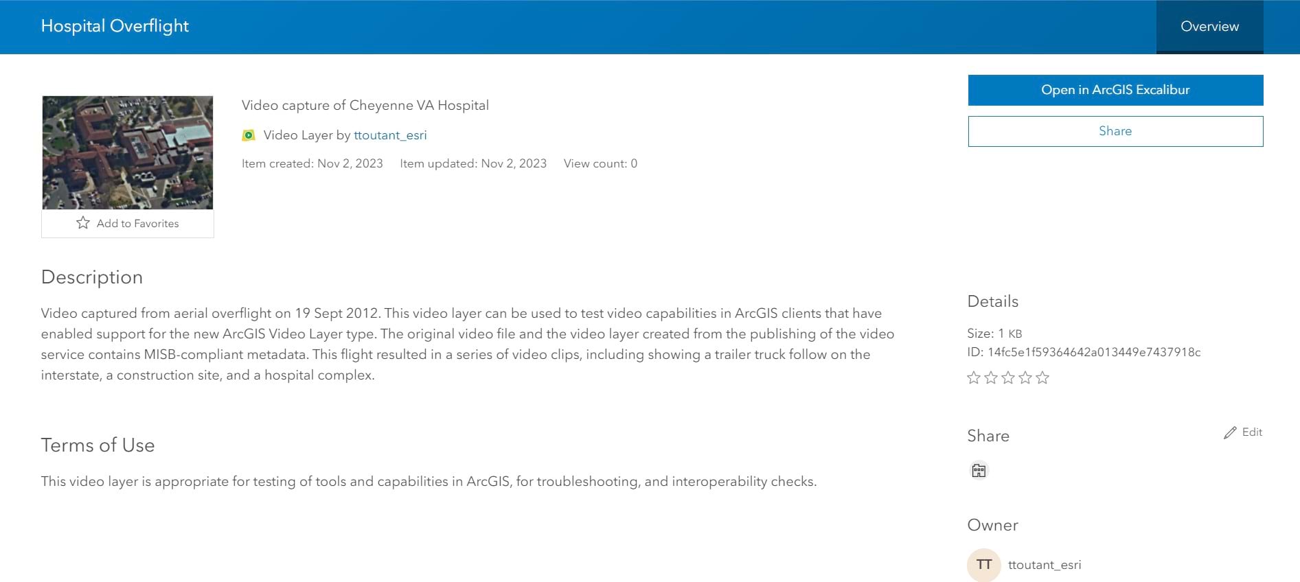
ArcGIS Video Server allows users to publish videos and service enables them for use over the web as the new video layer in ArcGIS client applications. As we move into 2024, more client applications will add support for the video layer, but at this initial release our client application is ArcGIS Excalibur.
As an ArcGIS Enterprise web application for imagery and video analysis, Excalibur is a natural fit for adding video support. The new web capabilities, including publishing and consuming video as a service, are now available in the November 2023 release of ArcGIS Excalibur.
ArcGIS Video Server publishes two categories of video: video from a file and video from a live stream.
- For file-based video, the ArcGIS Video Server is where you can upload and publish your video as a service and access the service through a streaming protocol called HTTP Live Streaming or HLS. The HLS protocol uses adaptive bitrate streaming and is widely used in mobile devices and entertainment streaming.
- For live streams of video, ArcGIS Video Server is designed to create a video service that stores connection information to live streams from a video management system, or from the internet.
Once your video is published as a service, it becomes available in your enterprise portal as an item.
Using video layers in ArcGIS Excalibur brings a new data type into your workflow. You can work with feature data and videos together for remote inspections, collect observations from videos, and improve situational awareness by playing live videos. You also can use your ArcGIS Enterprise to share your video services and ensure your organization has role-based discovery and access to your video services.
How to get started
We look forward to working with existing and new video customers as we bring these new video capabilities to ArcGIS! Please visit our website here and help us grow our community here. Learn how to use ArcGIS Video Server with this hands-on training.


Article Discussion: