ArcGIS StoryMaps is the professional tool for harnessing the power of maps to communicate your work using place-based storytelling. The easy-to-use builder enables you to combine maps, 3D scenes, embedded content, multimedia, and more to create an interactive narrative that can inspire interest — and action — from your readers.
Each month, our team uses community feedback to help inform new capabilities that can enhance your storytelling adventures. Check out what’s new this month!
Quick links
- Integrated video player
- Expand image option (timeline, sidecar media, briefings)
- Accessibility updates
- And more…
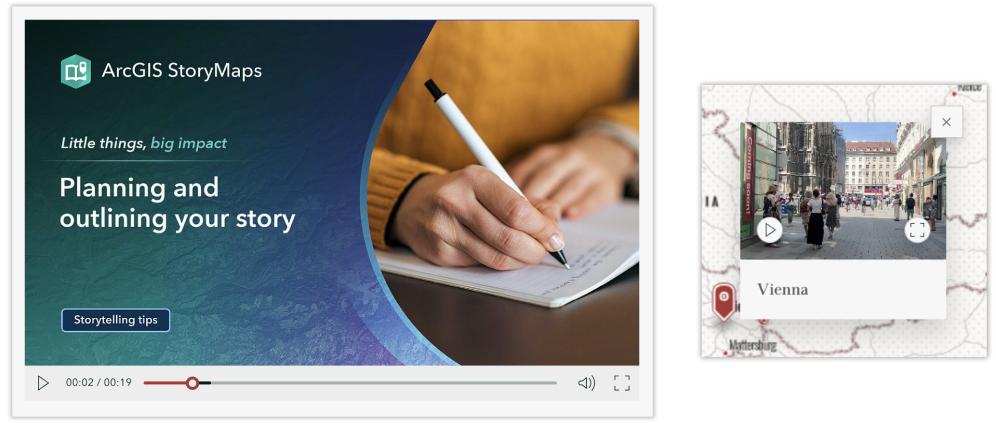
Integrated video player
Incorporating a video into your stories and briefings is a great way to create a more immersive experience for your audience. Previously, the video player appeared with default controls determined by your browser, which led to varied viewing experiences. We are excited to introduce our new integrated video player that provides a more consistent — and accessible — viewing experience for all!
Now, when you add a video to the body of your story, briefing, collection, or an immersive block, the player is equipped with a docked control bar that fits your video to preserve its full dimensions. When you add a video to an express map pop-up, the controls are simplified for a better viewing experience; the video can be expanded to access the full range of controls.
Be sure your videos are accessible! Check out our blog Details matter: Elevate your story with these finishing touches for tips to do just that.

Expand image option (timeline, sidecar media, briefings)
Expanding images in your stories and briefings allows readers to explore details up close, but there are instances in which this may disrupt your reader’s experience more than enhance it. Previously, images added to a timeline, sidecar media panel, or briefing defaulted to being solely expandable; now, you can toggle this option on or off.
After adding an image to any of those items, you will find the option to Allow readers to expand image when adjusting the Image options.
Want to add images to your items like a pro? Here’s A guide to working with images in ArcGIS StoryMaps.
Accessibility updates
We strive to enable a straightforward process for creating accessible digital content using ArcGIS StoryMaps. Here are some of this month’s enhancements that support accessible storytelling:
- Ridgeline theme colors are updated to improve contrast.
- Spacing between list items is increased for better readability. We suggest reviewing your briefings to ensure that any lists remain fit within your slides.
- Briefings presentation mode toolbar now hides and shows based on your mouse activity.
Learn more about How to get started with accessible storytelling using ArcGIS StoryMaps.
And more…
Check out the release notes for more detail about other small changes and fixes released this month.
Thank you to Ashley Du and Will Hackney for their contributions to this post.
All Adobe Stock images are © 2025 Adobe Stock. All rights reserved.


Article Discussion: